

2,996 datasets found
-
Federal
SMAP L3 Radiometer Global Daily 36 km EASE-Grid Soil Moisture V009
National Aeronautics and Space Administration —
This Level-3 (L3) soil moisture product provides a composite of daily estimates of global land surface conditions retrieved by the Soil Moisture Active Passive (SMAP)... -
Federal
SRTM Water Body Data
National Aeronautics and Space Administration —
The SRTM Water Body Data files are a by-product of the data editing performed by the National Geospatial-Intelligence Agency (NGA) to produce the finished SRTM... -
Federal
Asteroids - NeoWs API
National Aeronautics and Space Administration —
NeoWs (Near Earth Object Web Service) is a RESTful web service for near earth Asteroid information. With NeoWs a user can: search for Asteroids based on their closest... -
Federal
GOES-R Geostationary Lightning Mapper (GLM) Gridded Data Products V1
National Aeronautics and Space Administration —
The GOES-R Geostationary Lightning Mapper (GLM) Gridded Data Products consist of full disk extent gridded lightning flash data collected by the Geostationary... -
Federal
Global Sentinel-1 Burst ID Map
National Aeronautics and Space Administration —
Sentinel-1 performs systematic acquisition of bursts in both IW and EW modes. The bursts overlap almost perfectly between different passes and are always located at... -
Federal
Daily 8-Hour Maximum and Annual O3 Concentrations for the Contiguous United States, 1-km Grids, v1 (2000 - 2016)
National Aeronautics and Space Administration —
The Daily 8-Hour Maximum and Annual O3 Concentrations for the Contiguous United States, 1-km Grids, v1 (2000 - 2016) data set contains estimates of ozone... -
Federal
Fermi Solar Flare X-Ray and Gamma-Ray Observations
National Aeronautics and Space Administration —
The Fermi Gamma-ray Space Telescope was launched in June 2008 to explore high-energy phenomena in the Universe. This GI program is targeted specifically at Fermi... -
Federal
Landsat 2000
National Aeronautics and Space Administration —
Landsat.org, an affiliate of the Tropical Rain Forest Information Center (TRFIC), now hosts the Global Orthorectified Landsat Datasets for four epochs: 1970's MSS,... -
Federal
Annual Global High-Resolution Extreme Heat Estimates (GEHE), 1983-2016
National Aeronautics and Space Administration —
The Annual Global High-Resolution Extreme Heat Estimates (GEHE), 1983-2016 data set provides global 0.05 degrees (~5 km) gridded annual counts of the number of days... -
Federal
GPM Ground Validation Doppler on Wheels (DOW) OLYMPEX V2
National Aeronautics and Space Administration —
The GPM Ground Validation Doppler on Wheels (DOW) OLYMPEX V2 dataset was obtained by a dual-polarization and dual-frequency X-band mobile radar operated by the Center... -
Federal
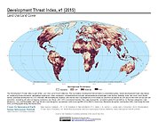
Development Threat Index
National Aeronautics and Space Administration —
The Development Threat Index data set is a terrestrial global, future development threat map based on combining these resources: agricultural expansion, urban... -
Federal
Global Database of Light-based Geospatial Income Inequality (LGII) Measures, Version 1
National Aeronautics and Space Administration —
The Global Database of Light-based Geospatial Income Inequality (LGII) Measures, Version 1 data set contains Gini-coefficients of inequality for 234 countries and... -
Federal
National Aggregates of Geospatial Data Collection: Population, Landscape, And Climate Estimates, Version 4 (PLACE IV)
National Aeronautics and Space Administration —
The National Aggregates of Geospatial Data Collection: Population, Landscape, And Climate Estimates, Version 4 (PLACE IV) provides measures of population (head... -
Federal
2018 Environmental Performance Index (EPI)
National Aeronautics and Space Administration —
The 2018 Environmental Performance Index (EPI) ranks 180 countries on 24 performance indicators in the following 10 issue categories: air quality, water and... -
Federal
NASA Aerial Photography
National Aeronautics and Space Administration —
The National Aeronautics and Space Administration (NASA) Aerial Photography data set is a film archive of photographs from the Lyndon B. Johnson Space Center (JSC) in...
2,996 datasets found