
-
Federal
TROPICS07 L2B Deep Multispectral INtensity (DMIN) of Tropical Cyclones Estimator Algorithm V0.2
National Aeronautics and Space Administration —
The "Time-Resolved Observations of Precipitation structure and storm Intensity with a Constellation of Smallsats" (TROPICS) mission has a goal of providing nearly... -
Federal
TROPICS05 L2B Deep Multispectral INtensity (DMIN) of Tropical Cyclones Estimator Algorithm V0.2
National Aeronautics and Space Administration —
The "Time-Resolved Observations of Precipitation structure and storm Intensity with a Constellation of Smallsats" (TROPICS) mission has a goal of providing nearly... -
Federal
MLS/Aura Near-Real-Time L2 Nitrous Oxide (N2O) Mixing Ratio V005 (ML2N2O_NRT) at GES DISC
National Aeronautics and Space Administration —
ML2N2O_NRT is the EOS Aura Microwave Limb Sounder (MLS) Near-Real-Time (NRT) product for nitrous oxide (N2O). This product contains N2O profiles derived from the 190... -
Federal
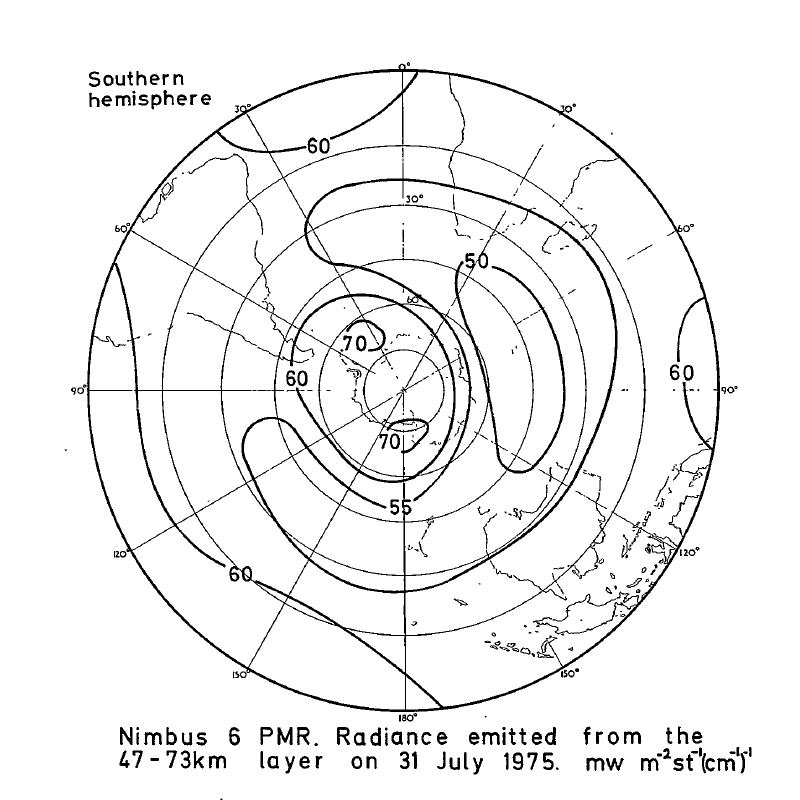
PMR/Nimbus-6 Level 1 Radiance Data from CD-ROM V001 (PMRN6L1RAD_CDROM) at GES DISC
National Aeronautics and Space Administration —
PMRN6L1RAD_CDROM is the gridded Nimbus-6 Pressure Modulated Radiometer (PMR) Level 1 Radiance Data Product. The radiances are measured at CO2 lines in the 15 micron... -
Federal
BUV/Nimbus-4 Level 2 High-Density Ozone Data V005 (BUVN4L2HDBUV) at GES DISC
National Aeronautics and Space Administration —
The Nimbus-4 BUV Level 2 High-Density Ozone Data collection contains the vertical distribtuion and total column amount of ozone, as well as the full set of ancillary... -
Federal
OCO-2 Level 0 spacecraft attitude data V10 (OCO2_Att) at GES DISC
National Aeronautics and Space Administration —
Version 10 is the current version of the data set. Older versions will no longer be available and are superseded by Version 10. The Orbiting Carbon Observatory is the... -
Federal
OCO-2 Level 1A collated, parsed, science or calibration data V11 (OCO2_L1aIn_Sample) at GES DISC
National Aeronautics and Space Administration —
Version 11 is the current version of the data set. Older versions will no longer be available and are superseded by Version 11. The Orbiting Carbon Observatory is the... -
Federal
Legates Surface and Ship Observations of Precipitation Climatology 0.5 x 0.5 degree V1 (RAIN_LEGATES) at GES DISC
National Aeronautics and Space Administration —
The Legates Surface and Shipboard Rain Gauge Observations data set consists of a global climatology of monthly mean precipitation values. A global climatology of mean... -
Federal
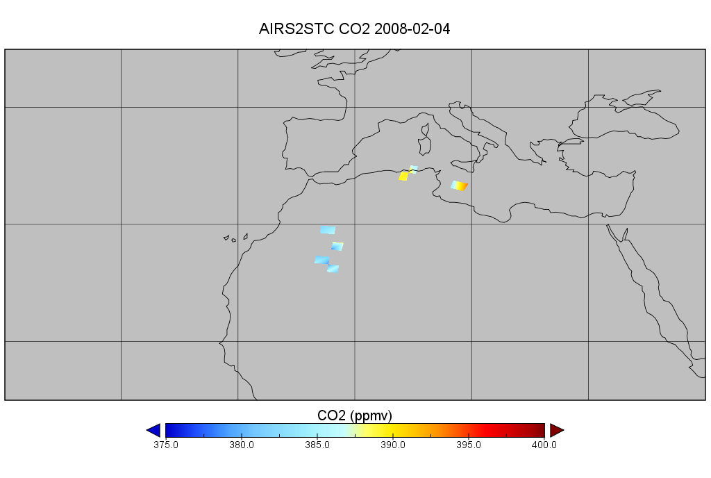
AIRS/Aqua L2 CO2 in the free troposphere (AIRS-only) V005 (AIRS2STC) at GES DISC
National Aeronautics and Space Administration —
The Atmospheric Infrared Sounder (AIRS) is a grating spectrometer (R = 1200) aboard the second Earth Observing System (EOS) polar-orbiting platform, EOS Aqua. In... -
Federal
TRMM Ground Validation Radar Reflectivity Single Level Cartesian Grid 1 hour V7 (TRMM_baseUW) at GES DISC
National Aeronautics and Space Administration —
This dataset is part of the University of Washington TRMM Ground Validation products. Data contains single level, cartesian grids containing output of NCAR SPRINT... -
Federal
GPM DPR Ku-band Received Power L1B 1.5 hours 5 km V07 (GPM_PRL1KU) at GES DISC
National Aeronautics and Space Administration —
Version 07 is the current version of the data set. Older versions are no longer available and have been superseded by Version 07. This product contains the calibrated... -
Federal
OCO-2 Level 1A collated, parsed, calibration data V11.2 (OCO2_L1aIn_Pixel) at GES DISC
National Aeronautics and Space Administration —
Version 11.2 is the current version of the data set. Older versions will no longer be available and are superseded by Version 11.2. The Orbiting Carbon Observatory is... -
Federal
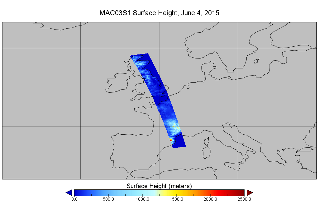
MODIS/Aqua Geolocation Fields 1km 5-Min 1A Wide Swath Subset along CloudSat V002 (MAC03S1) at GES DISC NGDA
National Aeronautics and Space Administration —
This is the wide-swath MODIS/Aqua subset along CloudSat field of view track. The goal of the wide-swath subset is to select and return MODIS data that are within... -
Federal
THIR/Nimbus-5 Level 1 Meteorological Radiation Data at 6.7 microns V001 (THIRN5L1CH67) at GES DISC
National Aeronautics and Space Administration —
THIRN5L1CH67 is the Nimbus-5 Temperature-Humidity Infrared Radiometer (THIR) Level 1 Meteorological Radiation Data at 6.7 microns product and contains radiances... -
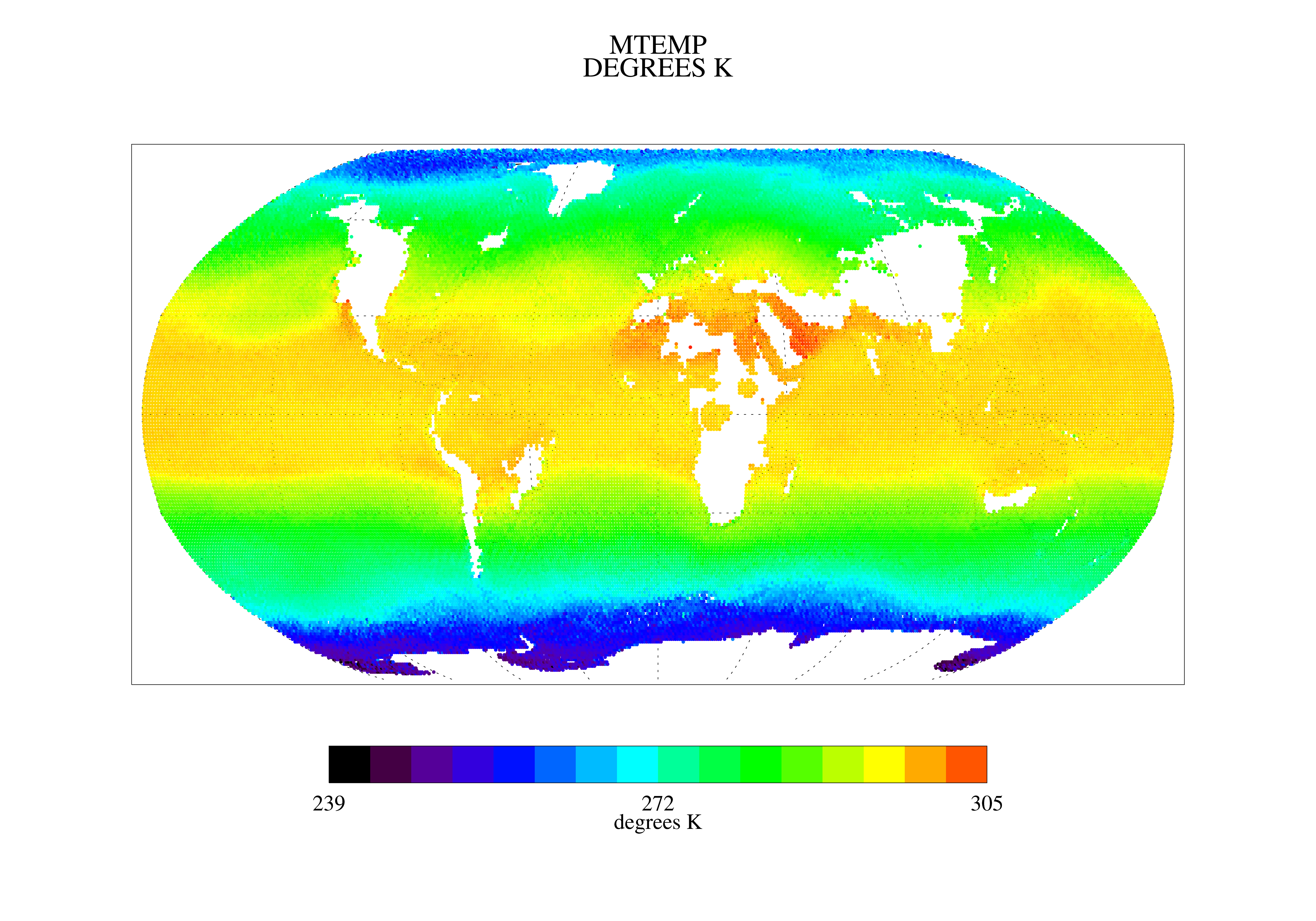
Federal
TRMM Microwave Imager Precipitation Profile L3 1 month 0.5 degree x 0.5 degree V7 (TRMM_3A12) at GES DISC
National Aeronautics and Space Administration —
The new equivalent for this dataset should be searched for as "GPM_3GPROFTRMMTMI_CLIM". This product contains global monthly means of surface precipitation rate, rain... -
Federal
OCO-2 Level 0 spacecraft ephemerides, Retrospective Processing V11r (OCO2_Eph) at GES DISC
National Aeronautics and Space Administration —
Version 11r is the current version of the data set. Older versions will no longer be available and are superseded by Version 11r. The Orbiting Carbon Observatory is... -
Federal
TOVS LMD MONTHLY GRIDS from NOAA-12 V01 (TOVSBMND) at GES DISC
National Aeronautics and Space Administration —
Level 3 parameters from HIRS/2 and MSU radiances using the Improved Initialization Inversion (3I) classification retrieval scheme by the Laboratoire de Meteorologie... -
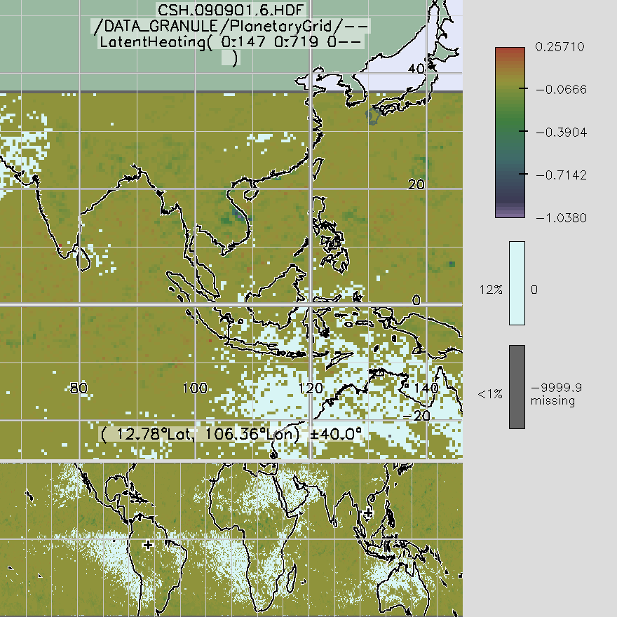
Federal
TRMM Convective and Stratiform Heating L3 1 month 0.5 degree x 0.5 degree V6 (TRMM_CSH) at GES DISC
National Aeronautics and Space Administration —
These data are output from the Goddard Convective-Stratiform Heating (CSH) algorithm. The dataset contains global 0.5 x 0.5 monthly latent heating profiles from... -
Federal
Sentinel-5P TROPOMI SNPP VIIRS cloud product band 6 (NIR detector) 1-Orbit L2 5.5km x 3.5km V2 (S5P_L2__NP_BD6_HiR) at GES DISC
National Aeronautics and Space Administration —
Starting from August 6th in 2019, Sentinel-5P TROPOMI along-track high spatial resolution (~5.5km at nadir) has been implemented. For data before August 6th of 2019,... -
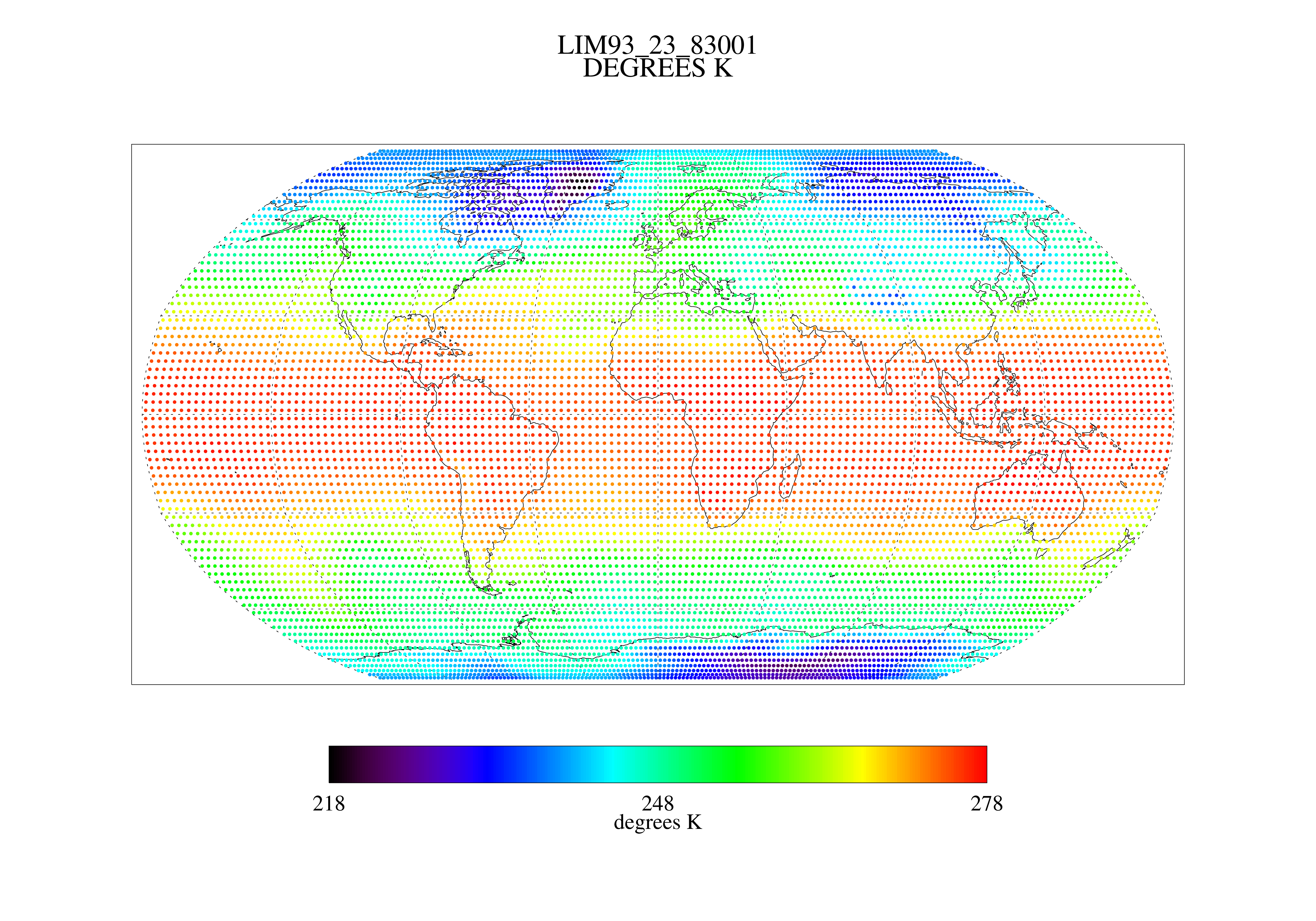
Federal
MSU Ch 2/3 Daily Lower Troposphere Temps with Limb93 Correction L3 1 day 2.5 degree x 2.5 degree V001 (MSULTT) at GES DISC
National Aeronautics and Space Administration —
The Microwave Sounding Unit (MSU) Lower Troposphere Deep Layer Temperature product (MSULTT) provides gridded lower tropospheric temperatures derived from MSU...

Official websites use .gov
A
.gov website belongs to an official government
organization in the United States.
Secure .gov websites use HTTPS
A
lock (
) or https:// means you’ve safely connected to
the .gov website. Share sensitive information only on official,
secure websites.