

1,128 datasets found
-
Federal
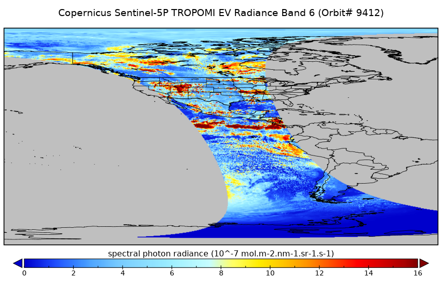
Sentinel-5P TROPOMI Radiance product band 6 (NIR detector) L1B 5.5km x 3.5km V2 (S5P_L1B_RA_BD6_HiR) at GES DISC
National Aeronautics and Space Administration —
Starting from August 6th in 2019, Sentinel-5P TROPOMI along-track high spatial resolution (~5.5km at nadir) has been implemented. For data before August 6th of 2019,... -
Federal
SatCORPS CERES GEO Edition 4 GOES-13 Southern Hemisphere Version 1.0
National Aeronautics and Space Administration —
CER_GEO_Ed4_GOE13_SH_V01 is the Satellite Cloud and Radiation Property retrieval System (SatCORPS) Clouds and the Earth's Radiant Energy System (CERES) Geostationary... -
Federal
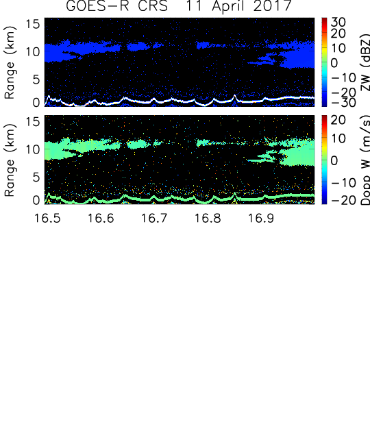
GOES-R PLT Cloud Radar System (CRS) V1
National Aeronautics and Space Administration —
The GOES-R PLT Field Campaign Cloud Radar System (CRS) dataset provides high-resolution profiles of reflectivity and Doppler velocity at aircraft nadir along the... -
Federal
Bradys Hot Springs Geothermal Area Build FEM Configuration
Department of Energy —
This submission contains mesh information, nodal coordinates, connectivity data, and list of query points for the build FEM configuration. -
Federal
Tidal Resource Data from Sequim Bay Inlet, WA, August 2020
Department of Energy —
Data from a Nortek Signature1000 deployed on a lander for 14 days in Aug 2020 in the entrance to Sequim Bay, WA. Raw data were processed using the DOLfYN python... -
Federal
Conductance Steamflow Relationship
Department of Energy —
These histograms represent our calibration of conductance of a volcanic geothermal field (with a clay cap) and the observed steam flow rates. Darajat is a vapor... -
Federal
TROPICS01 L2B Neural-network Atmospheric Vertical Temperature & Moisture Profiles V1.0
National Aeronautics and Space Administration —
The "Time-Resolved Observations of Precipitation structure and storm Intensity with a Constellation of Smallsats" (TROPICS) mission has a goal of providing nearly...
1,128 datasets found