
-
Federal
National Wildlife Refuge System Map
Department of the Interior —
When President Theodore Roosevelt made Florida's tiny Pelican Island a refuge for birds in 1903, he wrote the ¬first chapter of a great American conservation success... -
Federal
Images
National Aeronautics and Space Administration —
Images for the website main pages and all configurations. The upload and access points for the other images are: Website Template RSW images BSCW Images HIRENASD Images -
Federal
GOES-R PLT Cloud Physics LiDAR (CPL) V1
National Aeronautics and Space Administration —
The GOES-R PLT Cloud Physics Lidar (CPL) dataset consists of backscatter coefficient, lidar depolarization ratio, layer top/base height, layer type, particulate... -
Federal
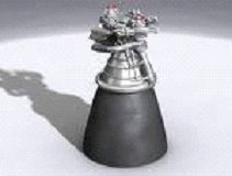
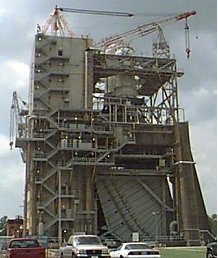
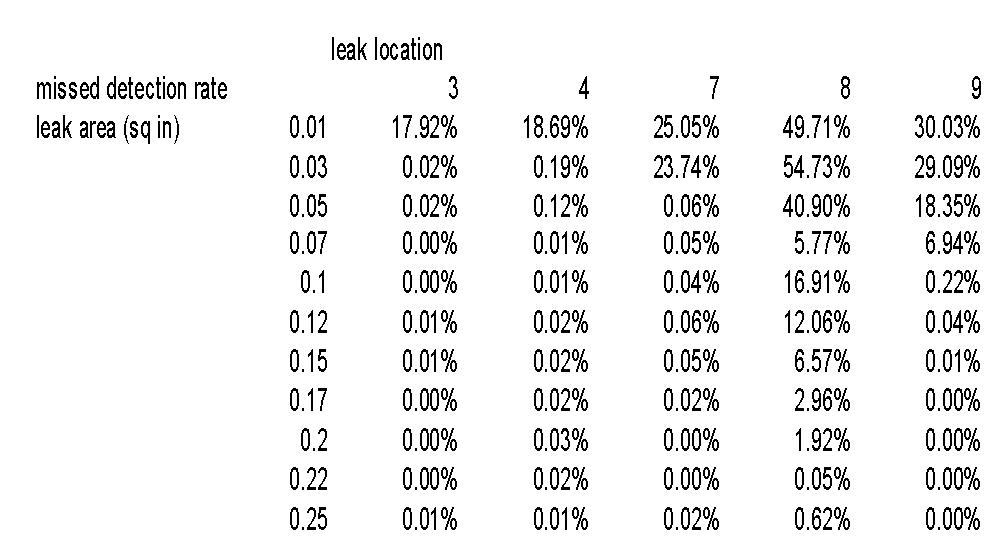
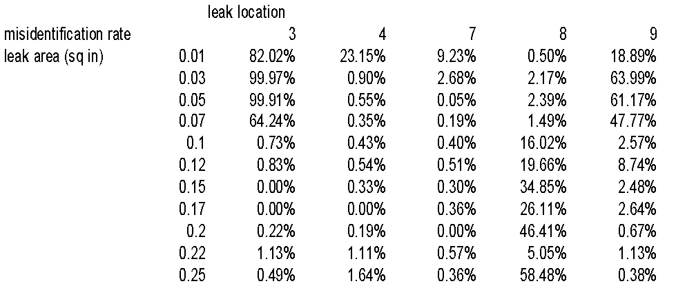
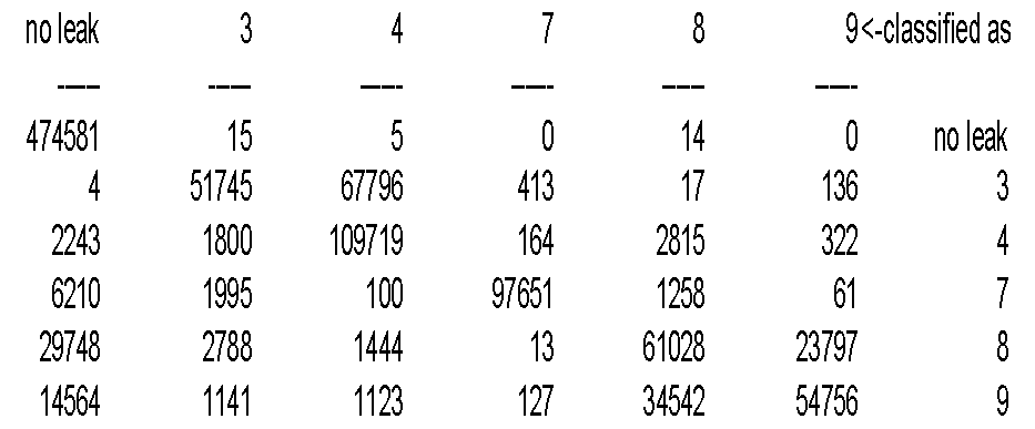
Using Decision Trees to Detect and Isolate Leaks in the J-2X
National Aeronautics and Space Administration —
Full title: Using Decision Trees to Detect and Isolate Simulated Leaks in the J-2X Rocket Engine Mark Schwabacher, NASA Ames Research Center Robert Aguilar, Pratt... -
State
HEC DSSVue Plugins
State of California —
Introduction Plugins written to extend HEC-DSSVue # Godin Filter Godin filters are used to remove tidal signals from timeseries of stage, flow and other such... -
Federal
Real System Failures
National Aeronautics and Space Administration —
This resource area contains descriptions of actual electronic systems failure scenarios with an emphasis on the diversity of failure modes and effects that can befall... -
County
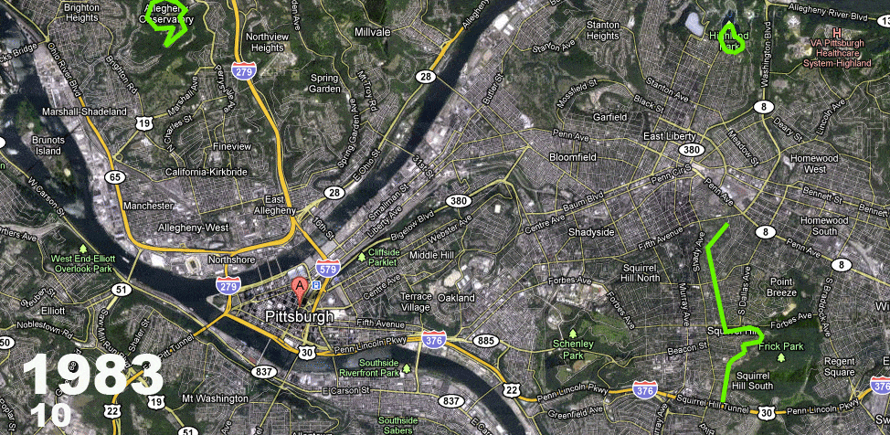
On-road Bicycle Pavement Markings
Allegheny County / City of Pittsburgh / Western PA Regional Data Center —
A mile by mile breakdown of the on-street bicycle pavement markings installed within the City of Pittsburgh. These include bike lanes, shared lane markings... -
Federal
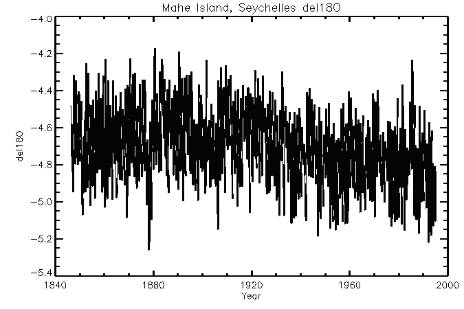
NOAA/WDS Paleoclimatology - Mahe - del18O Data
National Oceanic and Atmospheric Administration, Department of Commerce —
This archived Paleoclimatology Study is available from the NOAA National Centers for Environmental Information (NCEI), under the World Data Service (WDS) for... -
Federal
CAMEX-3 LiDAR Atmospheric Sensing Experiment (LASE) Imagery V1
National Aeronautics and Space Administration —
The CAMEX-3 LiDAR Atmospheric Sensing Experiment (LASE) Imagery dataset is a browse-only dataset that consists of plotted reflectivity data collected by the LiDAR... -
Federal
Simulating Degradation Data for Prognostic Algorithm Development
National Aeronautics and Space Administration —
PHM08 Challenge Dataset is now publicly available at the NASA Prognostics Respository + Download INTRODUCTION - WHY SIMULATE DEGRADATION DATA? Of various challenges... -
Federal
NOAA/WDS Paleoclimatology - Brown fire data from Black Hills Plot 114 - IMPD US114001
National Oceanic and Atmospheric Administration, Department of Commerce —
This archived Paleoclimatology Study is available from the NOAA National Centers for Environmental Information (NCEI), under the World Data Service (WDS) for... -
Federal
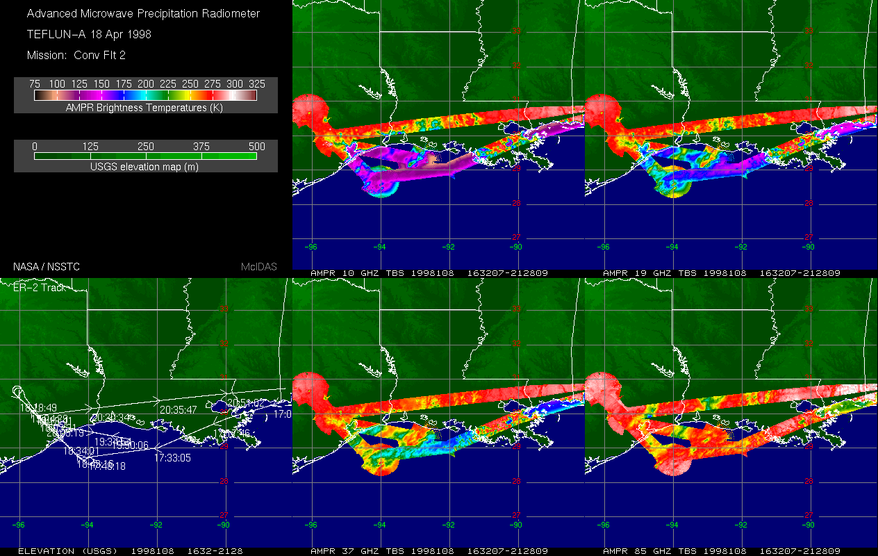
AMPR TEFLUN-A BRIGHTNESS TEMPERATURE (TB) V1
National Aeronautics and Space Administration —
The Advanced Microwave Precipitation Radiometer (AMPR) was deployed during the Texas-Florida Underflights (TEFLUN-A); the first of three TRMM ground validation... -
Federal
NOAA/WDS Paleoclimatology - Brown fire data from Black Hills Plot 202 - IMPD US202001
National Oceanic and Atmospheric Administration, Department of Commerce —
This archived Paleoclimatology Study is available from the NOAA National Centers for Environmental Information (NCEI), under the World Data Service (WDS) for... -
Federal
NOAA/WDS Paleoclimatology - Brown fire data from Black Hills Plot 201 - IMPD US201001
National Oceanic and Atmospheric Administration, Department of Commerce —
This archived Paleoclimatology Study is available from the NOAA National Centers for Environmental Information (NCEI), under the World Data Service (WDS) for... -
Federal
NOAA/WDS Paleoclimatology - Brown fire data from Black Hills Plot 110 - IMPD US110001
National Oceanic and Atmospheric Administration, Department of Commerce —
This archived Paleoclimatology Study is available from the NOAA National Centers for Environmental Information (NCEI), under the World Data Service (WDS) for... -
Federal
NOAA/WDS Paleoclimatology - Brown fire data from Black Hills Plot 103 - IMPD US103001
National Oceanic and Atmospheric Administration, Department of Commerce —
This archived Paleoclimatology Study is available from the NOAA National Centers for Environmental Information (NCEI), under the World Data Service (WDS) for... -
Federal
NOAA/WDS Paleoclimatology - Brown fire data from Black Hills Plot 106 - IMPD US106001
National Oceanic and Atmospheric Administration, Department of Commerce —
This archived Paleoclimatology Study is available from the NOAA National Centers for Environmental Information (NCEI), under the World Data Service (WDS) for... -
Federal
NOAA/WDS Paleoclimatology - Brown fire data from Black Hills Plot 209 - IMPD US209001
National Oceanic and Atmospheric Administration, Department of Commerce —
This archived Paleoclimatology Study is available from the NOAA National Centers for Environmental Information (NCEI), under the World Data Service (WDS) for... -
Federal
NOAA/WDS Paleoclimatology - Brown fire data from Black Hills Plot 108 - IMPD US108001
National Oceanic and Atmospheric Administration, Department of Commerce —
This archived Paleoclimatology Study is available from the NOAA National Centers for Environmental Information (NCEI), under the World Data Service (WDS) for...

Official websites use .gov
A
.gov website belongs to an official government
organization in the United States.
Secure .gov websites use HTTPS
A
lock (
) or https:// means you’ve safely connected to
the .gov website. Share sensitive information only on official,
secure websites.