
-
Federal
Santa Monica, California Tsunami Forecast Grids for MOST Model
National Oceanic and Atmospheric Administration, Department of Commerce —
The Santa Monica, California Forecast Model Grids provides bathymetric data strictly for tsunami inundation modeling with the Method of Splitting Tsunami (MOST)... -
Federal
Santa Monica, California 1/3 arc-second NAVD 88 Coastal Digital Elevation Model
National Oceanic and Atmospheric Administration, Department of Commerce —
NOAA's National Geophysical Data Center (NGDC) is building high-resolution digital elevation models (DEMs) for select U.S. coastal regions. These integrated... -
Federal
National Status and Trends, Benthic Surveillance Project Sites, 1984-1992, National Centers for Coastal Ocean Science
National Oceanic and Atmospheric Administration, Department of Commerce —
This data set reports information regarding the nominal sampling locations for the National Status and Trends Benthic Surveillance Project sites. One record is... -
Federal
W00661: NOS Hydrographic Survey , External Source Data 2022, 2022-04-28
National Oceanic and Atmospheric Administration, Department of Commerce —
The National Oceanic and Atmospheric Administration (NOAA) has the statutory mandate to collect hydrographic data in support of nautical chart compilation for safe... -
Federal
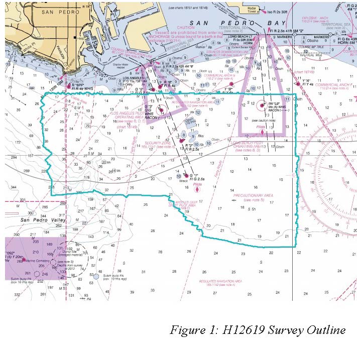
H12619: NOS Hydrographic Survey , Approaches to LA Long Beach, CA, 2013-11-03
National Oceanic and Atmospheric Administration, Department of Commerce —
The National Oceanic and Atmospheric Administration (NOAA) has the statutory mandate to collect hydrographic data in support of nautical chart compilation for safe... -
Federal
H12618: NOS Hydrographic Survey , Approaches to LA Long Beach, CA, 2013-11-04
National Oceanic and Atmospheric Administration, Department of Commerce —
The National Oceanic and Atmospheric Administration (NOAA) has the statutory mandate to collect hydrographic data in support of nautical chart compilation for safe... -
Federal
H04793: NOS Hydrographic Survey , 1927-12-31
National Oceanic and Atmospheric Administration, Department of Commerce —
The National Oceanic and Atmospheric Administration (NOAA) has the statutory mandate to collect hydrographic data in support of nautical chart compilation for safe... -
Federal
W00660: NOS Hydrographic Survey , 2021-08-20
National Oceanic and Atmospheric Administration, Department of Commerce —
The National Oceanic and Atmospheric Administration (NOAA) has the statutory mandate to collect hydrographic data in support of nautical chart compilation for safe... -
Federal
H12617: NOS Hydrographic Survey , Approaches to LA Long Beach, CA, 2013-11-03
National Oceanic and Atmospheric Administration, Department of Commerce —
The National Oceanic and Atmospheric Administration (NOAA) has the statutory mandate to collect hydrographic data in support of nautical chart compilation for safe... -
Federal
W00338: NOS Hydrographic Survey , 2014-07-20
National Oceanic and Atmospheric Administration, Department of Commerce —
The National Oceanic and Atmospheric Administration (NOAA) has the statutory mandate to collect hydrographic data in support of nautical chart compilation for safe... -
Federal
H12620: NOS Hydrographic Survey , Approaches to LA Long Beach, CA, 2013-11-11
National Oceanic and Atmospheric Administration, Department of Commerce —
The National Oceanic and Atmospheric Administration (NOAA) has the statutory mandate to collect hydrographic data in support of nautical chart compilation for safe... -
Federal
National Status and Trends, Benthic Surveillance Project Aryl Hydrocarbon Hydrolase (AHH) Data, 1988-1992, National Centers for Coastal Ocean Science
National Oceanic and Atmospheric Administration, Department of Commerce —
In order to determine the current status of and detect any long-term trends in the environmental quality of U.S. nearshore waters, NOAA initiated the National Status... -
Federal
National Status and Trends, Benthic Surveillance Project Pathology, 1984-1992, National Centers for Coastal Ocean Science
National Oceanic and Atmospheric Administration, Department of Commerce —
In order to determine the current status of and to detect any long-term trends in the environmental quality of U.S. nearshore waters, NOAA initiated the National... -
Federal
National Status and Trends, Benthic Surveillance Project Chemistry Data, 1984-1992, National Centers for Coastal Ocean Science
National Oceanic and Atmospheric Administration, Department of Commerce —
The National Status and Trends (NSandT) Benthic Surveillance Project Chemistry data file reports the trace concentrations of a suite of chemical contaminants in... -
Federal
National Status and Trends, Benthic Surveillance Project Aryl Hydrocarbon Hydrolase (AHH) Data, 1988-1992, National Centers for Coastal Ocean Science
National Oceanic and Atmospheric Administration, Department of Commerce —
In order to determine the current status of and detect any long-term trends in the environmental quality of U.S. nearshore waters, NOAA initiated the National Status... -
Federal
Santa Monica, California 1/3 arc-second MHW Coastal Digital Elevation Model
National Oceanic and Atmospheric Administration, Department of Commerce —
NOAA's National Geophysical Data Center (NGDC) is building high-resolution digital elevation models (DEMs) for select U.S. coastal regions. These integrated... -
Federal
National Status and Trends, Benthic Surveillance Project Sites, 1984-1992, National Centers for Coastal Ocean Science
National Oceanic and Atmospheric Administration, Department of Commerce —
This data set reports information regarding the nominal sampling locations for the National Status and Trends Benthic Surveillance Project sites. One record is... -
Federal
National Status and Trends, Benthic Surveillance Project Chemistry Data, 1984-1992, National Centers for Coastal Ocean Science
National Oceanic and Atmospheric Administration, Department of Commerce —
The National Status and Trends (NS&T) Benthic Surveillance Project Chemistry data file reports the trace concentrations of a suite of chemical contaminants in... -
Federal
Los Angeles, California Tsunami Forecast Grids for MOST Model
National Oceanic and Atmospheric Administration, Department of Commerce —
The Los Angeles, California Forecast Model Grids provides bathymetric data strictly for tsunami inundation modeling with the Method of Splitting Tsunami (MOST) model.... -
Federal
Orange County, California 1/3 arc-second NAVD 88 Coastal Digital Elevation Model
National Oceanic and Atmospheric Administration, Department of Commerce —
NOAA's National Centers for Environmental Information (NCEI) is building high-resolution digital elevation models (DEMs) for select U.S. coastal regions. These...

Official websites use .gov
A
.gov website belongs to an official government
organization in the United States.
Secure .gov websites use HTTPS
A
lock (
) or https:// means you’ve safely connected to
the .gov website. Share sensitive information only on official,
secure websites.