
-
Federal
Social Vulnerability Index (SoVI) for Washington based on 2000 Census Block Groups
National Oceanic and Atmospheric Administration, Department of Commerce —
This data depicts the social vulnerability of Washington census block groups to environmental hazards. Data were culled primarily from the 2000 Decennial Census. -
Federal
Time-Series Data on the Ocean and Great Lakes Economy for Counties, States, and the Nation between 2005 and 2019 (Sector Level)
National Oceanic and Atmospheric Administration, Department of Commerce —
Economics: National Ocean Watch (ENOW) contains annual time-series data for over 400 coastal counties, 30 coastal states, 8 regions, and the nation, derived from the... -
Federal
Hawaii Small Boat Cost-Earnings Data: 2020
National Oceanic and Atmospheric Administration, Department of Commerce —
These data represent a cost-earnings study of the Hawaii small boat fishery conducted in 2021. Data collected include fishing motivation, vessel characteristics,... -
Federal
New Hampshire / Southern Maine Ocean Uses Atlas
National Oceanic and Atmospheric Administration, Department of Commerce —
The Ocean Uses Atlas Project is an innovative partnership between the Coastal Response Research Center (CRRC) and NOAA's Office of Ocean and Coastal Resource... -
State
MD iMAP: Maryland Recreational Uses - Surface Water Sports
State of Maryland —
This is a MD iMAP hosted service layer. Find more information at http://imap.maryland.gov. Maryland - through its Coastal Zone Management (CZM) Program - is... -
Federal
Global Earthquake Proportional Economic Loss Risk Deciles
National Aeronautics and Space Administration —
The Global Earthquake Proportional Economic Loss Risk Deciles is a 2.5 minute grid of earthquake hazard economic loss as proportions of Gross Domestic Product (GDP)... -
Federal
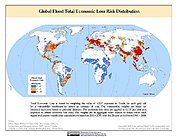
Global Landslide Total Economic Loss Risk Deciles
National Aeronautics and Space Administration —
The Global Landslide Total Economic Loss Risk Deciles is a 2.5 minute grid of global landslide total economic loss risks. A process of spatially allocating Gross... -
Federal
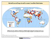
Global Multihazard Proportional Economic Loss Risk Deciles
National Aeronautics and Space Administration —
The Global Multihazard Proportional Economic Loss Risks is a 2.5 minute grid of a multihazard-based economic loss risk as a proportion of the economic productivity of... -
Federal
Shared Socioeconomic Pathways (SSPs) Literature Database, v1, 2014-2019
National Aeronautics and Space Administration —
The Shared Socioeconomic Pathways (SSPs) Literature Database, v1, 2014-2019 consists of biographic information, abstracts, and analysis of 1,360 articles published... -
Federal
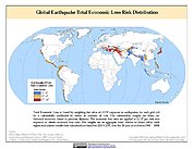
Global Earthquake Total Economic Loss Risk Deciles
National Aeronautics and Space Administration —
The Global Earthquake Total Economic Loss Risk Deciles is a 2.5 minute grid of global earthquake total economic loss risks. A process of spatially allocating Gross... -
Federal
Social Vulnerability Index (SoVI) for New York based on 2000 Census Block Groups
National Oceanic and Atmospheric Administration, Department of Commerce —
This data depicts the social vulnerability of New York census block groups to environmental hazards. Data were culled primarily from the 2000 Decennial Census. -
Federal
American Community Survey (ACS) 5-Year Estimates for Coastal Geographies
National Oceanic and Atmospheric Administration, Department of Commerce —
The American Community Survey (ACS) is an ongoing statistical survey that samples a small percentage of the population every year. These data have been apportioned to... -
Federal
Social Vulnerability Index (SoVI) for Maine based on 2000 Census Block Groups
National Oceanic and Atmospheric Administration, Department of Commerce —
This data depicts the social vulnerability of Maine census block groups to environmental hazards. Data were culled primarily from the 2000 Decennial Census. -
Federal
Social Vulnerability Index (SoVI) for Maryland based on 2000 Census Block Groups
National Oceanic and Atmospheric Administration, Department of Commerce —
This data depicts the social vulnerability of Maryland census block groups to environmental hazards. Data were culled primarily from the 2000 Decennial Census. -
Federal
California Ocean Uses Atlas
National Oceanic and Atmospheric Administration, Department of Commerce —
This dataset is a result of the California Ocean Uses Atlas Project: a collaboration between NOAA's National Marine Protected Areas Center and Marine Conservation... -
Federal
New Hampshire / Southern Maine Ocean Uses Atlas: Dominant and Aggregates
National Oceanic and Atmospheric Administration, Department of Commerce —
The Ocean Uses Atlas Project is an innovative partnership between the Coastal Response Research Center (CRRC) and NOAA's Office of Ocean and Coastal Resource... -
Federal
Hawaii Small Boat Cost-Earnings Data: 2014
National Oceanic and Atmospheric Administration, Department of Commerce —
These data represent a cost-earnings study of the Hawaii small boat fishery in 2014. Data collected include fisher classification, vessel characteristics, levels of...

Official websites use .gov
A
.gov website belongs to an official government
organization in the United States.
Secure .gov websites use HTTPS
A
lock (
) or https:// means you’ve safely connected to
the .gov website. Share sensitive information only on official,
secure websites.