

16 datasets found
-
Federal
Global Gridded Geographically Based Economic Data (G-Econ), Version 4
National Aeronautics and Space Administration —
The Global Gridded Geographically Based Economic Data (G-Econ), Version 4 contains derived one degree grid cells of Gross Domestic Product (GDP) data in Grid and... -
Federal
Potential Impacts of Climate Change on World Food Supply: Datasets from a Major Crop Modeling Study
National Aeronautics and Space Administration —
The Potential Impacts of Climate Change on World Food Supply: Datasets from a Major Crop Modeling Study contain projected country and regional changes in grain crop... -
Federal
China Dimensions Data Collection: China County-Level Data from Provincial Economic Yearbooks, Keyed to 1:1M GIS Map
National Aeronautics and Space Administration —
The China County-Level Data on Provincial Economic Yearbooks, Keyed To 1:1M GIS Map consists of socioeconomic and boundary data for the administrative regions of... -
Federal
China Dimensions Data Collection: China County-Level Data on Population (Census) and Agriculture, Keyed to 1:1M GIS Map
National Aeronautics and Space Administration —
The China County-Level Data on Population (Census) and Agriculture, Keyed To 1:1M GIS Map consists of census, agricultural economic, and boundary data for the... -
Federal
Effects of Climate Change on Global Food Production from SRES Emissions and Socioeconomic Scenarios
National Aeronautics and Space Administration —
The Effects of Climate Change on Global Food Production from SRES Emissions and Socioeconomic Scenarios is an update to a major crop modeling study by the NASA... -
Federal
Shared Socioeconomic Pathways (SSPs) Literature Database, v1, 2014-2019
National Aeronautics and Space Administration —
The Shared Socioeconomic Pathways (SSPs) Literature Database, v1, 2014-2019 consists of biographic information, abstracts, and analysis of 1,360 articles published... -
Federal
VIIRS Plus DMSP Change in Lights (VIIRS+DMSP dLIGHT)
National Aeronautics and Space Administration —
The VIIRS Plus DMSP Change in Lights (VIIRS+DMSP dLIGHT) data set fuses nighttime lights imagery from the U.S. Air Force Defense Meteorological Satellite Program... -
Federal
West Africa Coastal Vulnerability Mapping: Commercial Crop Production, 2000
National Aeronautics and Space Administration —
The West Africa Coastal Vulnerability Mapping: Commercial Crop Production, 2000 data set includes 5-minute rasters of crop production in metric tons per grid cell for... -
Federal
West Africa Coastal Vulnerability Mapping: Economic Systems Index
National Aeronautics and Space Administration —
The West Africa Coastal Vulnerability Mapping: Economic Systems Index is a composite index based on several spatial indicators, including gridded Gross Domestic... -
Federal
China Dimensions Data Collection: Agricultural Statistics of the People's Republic of China: 1949-1990
National Aeronautics and Space Administration —
The Agricultural Statistics of the People's Republic of China, 1949-1990 is an historical collection of agricultural statistical data compiled by China's State... -
Federal
West Africa Coastal Vulnerability Mapping: Subset of DMSP-OLS Nighttime Lights for Economic Activity, 2010
National Aeronautics and Space Administration —
The West Africa Coastal Vulnerability Mapping: Subset of DMSP-OLS Nighttime Lights for Economic Activity, 2010 data set is based on Version 4 of the Defense... -
Federal
Sub-global Scenarios that Extend the Global SSP Narratives: Literature Database, Version 1, 2014-2021
National Aeronautics and Space Administration —
The Sub-global Scenarios that Extend the Global SSP Narratives: Literature Database, Version 1, 2014-2021 consists of 37 columns of bibliographic data, methodological... -
Federal
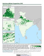
India Annual Winter Cropped Area, 2001-2016 NGDA
National Aeronautics and Space Administration —
The India Annual Winter Cropped Area, 2001 - 2016 consists of annual winter cropped areas for most of India (except the Northeastern states) from 2000-2001 to... -
Federal
IPCC Socio-Economic Baseline Dataset
National Aeronautics and Space Administration —
The Intergovernmental Panel on Climate Change (IPCC) Socio-Economic Baseline Dataset consists of population, human development, economic, water resources, land cover,...
16 datasets found