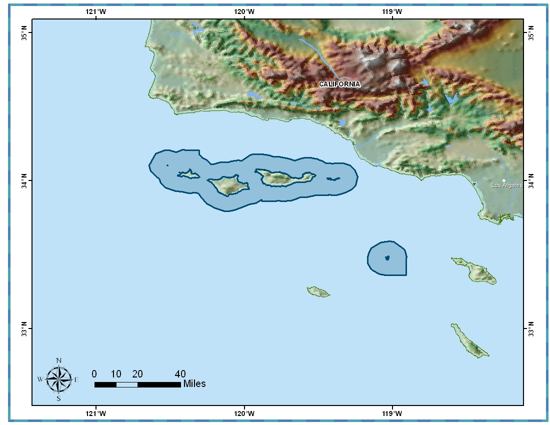
Channel Islands National Marine Sanctuary Boundary (polygons)
Access & Use Information
Downloads & Resources
-
https://www.sanctuaries.noaa.gov/library/imast_gis.htmlHTML
Downloadable Data | File Compression: unzip using pkunzip
-
Full Metadata Record
View the complete metadata record on InPort for more information about this...
-
Citation URLHTML
Online Resource
-
GCMD Keyword Forum Page
Global Change Master Directory (GCMD). 2024. GCMD Keywords, Version 19....
-
NOAA Data Management Plan (DMP)PDF
NOAA Data Management Plan for this record on InPort.
Dates
| Metadata Date | May 15, 2025 |
|---|---|
| Metadata Created Date | October 31, 2024 |
| Metadata Updated Date | May 20, 2025 |
| Reference Date(s) | 2008-06 (publication) |
| Frequency Of Update |
Metadata Source
- ISO-19139 ISO-19139 Metadata
Harvested from NOS ONMS
Graphic Preview

Additional Metadata
| Resource Type | Dataset |
|---|---|
| Metadata Date | May 15, 2025 |
| Metadata Created Date | October 31, 2024 |
| Metadata Updated Date | May 20, 2025 |
| Reference Date(s) | 2008-06 (publication) |
| Responsible Party | (Point of Contact, Custodian) |
| Contact Email | |
| Guid | gov.noaa.nmfs.inport:40040 |
| Access Constraints | Cite As: Office of National Marine Sanctuaries, [Date of Access]: Channel Islands National Marine Sanctuary Boundary (polygons) [Data Date Range], https://www.fisheries.noaa.gov/inport/item/40040., Access Constraints: None, Use Constraints: NOT FOR LEGAL USE, Distribution Liability: Digital boundary files are available for public consumption from the Office of National Marine Sanctuaies in hard copy or digital formats. See Distributor Contact Informationfor contact details. |
| Bbox East Long | -118.90712 |
| Bbox North Lat | 34.20707 |
| Bbox South Lat | 33.36241 |
| Bbox West Long | -120.64208 |
| Coupled Resource | |
| Frequency Of Update | |
| Graphic Preview Description | Channel Islands National Marine Sanctuary Boundary and Surrounds |
| Graphic Preview File | https://sanctuaries.noaa.gov/visit/images/ci_map_big.jpg |
| Graphic Preview Type | JPEG |
| Harvest Object Id | a04f0031-eb58-4e52-8a61-7d94643db058 |
| Harvest Source Id | f705727e-6c56-4072-92cc-ce5c5c5b4688 |
| Harvest Source Title | NOS ONMS |
| Licence | NOAA provides no warranty, nor accepts any liability occurring from any incomplete, incorrect, or misleading data, or from any incorrect, incomplete, or misleading use of the data. It is the responsibility of the user to determine whether or not the data is suitable for the intended purpose. |
| Lineage | |
| Metadata Language | eng |
| Metadata Type | geospatial |
| Old Spatial | {"type": "Polygon", "coordinates": [[[-120.64208, 33.36241], [-118.90712, 33.36241], [-118.90712, 34.20707], [-120.64208, 34.20707], [-120.64208, 33.36241]]]} |
| Progress | completed |
| Spatial Data Service Type | |
| Spatial Reference System | |
| Spatial Harvester | True |
Didn't find what you're looking for? Suggest a dataset here.

