

DEEPEN 3D PFA Favorability Models and 2D Favorability Maps at Newberry Volcano
Access & Use Information
Downloads & Resources
-
2D and 3D Leapfrog PFA Methodology Flowchart.pngPNG
Flow chart describing the PFA methodology used to produce these results.
-
3D Newberry Leapfrog Model v1.0.lfviewlfview
This is an outdated version. Leapfrog 3D geodata model, uncertainty models,...
-
3D Newberry Leapfrog Model v1.0.omfomf
This is an outdated version. See "3D Newberry Leapfrog Model v2.1.omf" below....
-
2D and 3D Favorability Models v1.0.zipZIP
This is an outdated version. See "2D and 3D Favorability Models v2.1.zip"...
-
2D and 3D Uncertainty Models v1.0.zipZIP
This is an outdated version. See "2D and 3D Uncertainty Models v2.0.zip"...
-
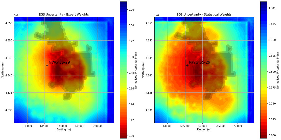
2D Uncertainty Maps for EGS Plays v1.0.pngPNG
This is an outdated version. See "2D Uncertainty Maps for EGS Plays v2.0.zip"...
-
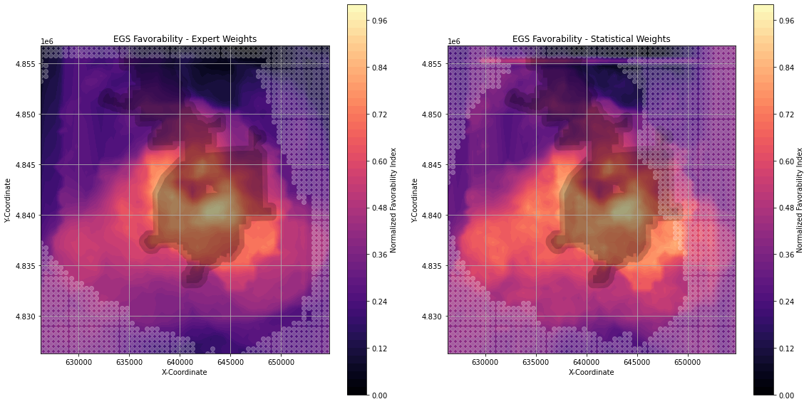
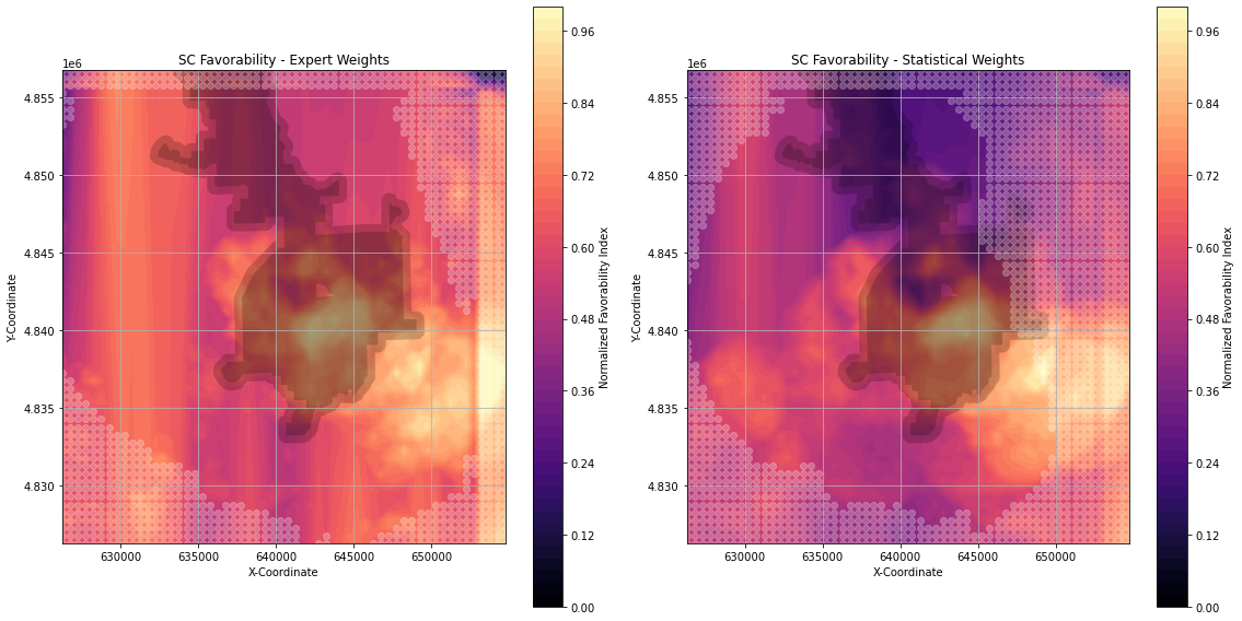
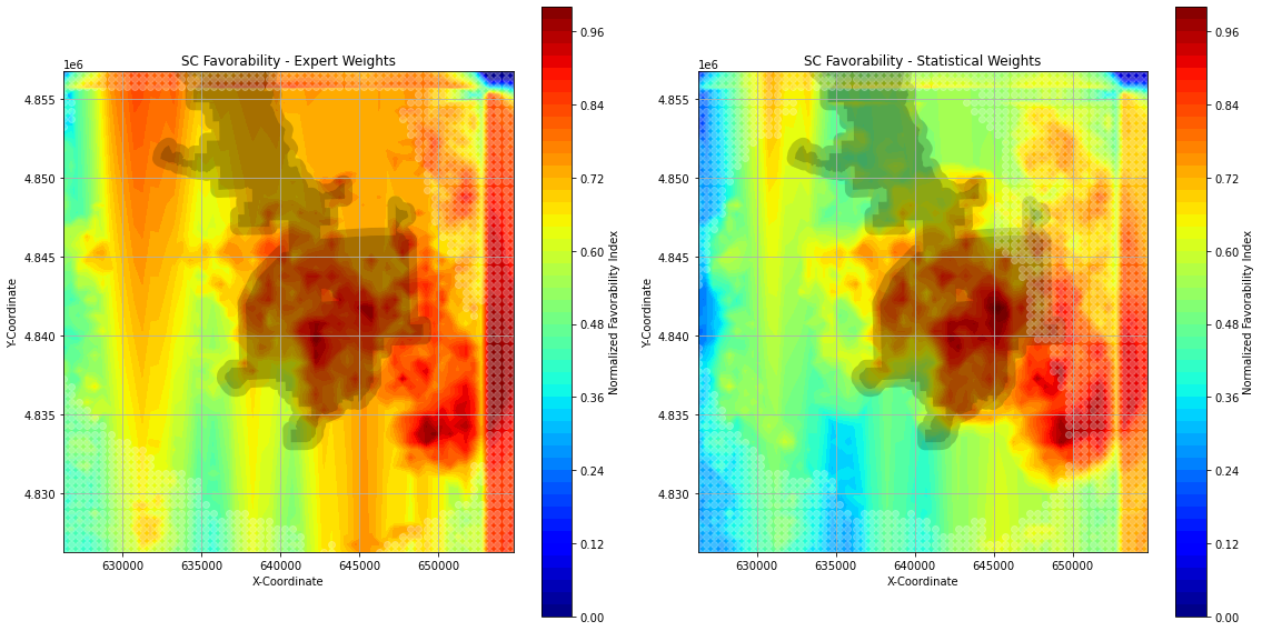
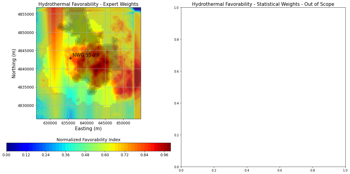
2D Favorability Maps for EGS Plays v1.0.pngPNG
This is an outdated version. See "2D Favorability Maps for EGS Plays...
-
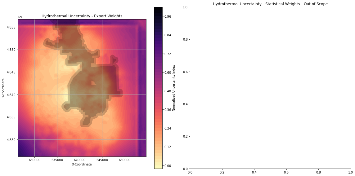
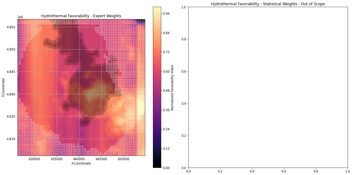
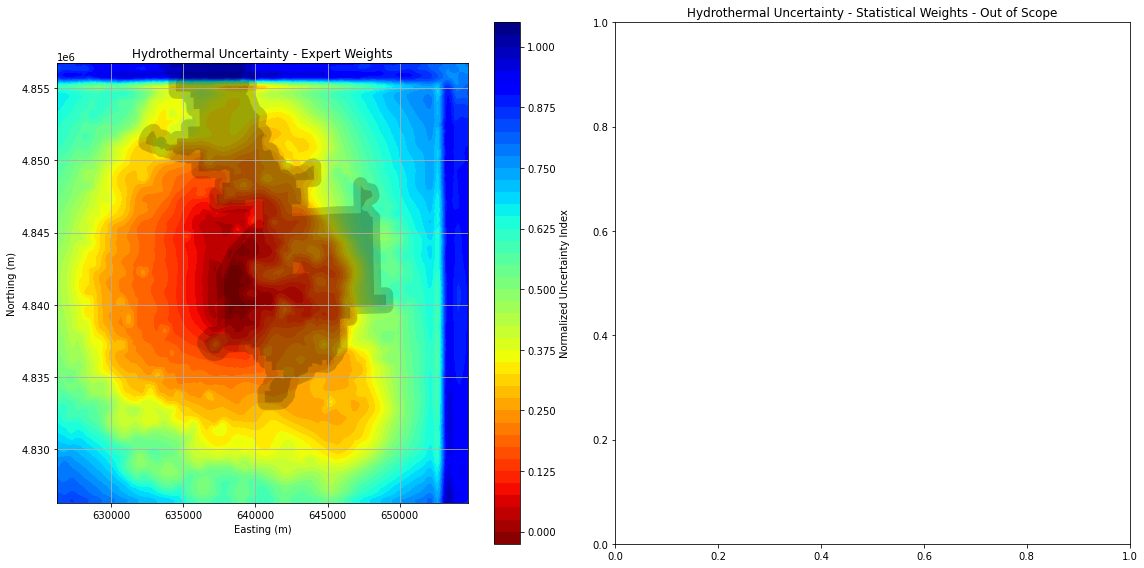
2D Uncertainty Map for Conventional...PNG
This is an outdated version. See "2D Uncertainty Maps for Conventional...
-
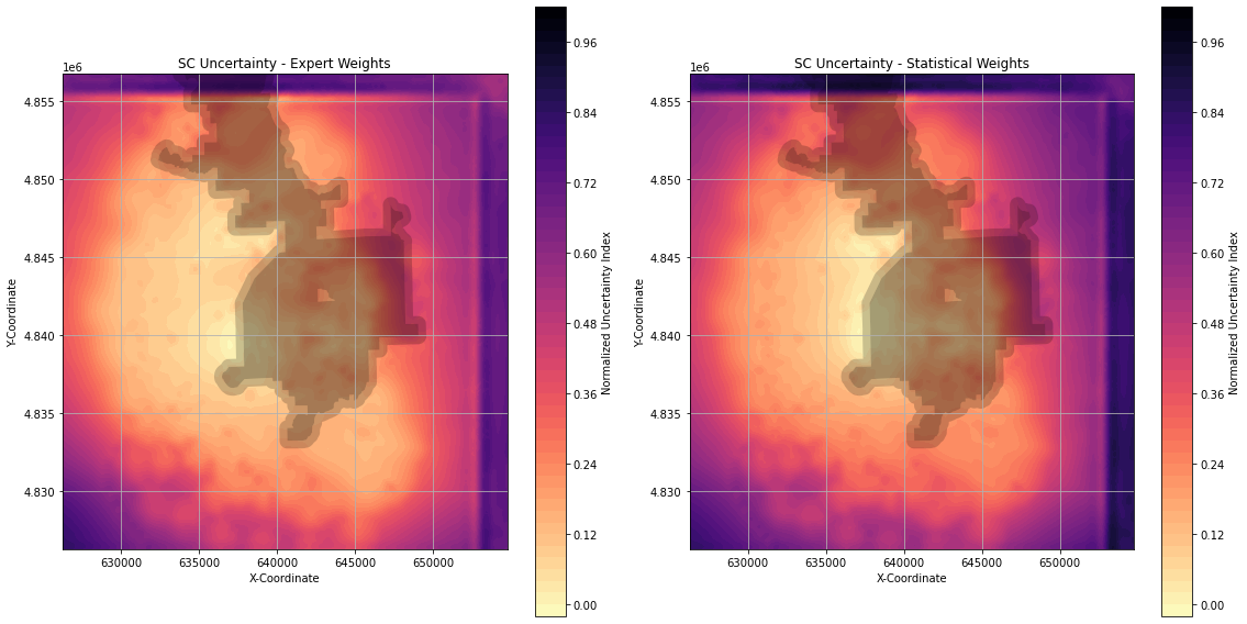
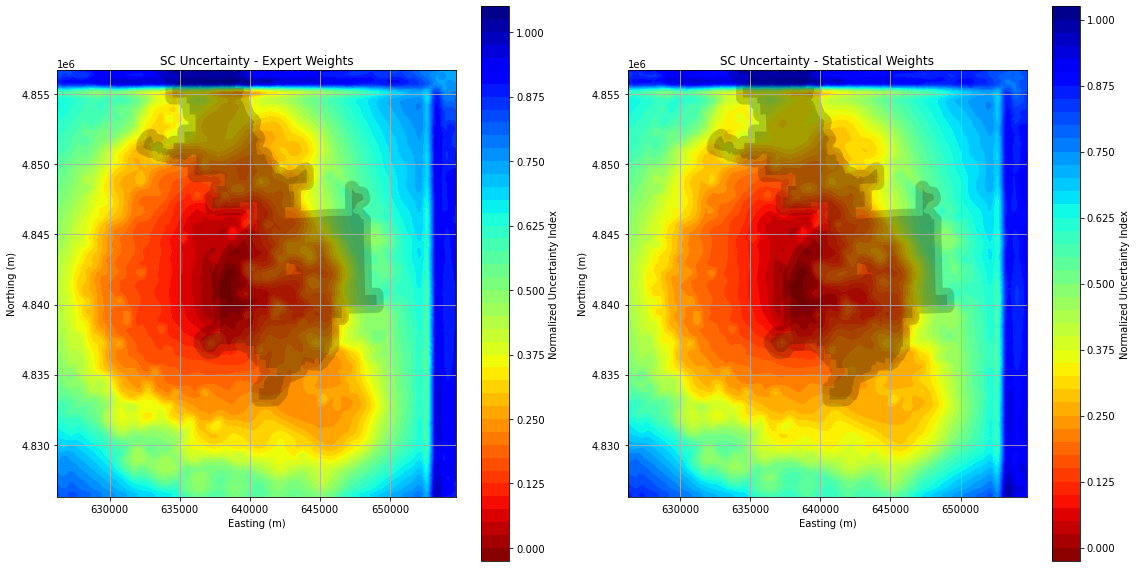
2D Uncertainty Maps for Supercritical Plays v1.0.pngPNG
This is an outdated version. See "2D Uncertainty Maps for Supercritical Plays...
-
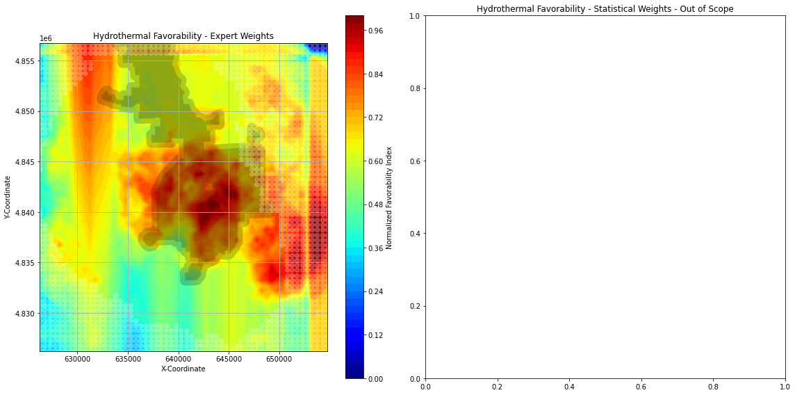
2D Favorability Map for Conventional...PNG
This is an outdated version. See "2D Favorability Map for Conventional...
-
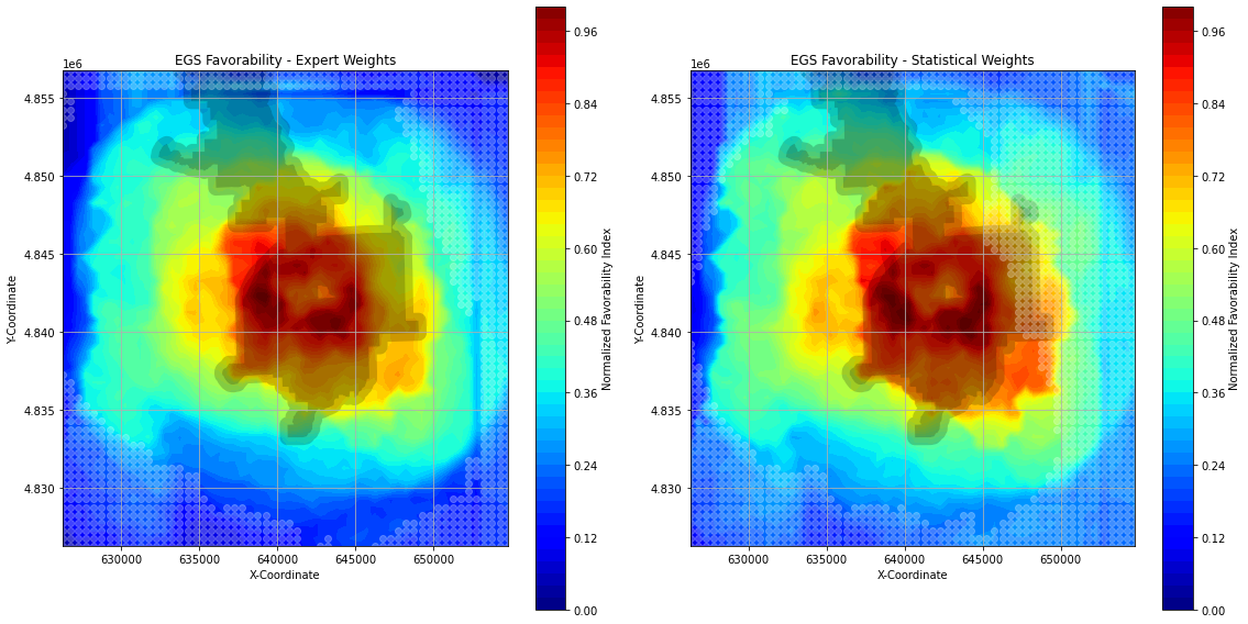
2D Favorability Maps for Supercritical Plays v1.0.pngPNG
This is an outdated version. See "2D Favorability Maps for Supercritical...
-
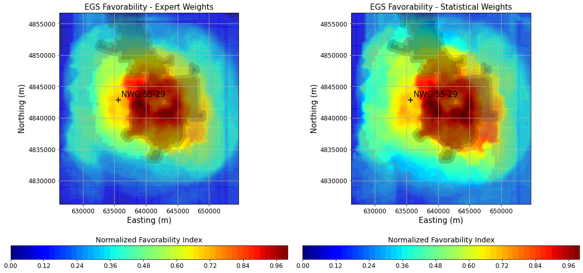
2D Favorability Maps for EGS Plays v2.1.pngPNG
This is an outdated version. See "2D Favorability Maps for EGS Plays...
-
2D Favorability Map for Conventional...PNG
This is an outdated version. See "2D Favorability Map for Conventional...
-
2D Favorability Maps for Supercritical Plays v2.1.pngPNG
This is an outdated version. See "2D Favorability Maps for Supercritical...
-
2D and 3D Favorability Models v2.1.zipZIP
This zipped directory contains CSV files representing updated 2D favorability...
-
3D Newberry Leapfrog Model v2.1.zipZIP
This is an outdated version. See "3D Newberry Leapfrog Model v2.1.1.zip"...
-
3D Newberry Leapfrog Model v2.1.omfomf
This is an outdated version. See "3D Newberry Leapfrog Model v2.1.1.omf"...
-
2D Uncertainty Maps for EGS Plays v2.0.pngPNG
Updated 2D maps showing relative uncertainty associated with favorability...
-
2D Uncertainty Map for Conventional...PNG
Updated 2D map showing relative uncertainty associated with favorability...
-
2D Uncertainty Maps for Supercritical Plays v2.0.pngPNG
Updated 2D maps showing relative uncertainty associated with favorability...
-
2D and 3D Uncertainty Models v2.0.zipZIP
This zipped directory contains updated CSV files representing 2D confidence...
-
3D Newberry Leapfrog Model v2.1.1.zipZIP
Updated Leapfrog 3D geodata model, uncertainty models, and PFA favorability...
-
3D Newberry Leapfrog Model v2.1.1.omfomf
Updated Leapfrog 3D geodata model, uncertainty models, and PFA favorability...
-
2D Favorability Maps for EGS Plays v2.1.2.pngPNG
Updated 2D maps showing relative favorability for EGS at Newberry Volcano,...
-
2D Favorability Maps for Conventional...PNG
Updated 2D map showing relative uncertainty associated with favorability...
-
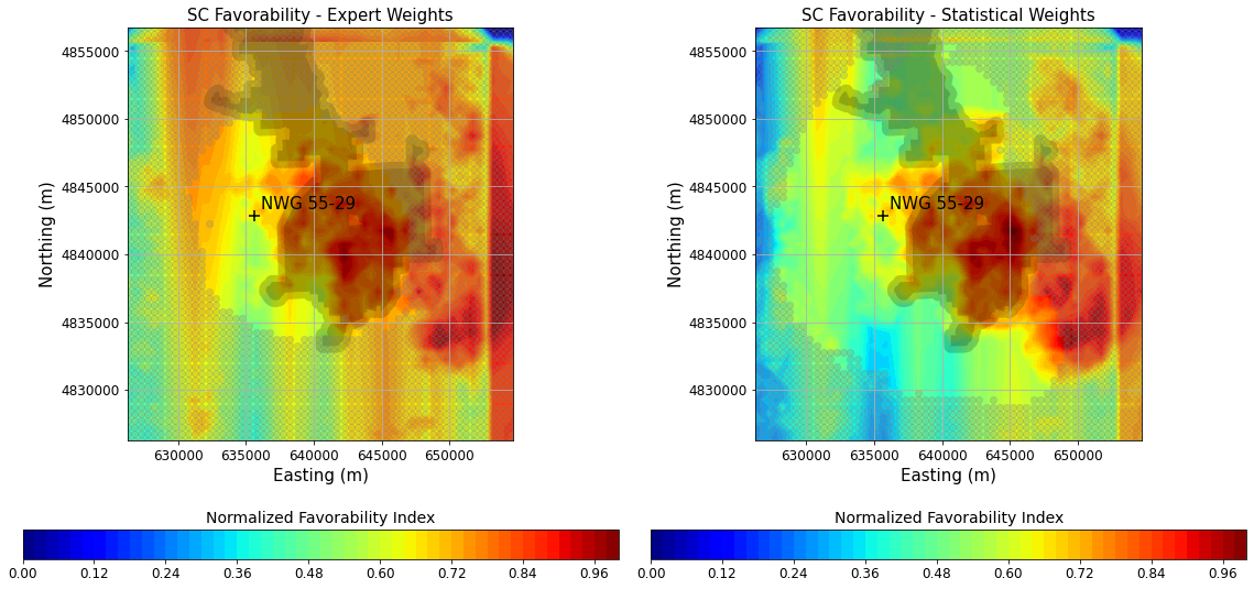
2D Favorability Maps for Supercritical Plays v2.1.2.pngPNG
Updated 2D maps showing relative favorability for supercritical resources at...
-
0. DEEPEN Final 3D PFA Favorability Models and...HTML
Link to GDR submission with only the final versions of PFA outputs.
-
Landing PageLanding Page
Dates
| Metadata Created Date | January 11, 2025 |
|---|---|
| Metadata Updated Date | January 20, 2025 |
Metadata Source
- Data.json Data.json Metadata
Harvested from OpenEI data.json
Additional Metadata
| Resource Type | Dataset |
|---|---|
| Metadata Created Date | January 11, 2025 |
| Metadata Updated Date | January 20, 2025 |
| Publisher | National Renewable Energy Laboratory |
| Maintainer | |
| Doi | 10.15121/1995530 |
| Identifier | https://data.openei.org/submissions/7603 |
| Data First Published | 2023-06-30T06:00:00Z |
| Data Last Modified | 2024-01-24T23:37:02Z |
| Public Access Level | public |
| Bureau Code | 019:20 |
| Metadata Context | https://openei.org/data.json |
| Metadata Catalog ID | https://openei.org/data.json |
| Schema Version | https://project-open-data.cio.gov/v1.1/schema |
| Catalog Describedby | https://project-open-data.cio.gov/v1.1/schema/catalog.json |
| Data Quality | True |
| Datagov Dedupe Retained | 20250120155001 |
| Harvest Object Id | 8ec3b8a3-ccb1-455c-9a34-e256e01182b7 |
| Harvest Source Id | 7cbf9085-0290-4e9f-bec1-91653baeddfd |
| Harvest Source Title | OpenEI data.json |
| Homepage URL | https://gdr.openei.org/submissions/1513 |
| License | https://creativecommons.org/licenses/by/4.0/ |
| Old Spatial | {"type":"Polygon","coordinates":-121.4333333,43.51666667,-121.0333333,43.51666667,-121.0333333,43.91666667,-121.4333333,43.91666667,-121.4333333,43.51666667} |
| Program Code | 019:006 |
| Projectlead | Lauren Boyd |
| Projectnumber | 37178 |
| Projecttitle | DE-risking Exploration of geothermal Plays in magmatic ENvironments (DEEPEN) |
| Source Datajson Identifier | True |
| Source Hash | 269a1bd08e7d1176b789013e4be79d869be4ef646849c9a3103e77337ee02b1c |
| Source Schema Version | 1.1 |
| Spatial | {"type":"Polygon","coordinates":-121.4333333,43.51666667,-121.0333333,43.51666667,-121.0333333,43.91666667,-121.4333333,43.91666667,-121.4333333,43.51666667} |
Didn't find what you're looking for? Suggest a dataset here.