

Snake River Plain Geothermal Play Fairway Analysis Heat, Permeability, and Seal CRS Map Raster Files
Access & Use Information
Downloads & Resources
-
aquifer_thickness.pngPNG
Thickness of Snake River and MH perched aquifers; isopachs from Lindholm 1996.
-
Paleo Lakes.pngPNG
Distribution of paleo lake deposits
-
Blank Template.pngPNG
Blank template used as basis for all raster files in this archive
-
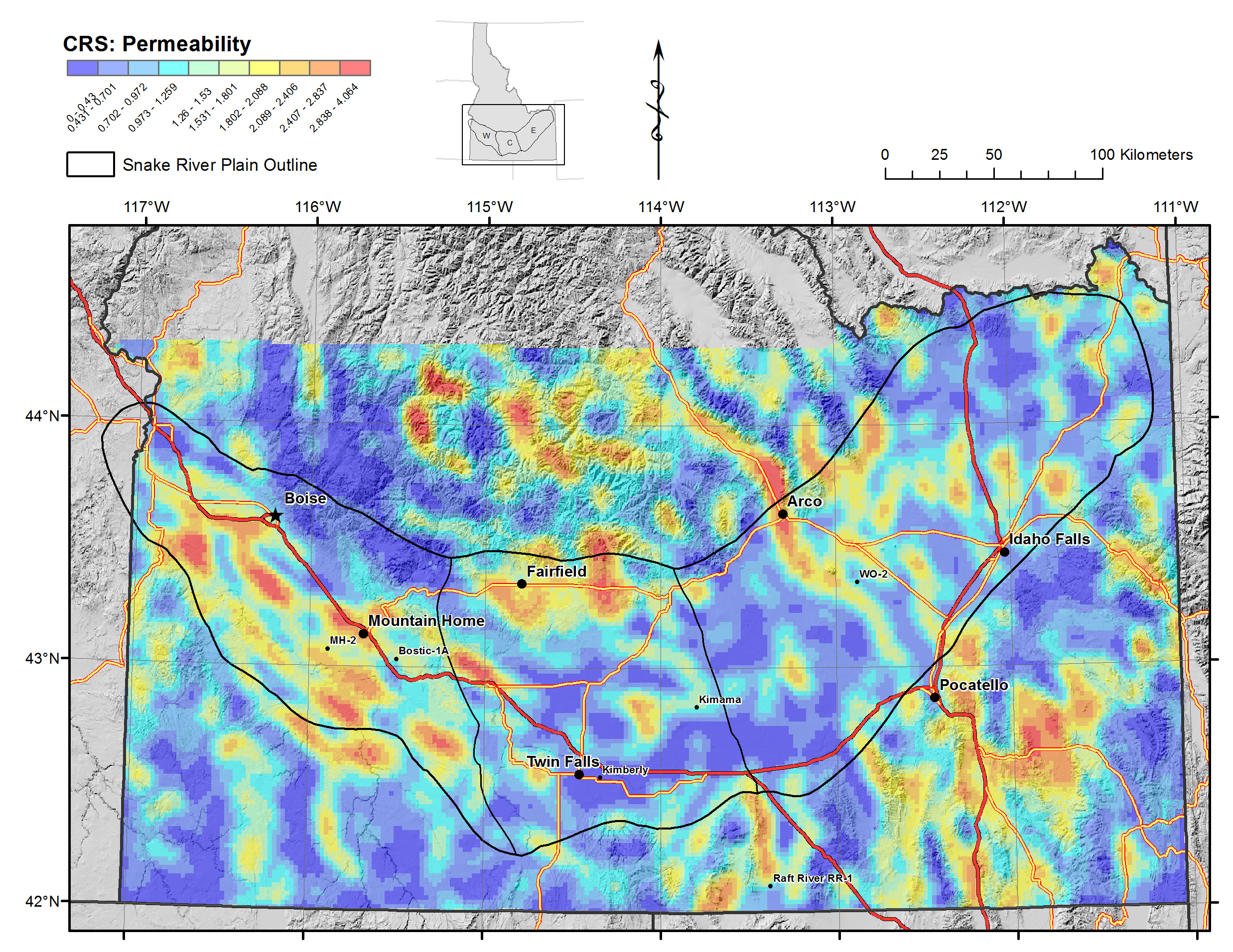
CRS Permeability.pngPNG
Common Risk Segment Map for Permeability, divided using natural breaks in data.
-
CCRS.pngPNG
Composite Common Risk Segment Map for overall geothermal potential,, divided...
-
CCRS Normalized.pngPNG
Composite Common Risk Segment Map for overall geothermal potential,...
-
CRS Heat.pngPNG
Common Risk Segment Map for Heat, divided using natural breaks in data
-
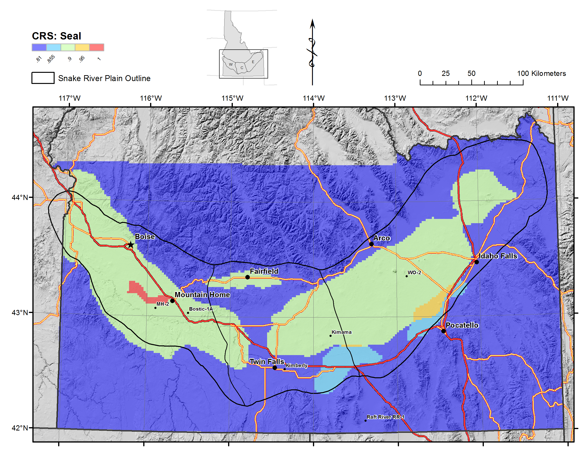
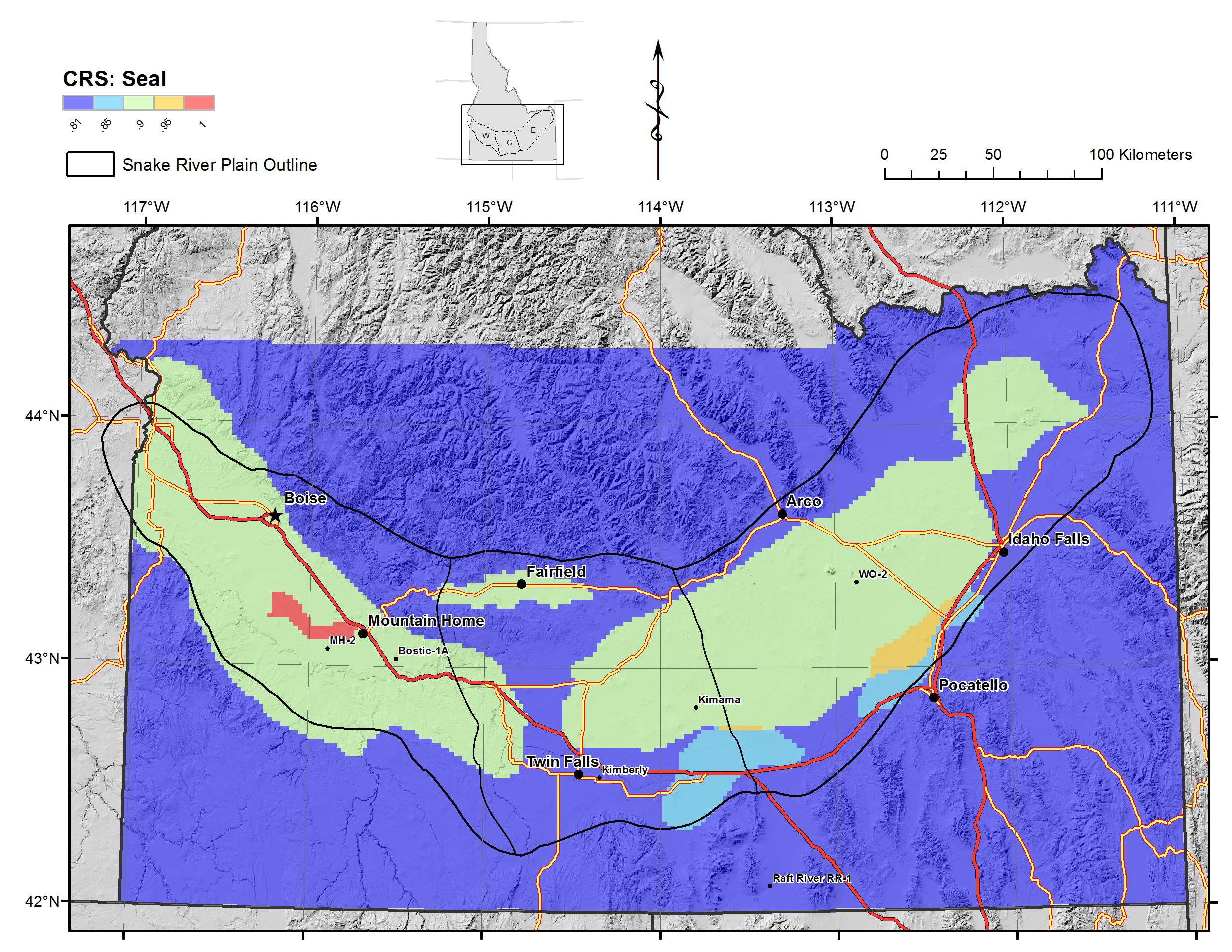
CRS_Seal.pngPNG
Common Risk Segment Map for Seals, weighted by thickness of seal.
-
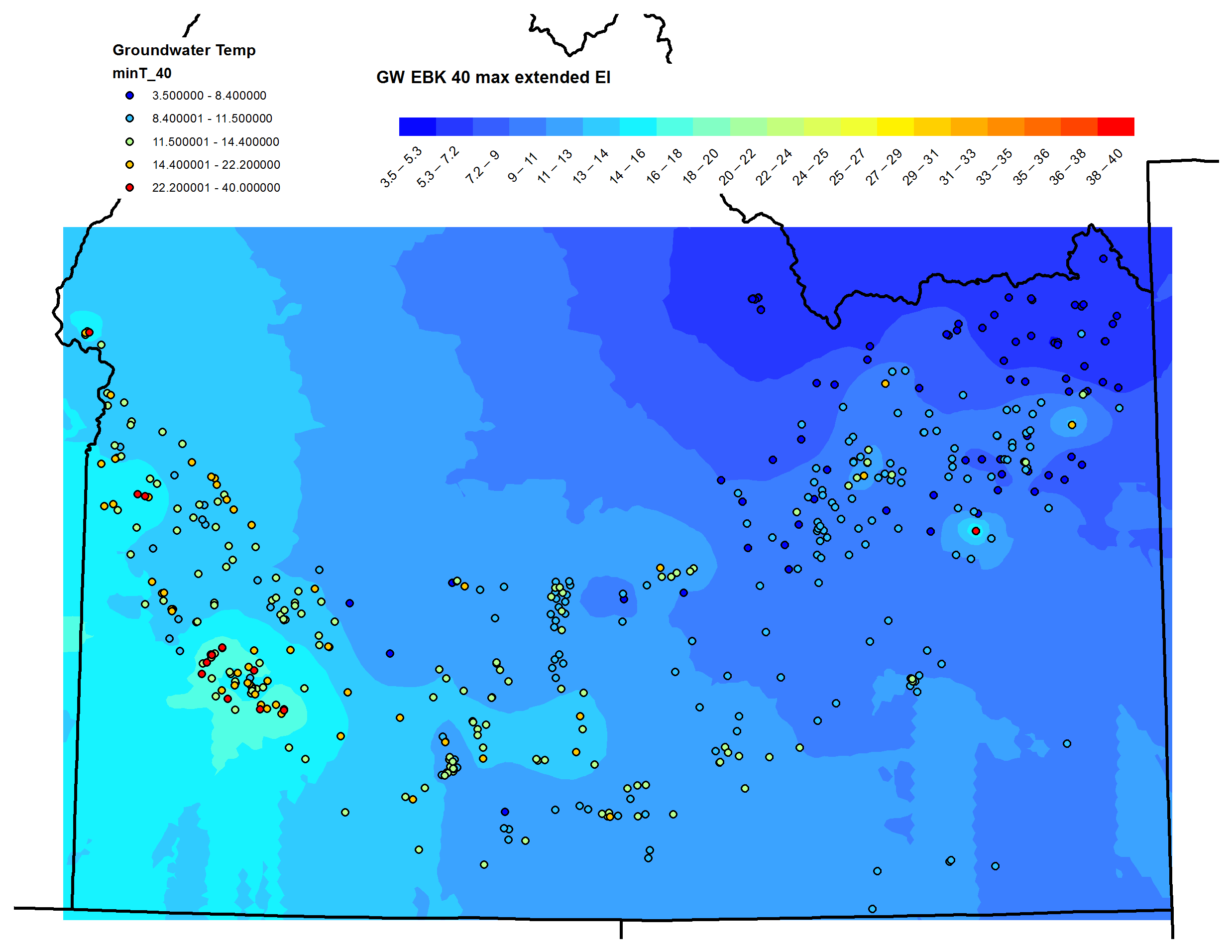
Groundwater Temperature - Equal Interval.pngPNG
Groundwater temperatures from Idaho Geological Survey database, interpolated...
-
Groundwater Temperature - Quantile.pngPNG
Groundwater temperatures from Idaho Geological Survey database, interpolated...
-
Groundwater Temperature SE Equal Interval.pngPNG
Standard error surface for groundwater temperatures, derived from Empirial...
-
CRS Permeability Normalized.pngPNG
Common Risk Segment Map for Permeability, normalized values from 0 to 1.0
-
CRS Heat Source Normalized.pngPNG
Common Risk Segment Map for Heat, normalized values from 0 to 1.0
-
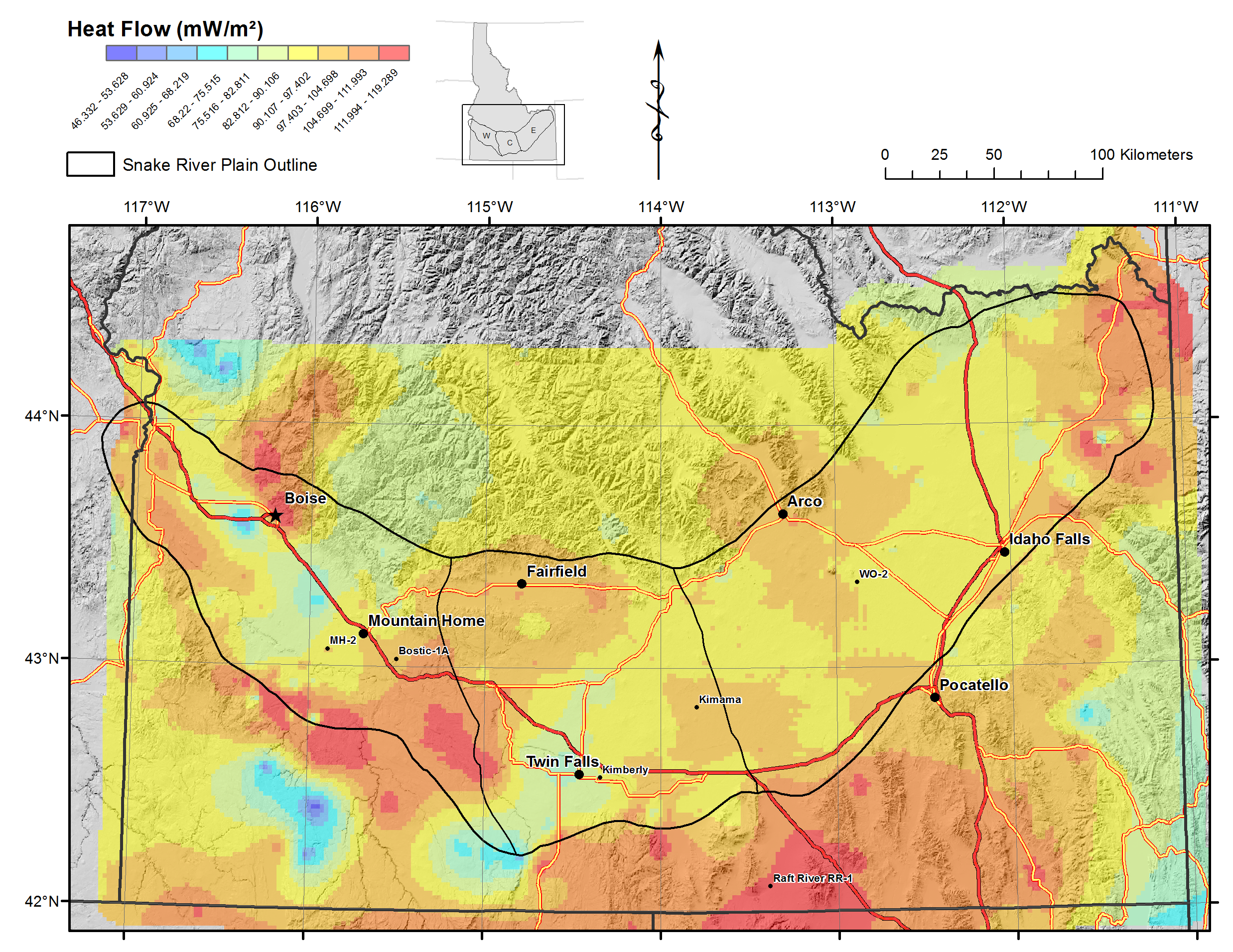
Heat Source Heat Flow.pngPNG
Heat flow from modified USGS database, interpolated by Empirical Bayesian...
-
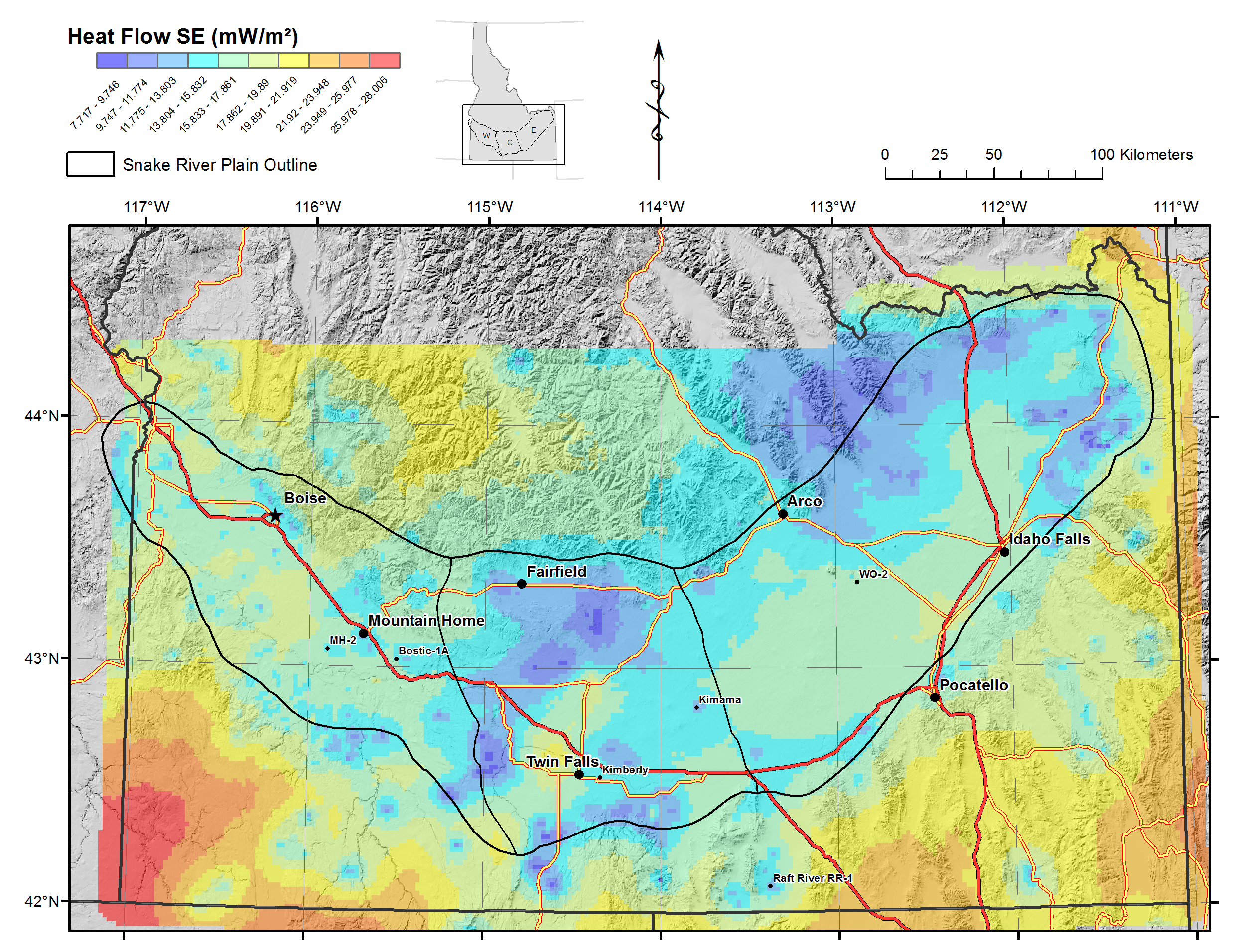
Heat Source Heat Flow SE.pngPNG
Standard error map for Heat Flow from Empirical Bayesian Kriging.
-
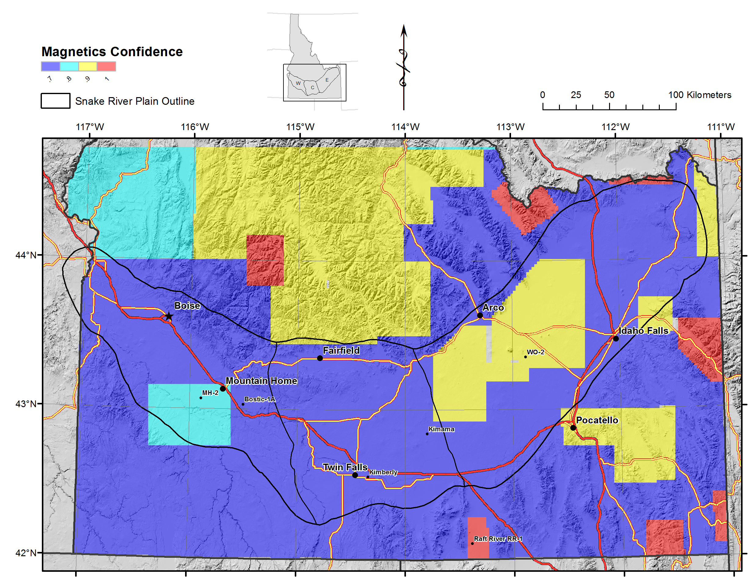
Magnetics Permeability - Confidence.pngPNG
Confidence layer for magnetic lineaments based on aeromag flight lines...
-
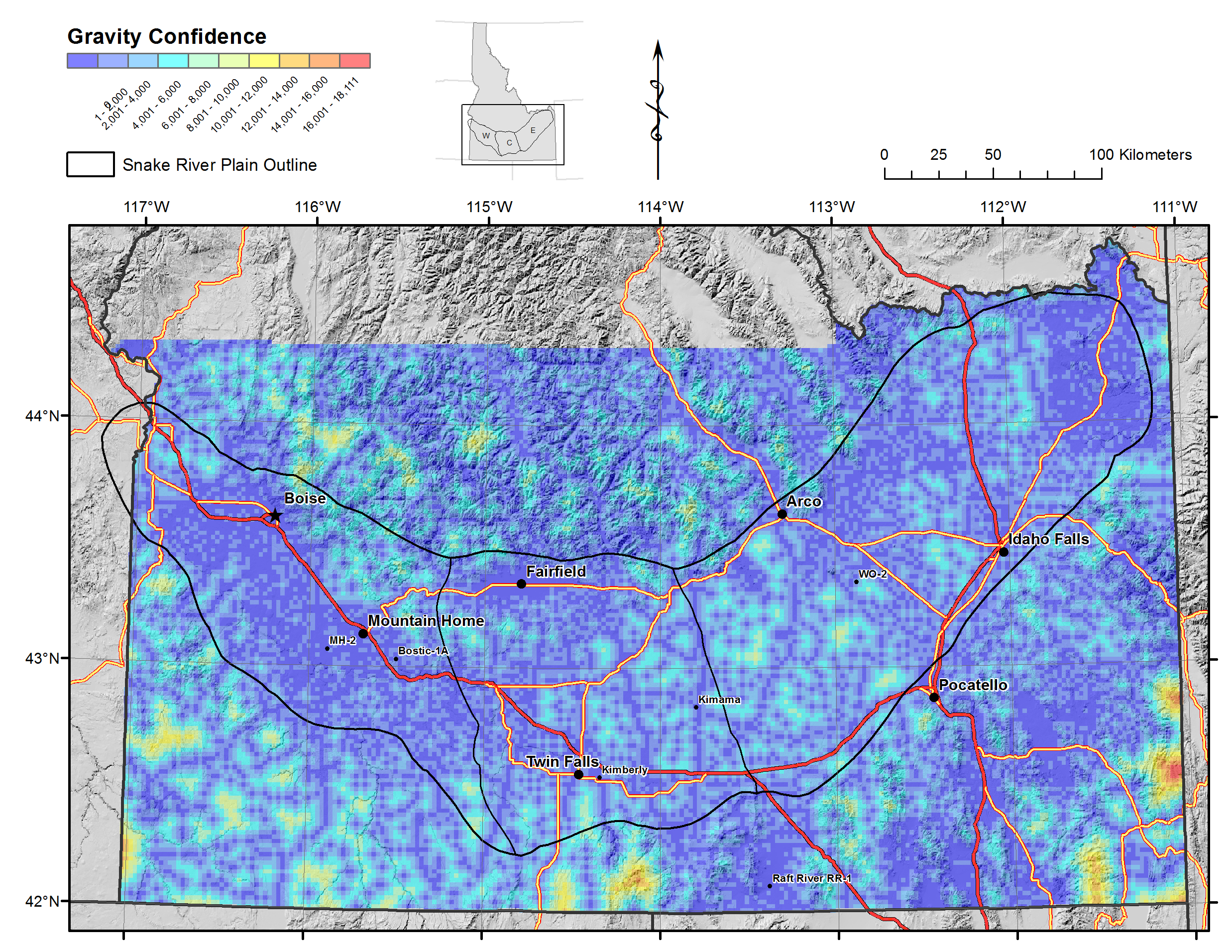
Gravity Permeability - Confidence.pngPNG
Confidence layer for gravity lineations, based on distance between gravity...
-
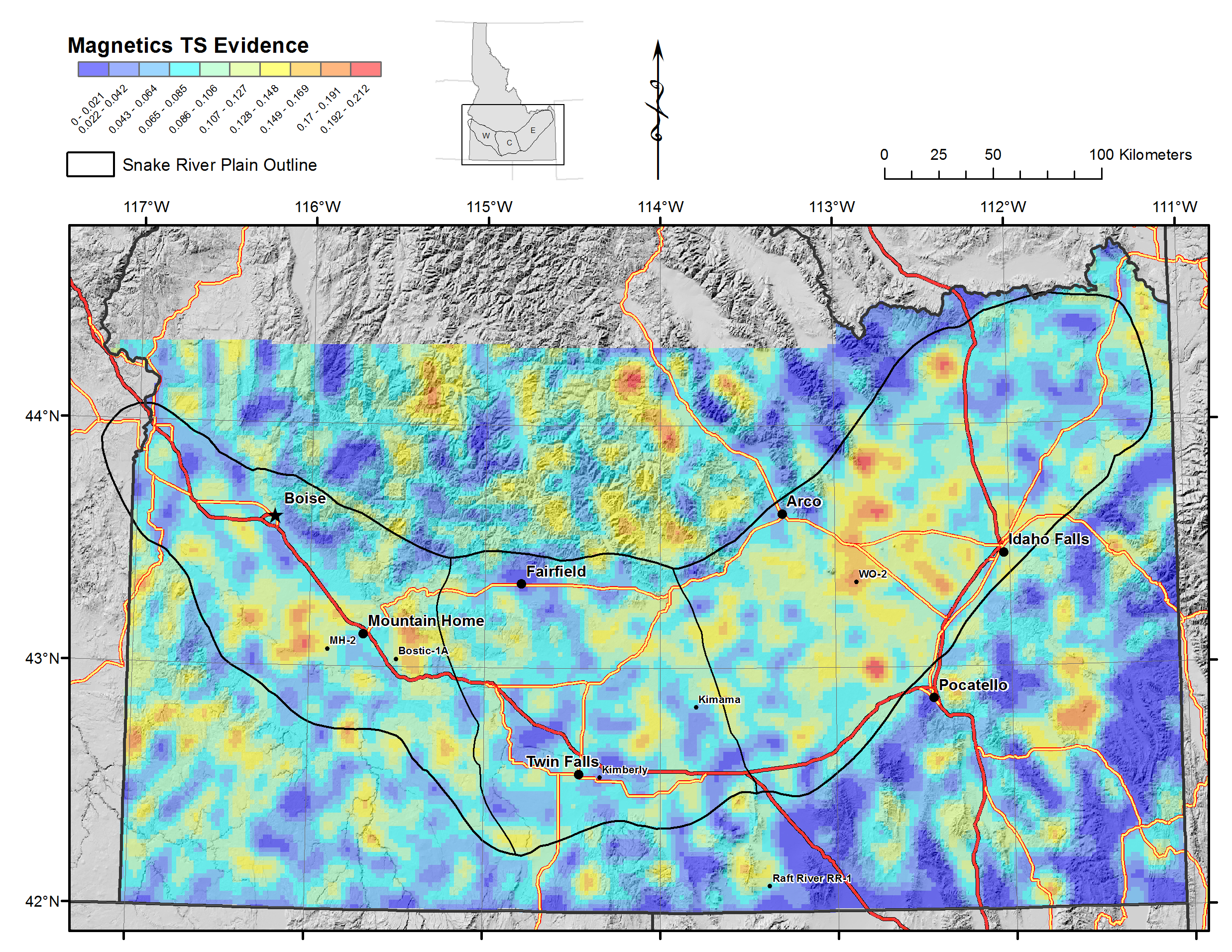
Magnetics Permeability - TS Evidence.pngPNG
Kernel density function of magnetic lineations, weighted by slip tendency.
-
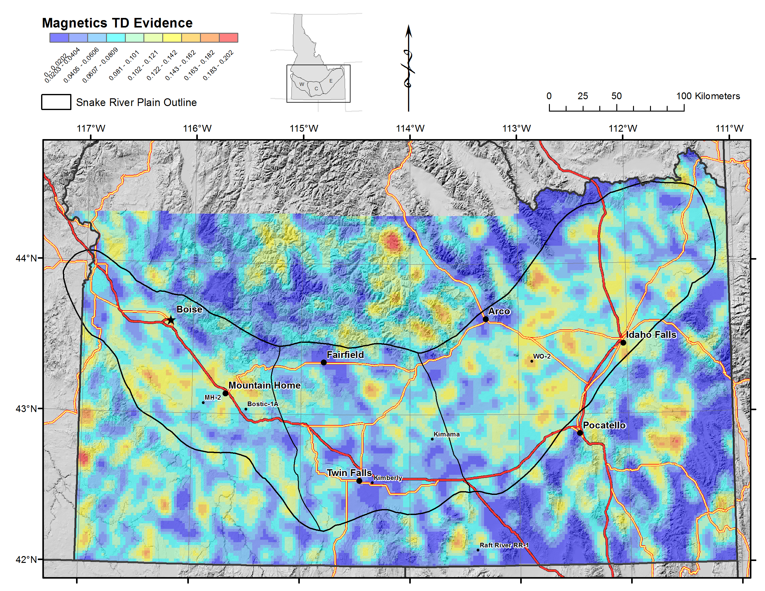
Magnetics Permeability - TD Evidence.pngPNG
Kernel density function of magnetic lineations, weighted by dilation tendency.
-
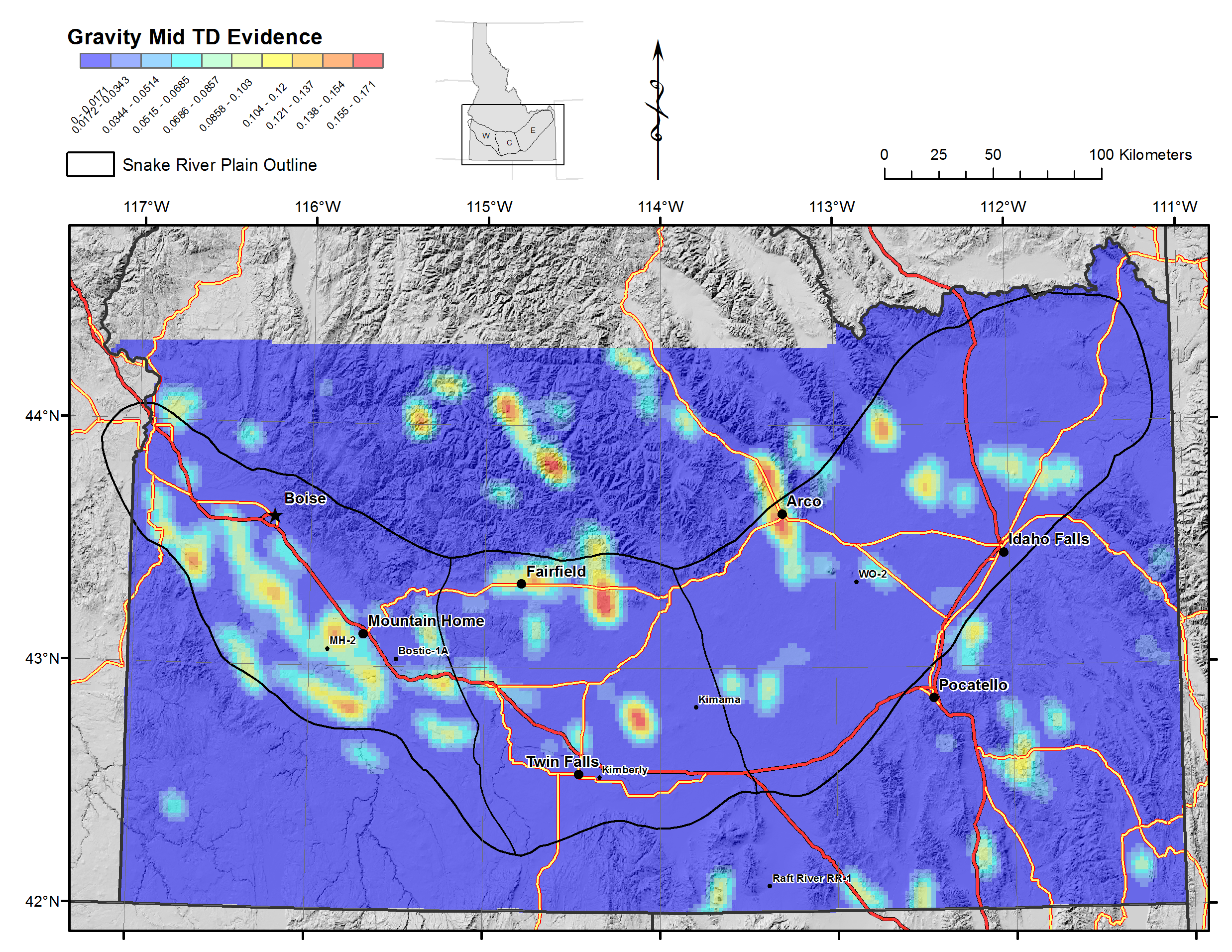
Gravity Mid Permeability - TD Evidence.pngPNG
Kernel density function of mid crustal gravity lineations, weighted by...
-
Gravity Mid Permeability - TS Evidence.pngPNG
Kernel density function of mid crustal gravity lineations, weighted by slip...
-
Mapped Faults Permeability - TD Risk.pngPNG
Risk map for mapped faults = mapped fault evidence layers time mapped fault...
-
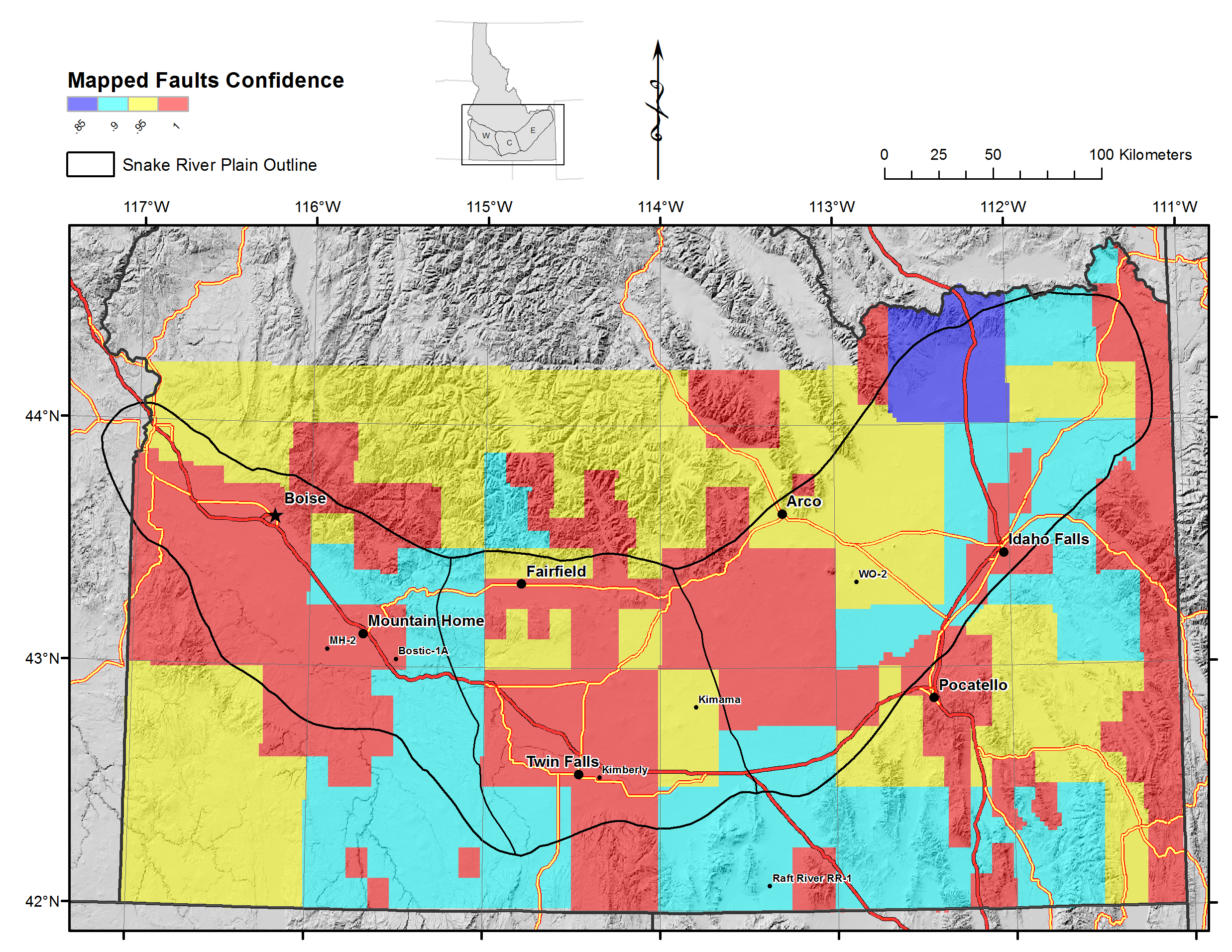
Mapped Faults Permeability - TD Confidence.pngPNG
Confidence layer for mapped faults, based on scale of field mapping.
-
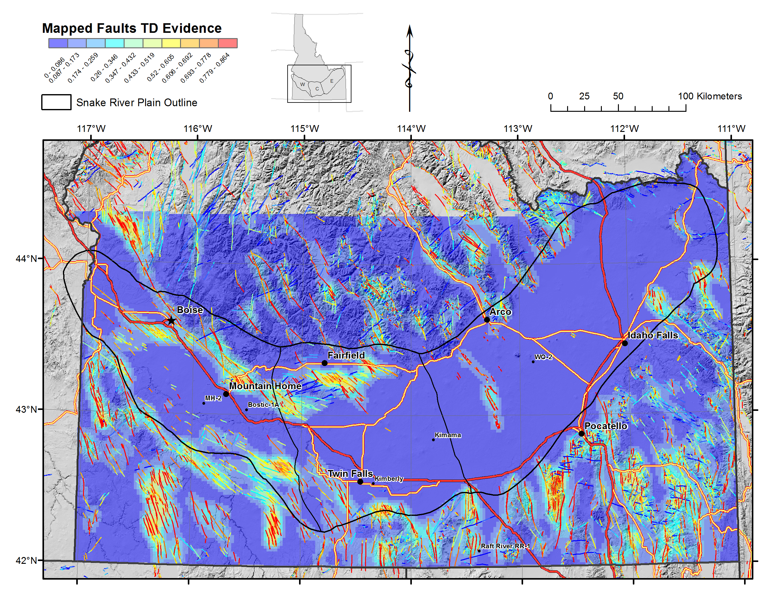
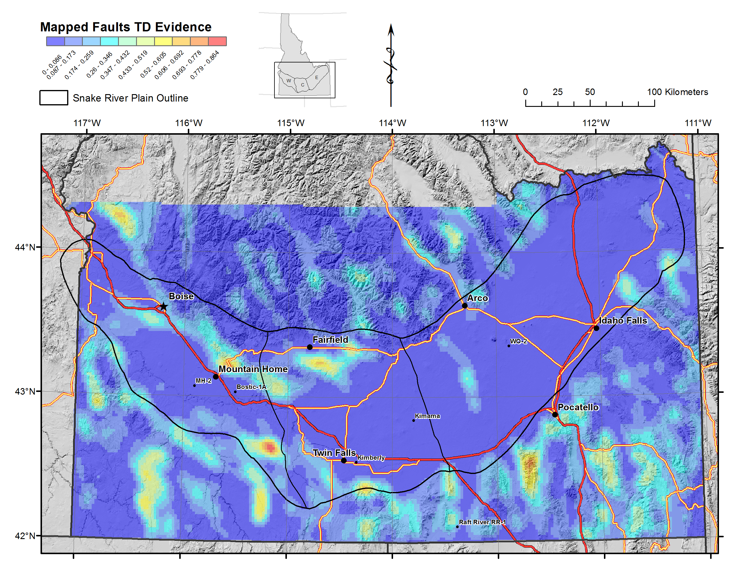
Mapped Faults Permeability - TD Evidence 2.pngPNG
Kernel density function of mapped faults, weighted by dilation tendency, with...
-
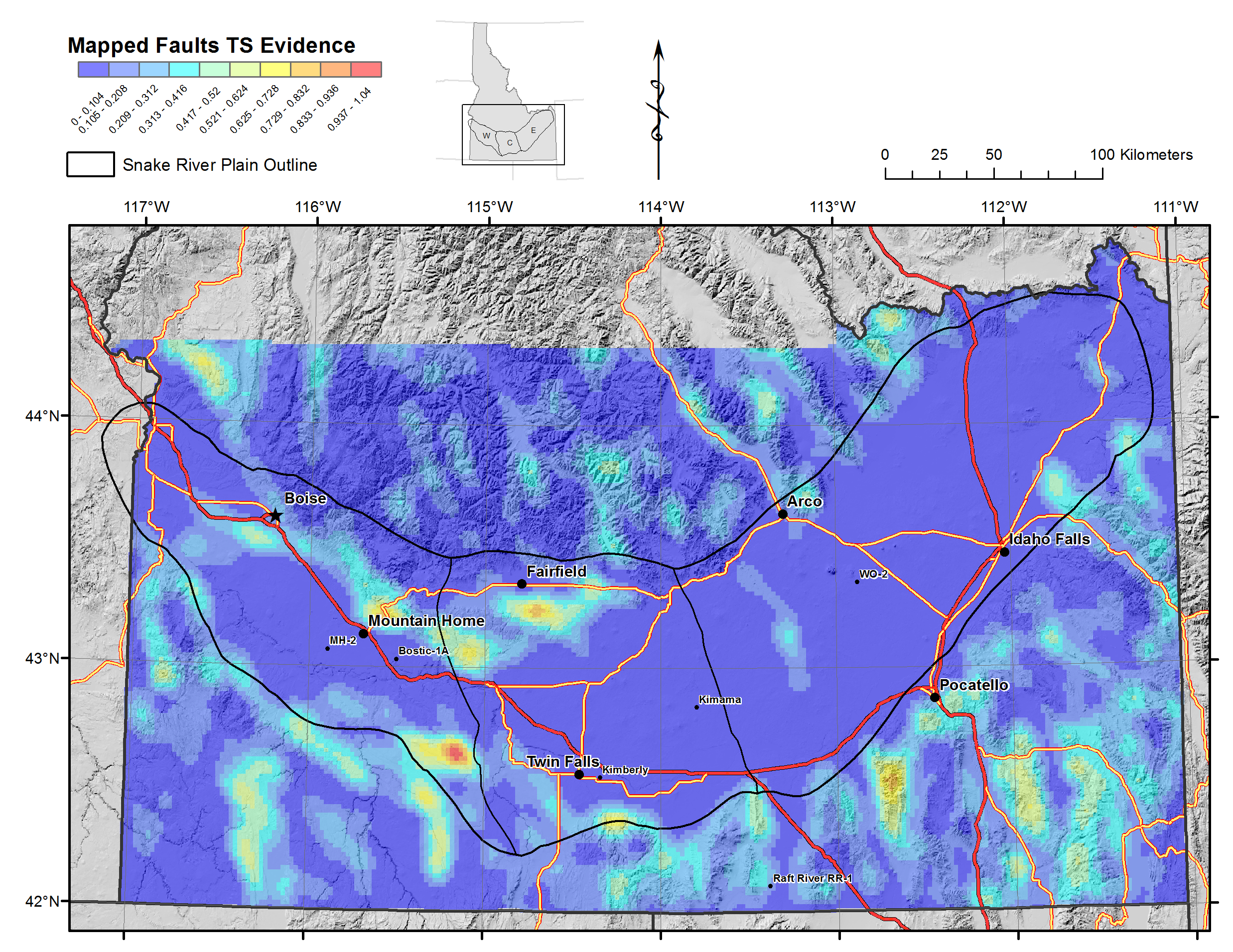
Mapped Faults Permeability - TS Evidence.pngPNG
Kernel density function of mapped faults, weighted by slip tendency.
-
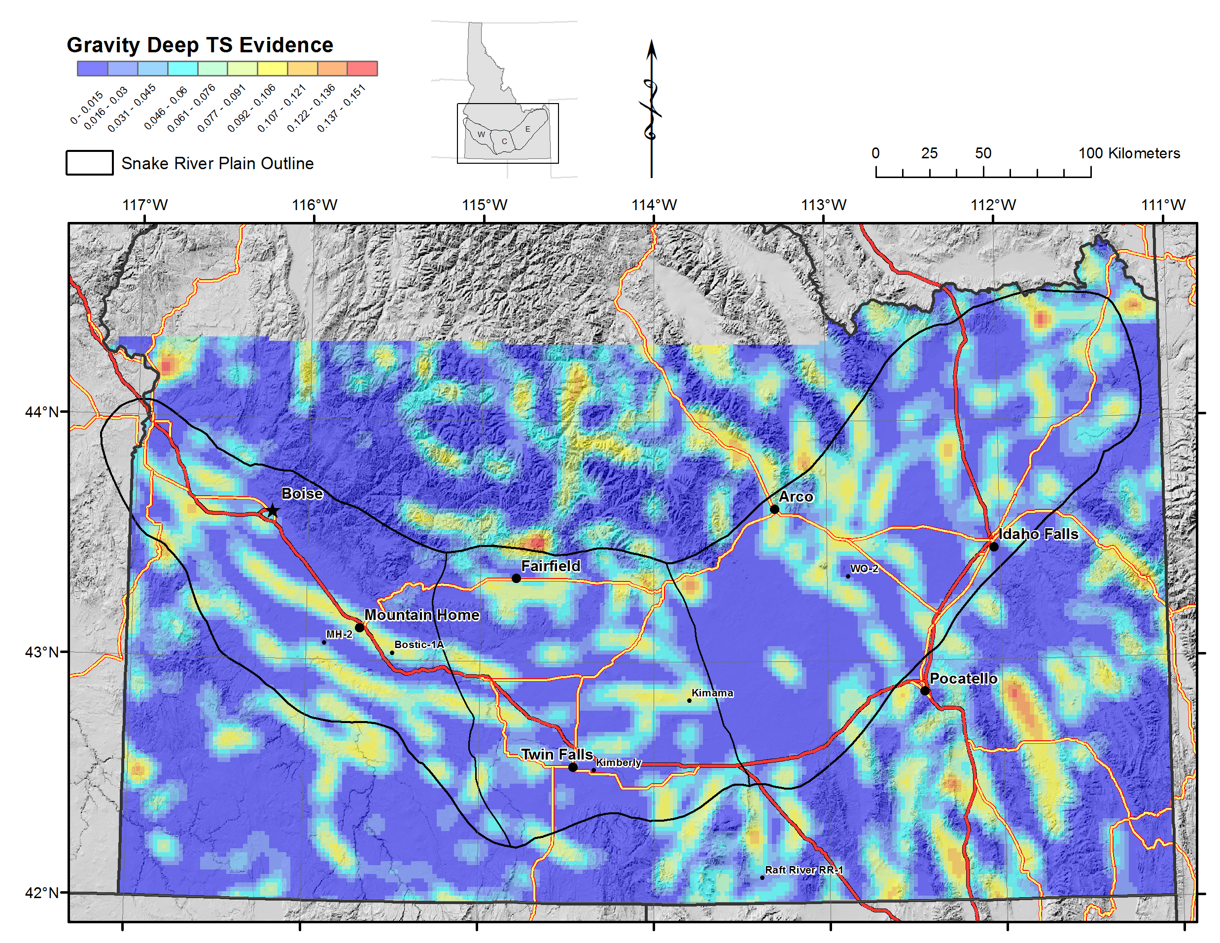
Gravity Deep Permeability - TS Evidence.pngPNG
Kernel density function of deep crustal gravity lineations, weighted by slip...
-
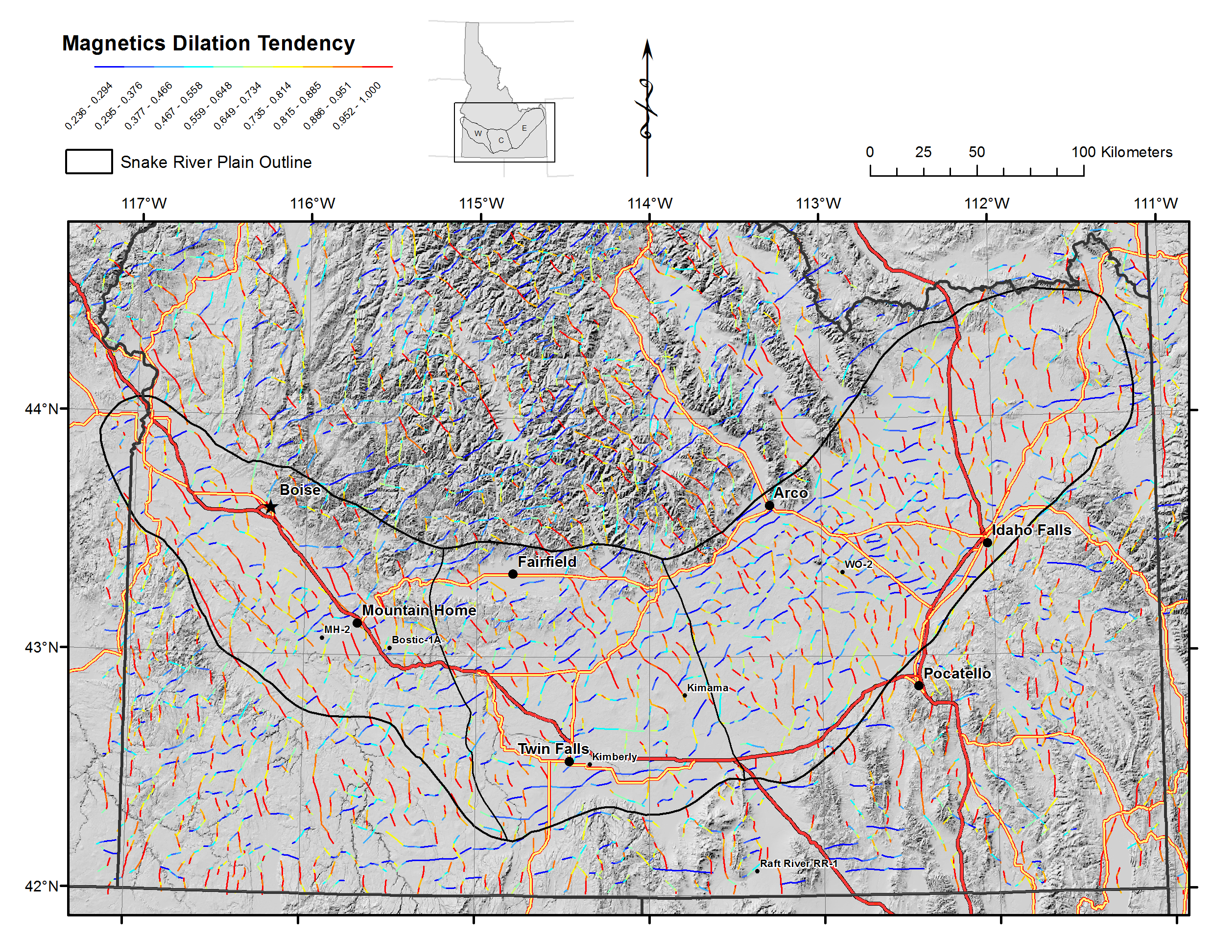
Magnetic TD.pngPNG
Magnetic lineations (from maximum horizontal gradients) dilation tendency
-
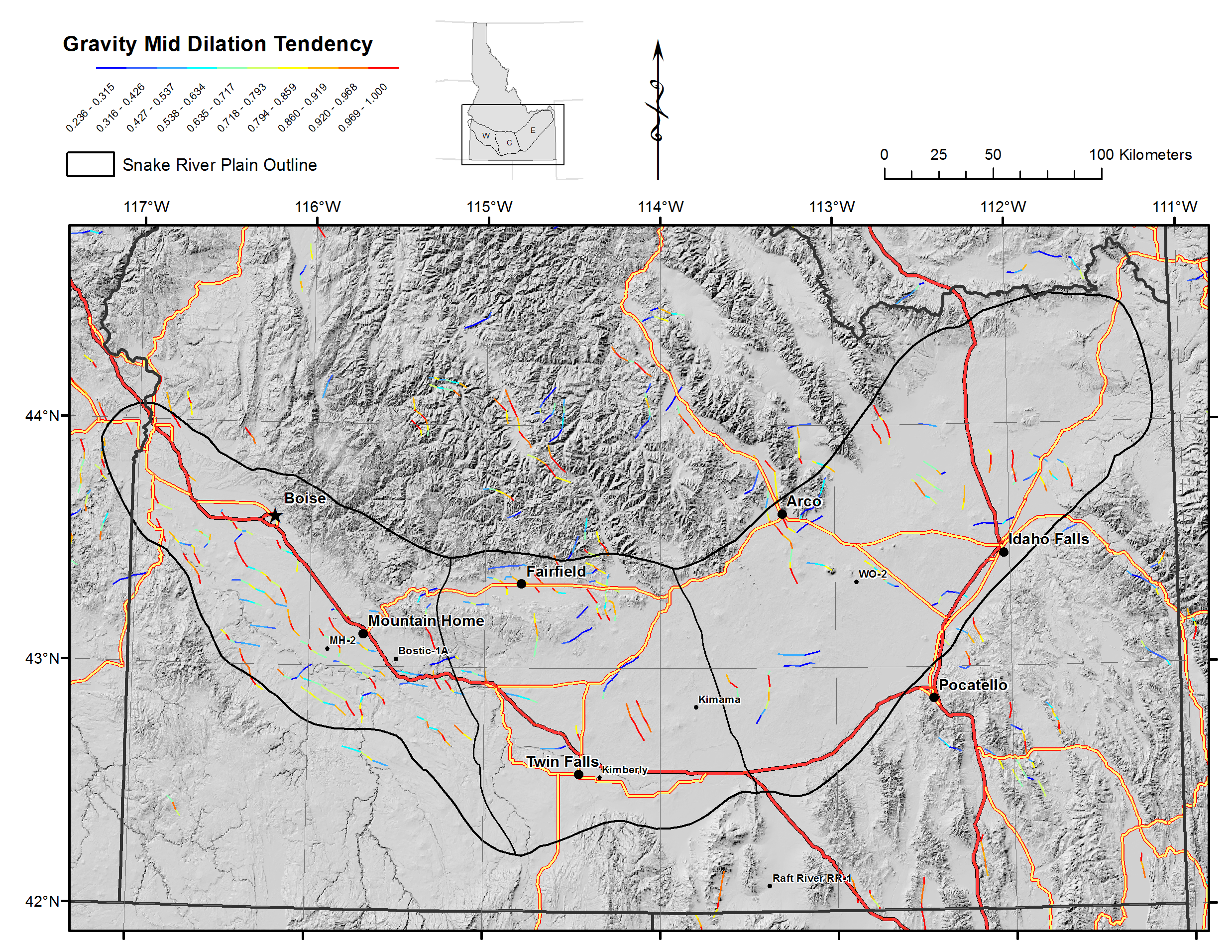
Gravity Mid TD.pngPNG
Mid-crustal gravity lineations (from maximum horizontal gradients) dilation...
-
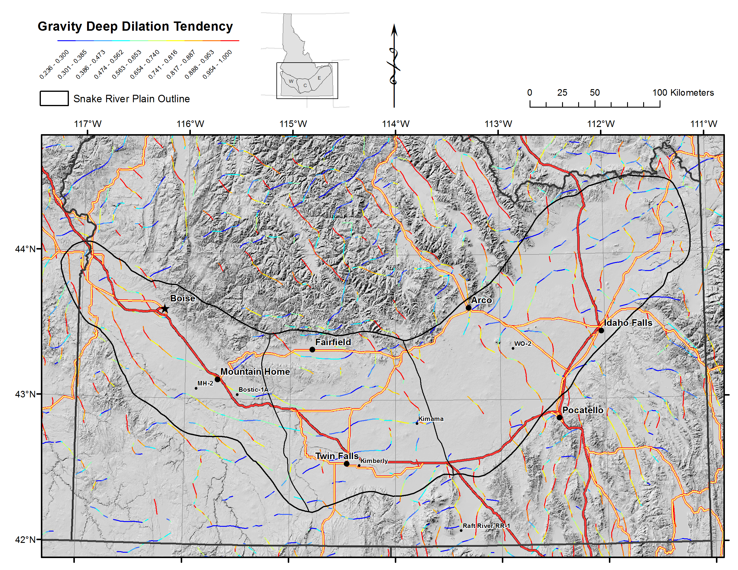
Gravity Deep TD.pngPNG
Deep-crustal gravity lineations (from maximum horizontal gradients) dilation...
-
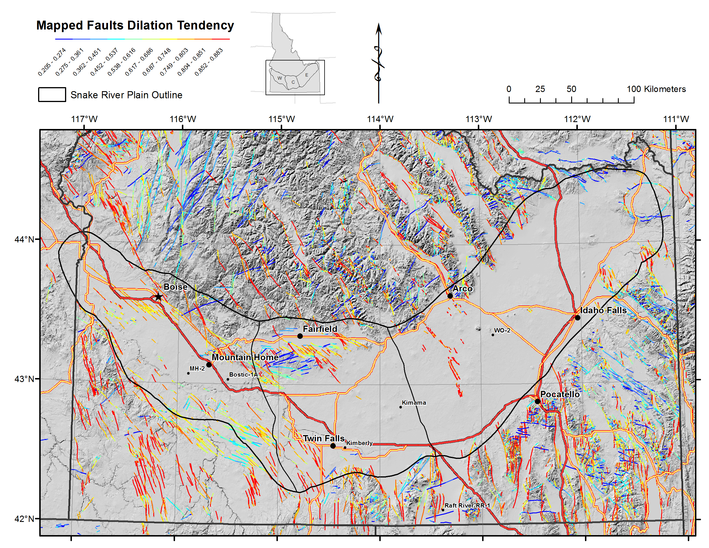
Mapped Faults TD.pngPNG
Mapped faults dilation tendency
-
Gravity Deep Permeability - TD Evidence.pngPNG
Kernel density function of deep crustal gravity lineations, weighted by...
-
Permeability CRS.pngPNG
Common Risk Segment Map for permeability.
-
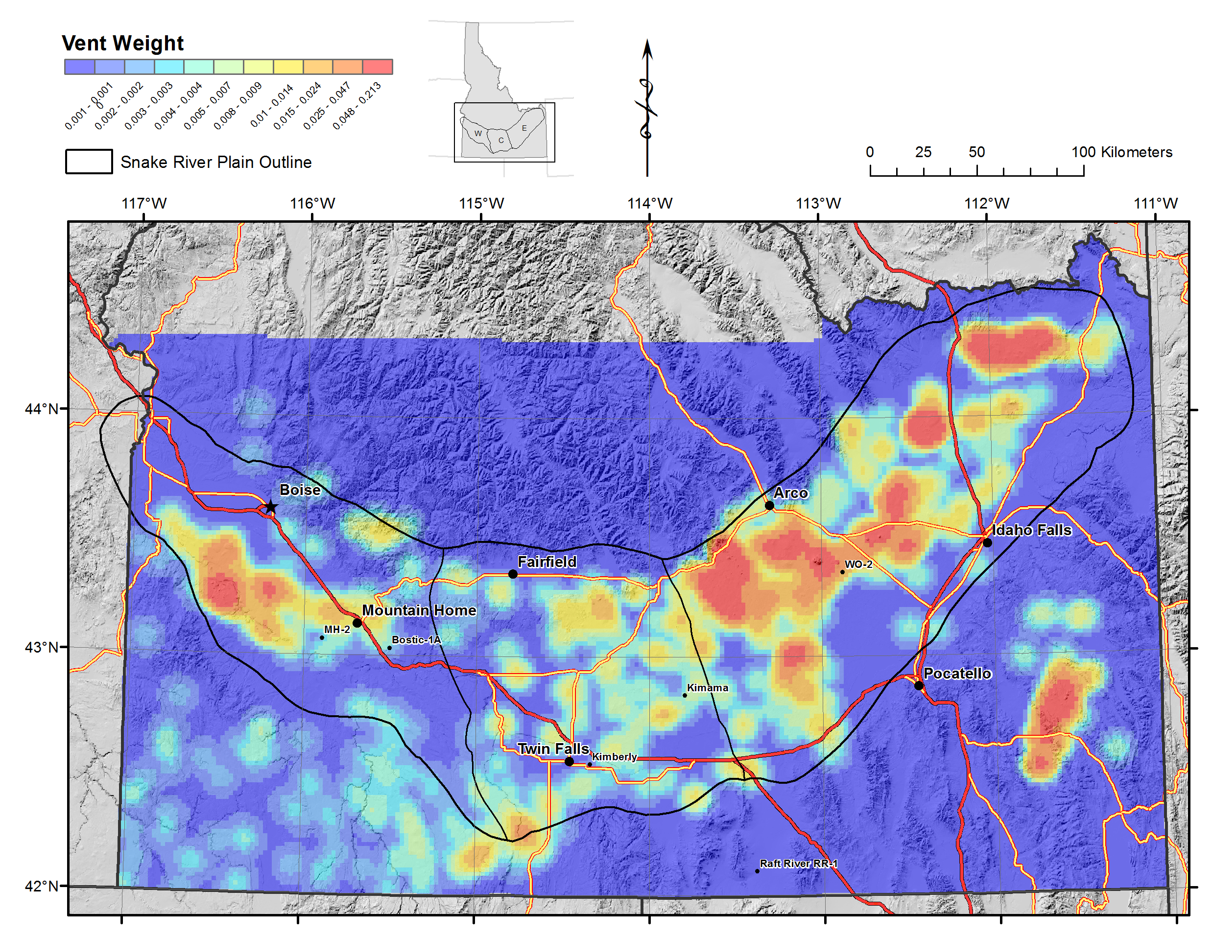
Heat Source Vents 2.pngPNG
Kernel density function for volcanic vents weighted by Age and Size., showing...
-
Seal CRS.pngPNG
Common Risk Segment Map for Seal.
-
Seal Aquifer.pngPNG
Distibution of impermeable seal at base of SRP aquifers; weighted 1 if...
-
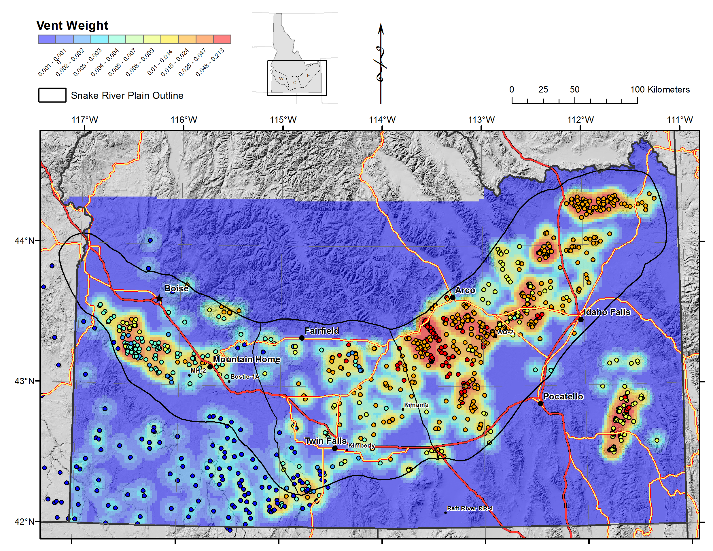
Heat Source Vents.pngPNG
Kernel density function for volcanic vents weighted by Age and Size.
-
Mapped Faults Permeability - TD Evidence.pngPNG
Kernel density function of mapped faults, weighted by dilation tendency.
-
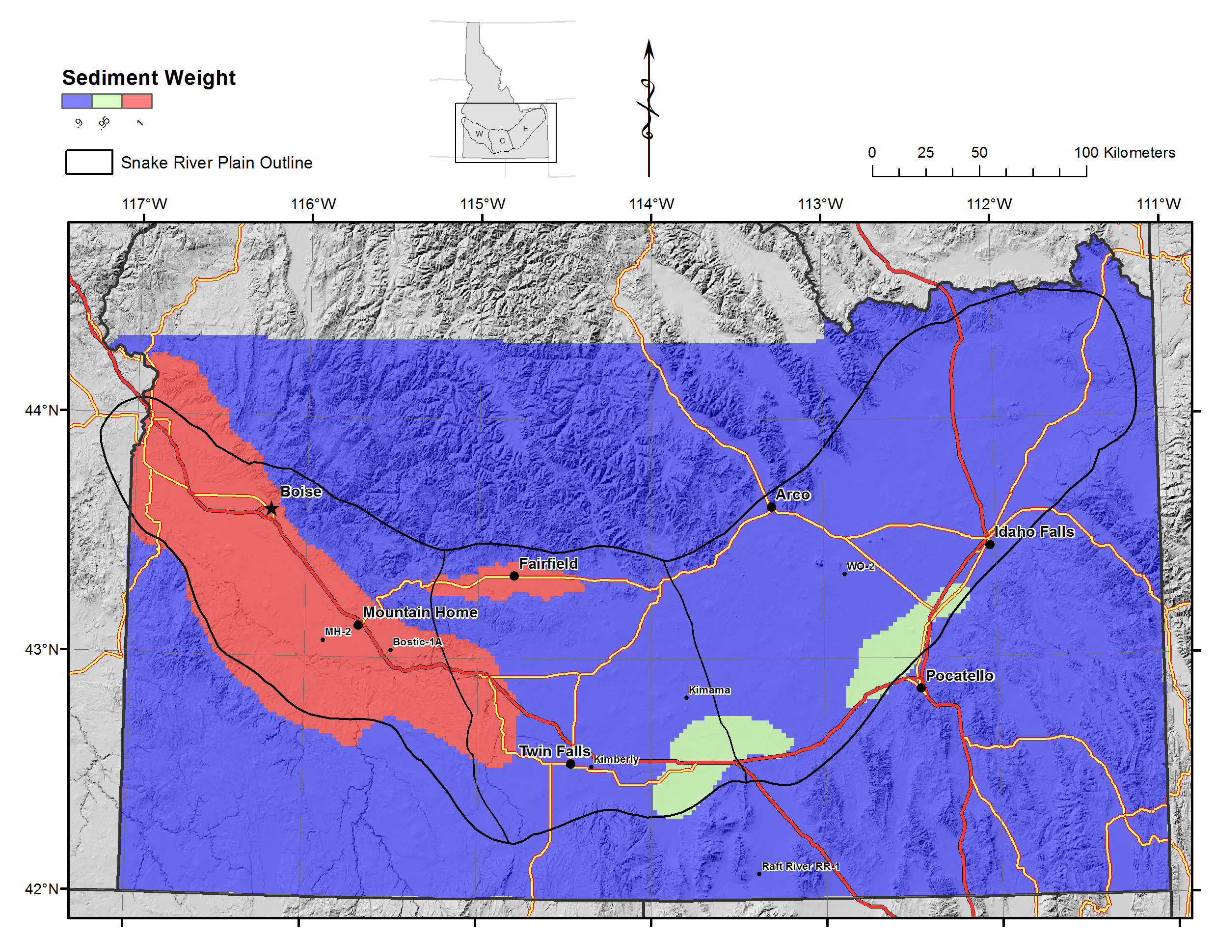
Seal Sediments.pngPNG
Distribution of impermeable lacustrine sediments weighted by thickness.
-
Landing PageLanding Page
Dates
| Metadata Created Date | January 11, 2025 |
|---|---|
| Metadata Updated Date | January 20, 2025 |
Metadata Source
- Data.json Data.json Metadata
Harvested from OpenEI data.json
Additional Metadata
| Resource Type | Dataset |
|---|---|
| Metadata Created Date | January 11, 2025 |
| Metadata Updated Date | January 20, 2025 |
| Publisher | Utah State University |
| Maintainer | |
| Doi | 10.15121/1254474 |
| Identifier | https://data.openei.org/submissions/6952 |
| Data First Published | 2015-10-09T06:00:00Z |
| Data Last Modified | 2020-01-08T23:26:44Z |
| Public Access Level | public |
| Bureau Code | 019:20 |
| Metadata Context | https://openei.org/data.json |
| Metadata Catalog ID | https://openei.org/data.json |
| Schema Version | https://project-open-data.cio.gov/v1.1/schema |
| Catalog Describedby | https://project-open-data.cio.gov/v1.1/schema/catalog.json |
| Data Quality | True |
| Datagov Dedupe Retained | 20250120143002 |
| Harvest Object Id | 9a8d95b6-56e1-4786-952f-f3513648b38a |
| Harvest Source Id | 7cbf9085-0290-4e9f-bec1-91653baeddfd |
| Harvest Source Title | OpenEI data.json |
| Homepage URL | https://gdr.openei.org/submissions/733 |
| License | https://creativecommons.org/licenses/by/4.0/ |
| Old Spatial | {"type":"Polygon","coordinates":-117.166365,41.989406,-111.042949,41.989406,-111.042949,44.74641,-117.166365,44.74641,-117.166365,41.989406} |
| Program Code | 019:006 |
| Projectlead | Holly Thomas |
| Projectnumber | EE0006733 |
| Projecttitle | Geothermal Play Fairway Analysis of the Snake River Plain, Idaho |
| Source Datajson Identifier | True |
| Source Hash | 496d498b44524e03db91f9dd77eda4c98d0794e0f1113ac82c51d8846bf878be |
| Source Schema Version | 1.1 |
| Spatial | {"type":"Polygon","coordinates":-117.166365,41.989406,-111.042949,41.989406,-111.042949,44.74641,-117.166365,44.74641,-117.166365,41.989406} |
Didn't find what you're looking for? Suggest a dataset here.