
WDTS: AVIRIS-Classic L2B Corrected and Georectified Surface Reflectance, 2013-2018
This dataset includes Level-2 (L2) surface reflectance imagery from the AVIRIS-Classic instrument collected for NASA's Western Diversity Time Series Project over California and Nevada in 2013 to 2018. AVIRIS-Classic imagery were collected on the NASA ER-2 from altitude of 19,800 m, yielding imagery with 15-20 m ground sample distance.
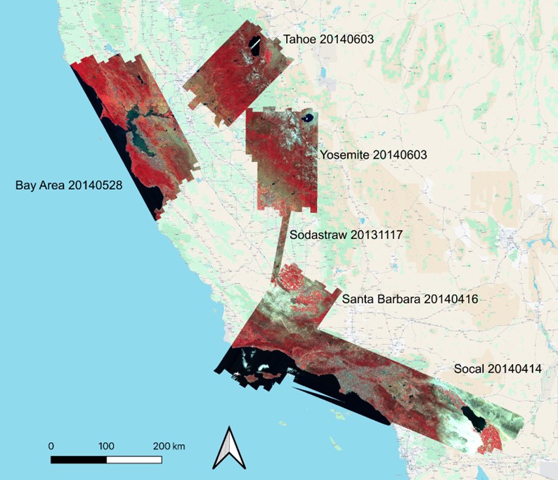
Figure 1. Color-infrared surface reflectance. Acquisitions shown are representative of the spatial coverage of flight boxes for the Western Diversity Time Series project over California and western Nevada, U.S.
Citation: Shafron, E., T. Zheng, Z. Ye, F.D. Schneider, N. Queally, R. Pavlick, and P.A. Townsend. 2025. WDTS: AVIRIS-Classic L2B Corrected and Georectified Surface Reflectance, 2013-2018. ORNL DAAC, Oak Ridge, Tennessee, USA. https://doi.org/10.3334/ORNLDAAC/2391