I feel a bit silly asking this yet will do so anyway to try to ave myself a lot of work.
I am interested in using MODIS-Aqua data to estimate and map chlorophyll-a from different bands as well as the chlor_a values already present. The goal is to use these data to do things ranging from looking for spatial patterns to calculating mean values for entire Great Lakes. I know about potential limitations (or not) of MODIS data in such waters and am not worried about those. I feel I have different problems/worries.
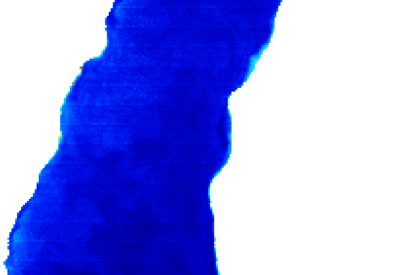
My initial approaches were 1) NOT in SeaDAS but rather R. My approach was limiting in that it started with L2 data and did not remedy for the MODIS bowtie in any way. The first image shows the L2 chlor_a displayed in SeaDAS.
From what I've read on the forum, I ought to be able to remedy the bowtie effect by 1) projecting the data, which I could do with SeaDAS, one file at a time, 2) reprojecting with GPT (if I could get it to work for multiple files), 3) reprojecting with SNAP (which lets one batch-reproject from the GUI), or 4) use l2bin followed by l3mapgen within shell scripts to batch process. I've spent way too much time on this already and in some ways feel I know less now than I did a year ago. But I have the 3rd and 4th approaches working so they win out.
So my questions are
1) Should I get the same Rrs and chlor_a values for a given pixel in a given scene for L2 data that I have reprojected and L3 data resulting from l2bin and l3mapgen?
2) Is that even the pertinent question?
3) If it is "best" to use the approach of l2bin then l3mapgen, is there some way to make l3mapgen process all bands of the l2bin result via shell script? I seem to only be able to make it work on one band at a time on my Mac. I can get l2bin to do all bands though.
4) How ought I choose from "Preserve resolution" or not when using Reproject. Is it better to resample all scenes in a time series from one place to the same origin/extent/resolution after reprjection or should I at least set a common resolution during reprojection?
5) If I am interested in taking the OCSSW approach and obtaining resolution of perhaps <2km, what should I choose for resolutions in l2bin and l3mapgen, respectively?
I know that was a lot. Sorry. Thanks to anyone who reads this and for your patience. I was not sure this was the right board.
Dave Warner