Using GPT's WriteImage Operator to output GeoTIFF
Posted: Fri Dec 08, 2017 9:53 am America/New_York
Hi Norman,
Thanks for your interest and information. My goal is to go from raw L0 VIIRS data to L2 SST and output this as a grayscale TIFF or GeoTIFF. I have to follow strict pixel sizing instructions (1100x1100m Mercator_1SP projection) so this TIFF can be used by an external script. I've tried this multiple ways and the most recent way has me using l2gen, l2bin, and then l3mapgen and finally creating a grayscale TIFF (I've attached it as a screenshot of it because it's too large to attach by itself)
The way I initially tried to do this was using gpt operators reproject and mosaic to output a grayscale TIFF to my specifications, but that feature is unavailable until v7.5. Now I *think* I've gotten pretty close here. The last question I really had was how to make sure that the final product is 1100x1100m Pixel Size for the specified ___domain and making sure that the projection is Mercator_1SP. When using l2bin in step 4, what should I set resolve to if I want 1100x1100m resolution given that my only options for that are 1km or 2km?
Thanks!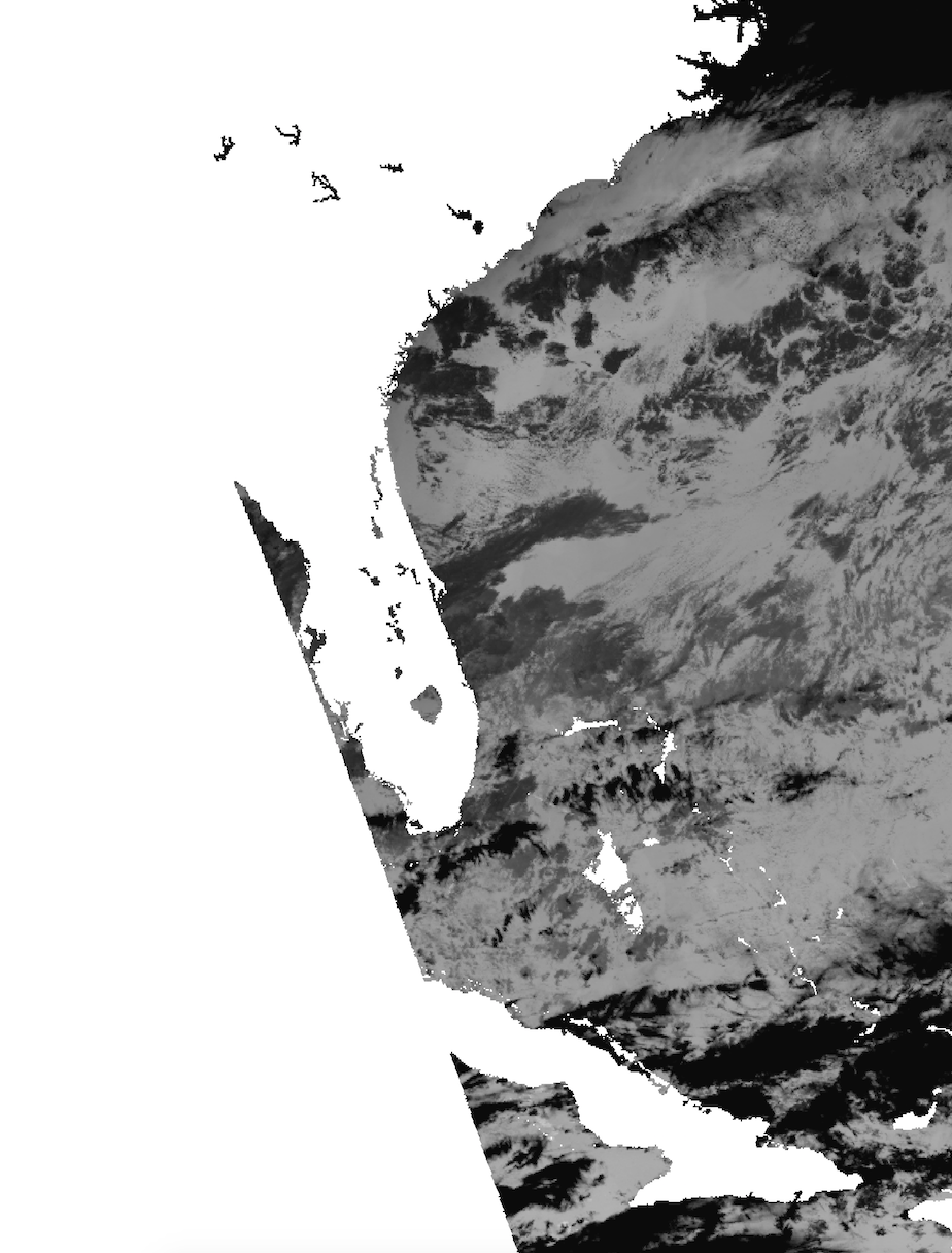
Thanks for your interest and information. My goal is to go from raw L0 VIIRS data to L2 SST and output this as a grayscale TIFF or GeoTIFF. I have to follow strict pixel sizing instructions (1100x1100m Mercator_1SP projection) so this TIFF can be used by an external script. I've tried this multiple ways and the most recent way has me using l2gen, l2bin, and then l3mapgen and finally creating a grayscale TIFF (I've attached it as a screenshot of it because it's too large to attach by itself)
     1. sh viiirs_L0.sh
     2. sh viirs_RDR.sh

     3. l2gen ifile=SVM01.h5 geofile=GMTCO.h5 ofile=SV_L2_file \
         l2prod1="sst qual_sst" resolution=1100 ctl_pt_incr=1 ctl_pt_incr=1 proc_ocean=1 \
         proc_sst=1 proc_land=0 atmocor=1 maskcloud=1 maskland=1 maskhilt=0 maskstlight=0

     4. l2bin infile=SV_L2_file ofile=SV_L2_binned resolve=2 suite=SST l3bprod=sst \
         prodtype=regional qual_max=4 verbose=1

     5. l3mapgen ifile=SV_L2_binned ofile=ao1.tiff product=sst projection=mercator \
         resolution=1100.1100 interp=area north=36.274 south=19.0 east=-72.735 \
         west=-87.75 oformat=TIFF palfile=/home/james/seadas-7.4/ocssw/run/data/common/palette/default-black0.pal \
         palette_dir=/Applications/seadas-7.4/ocssw/run/data/common/palette/
The way I initially tried to do this was using gpt operators reproject and mosaic to output a grayscale TIFF to my specifications, but that feature is unavailable until v7.5. Now I *think* I've gotten pretty close here. The last question I really had was how to make sure that the final product is 1100x1100m Pixel Size for the specified ___domain and making sure that the projection is Mercator_1SP. When using l2bin in step 4, what should I set resolve to if I want 1100x1100m resolution given that my only options for that are 1km or 2km?
Thanks!
