Page 1 of 1
What is the Space Oblique Mercator (SOM) projection?
Posted: Tue Jan 07, 2020 1:24 pm America/New_York
by EarthdataForumContributor
What is the Space Oblique Mercator (SOM) projection?
Re: What is the Space Oblique Mercator (SOM) projection?
Posted: Tue Jan 07, 2020 1:24 pm America/New_York
by asdc_user_services
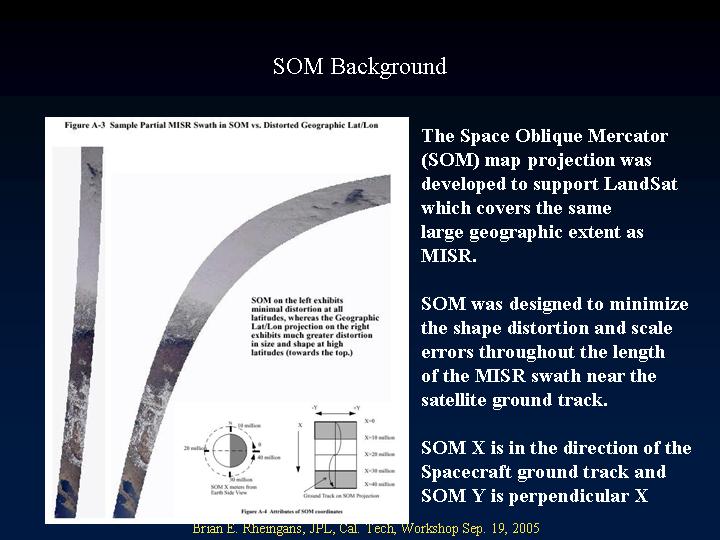
SOM is a space-based map projection in which the reference meridian nominally follows the spacecraft ground track. It provides a mapping from latitude and longitude to a coordinate system that is approximately aligned with the MISR swath. SOM was used because it minimizes distortion and resampling effects, and permits the greatest flexibility in the choice of Earth-based projections. SOM also allows direct cross-comparison with data from other instruments and simplifies global mapping, since the data have already been geolocated.
- faq_b1.jpg (61.88 KiB) Viewed 173 times