FIRMS: What does a fire detection mean on the ground?
Posted: Fri Feb 09, 2024 10:26 am America/New_York
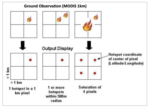
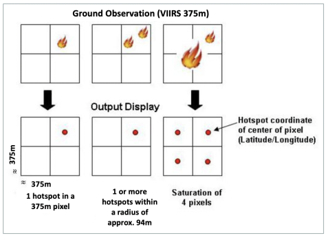
Satellites take a ‘snapshot’ of events as they pass over Earth. Each hotspot/active fire detection represents the center of a pixel flagged as containing one or more fires or other thermal anomalies (such as volcanoes). For MODIS the pixel is approximately 1 km and for VIIRS the pixel is approximately 375 m. The “___location” is the center point of the pixel (not necessarily the coordinates of the actual fire). The actual pixel size varies with the scan and track (see: What does scan and track mean?). The fire is often less than the size of the pixel (see: What size fires can be detected?). We are not able to determine the exact ___location or size of the fire; what we do know is that at least one fire is located within the flagged pixel. Sometimes you will see several active fires in a line. This generally represents a fire front.