Altitude value in CALIPSO Level-2 aerosol profile
Posted: Wed Jan 01, 2025 6:09 am America/New_York
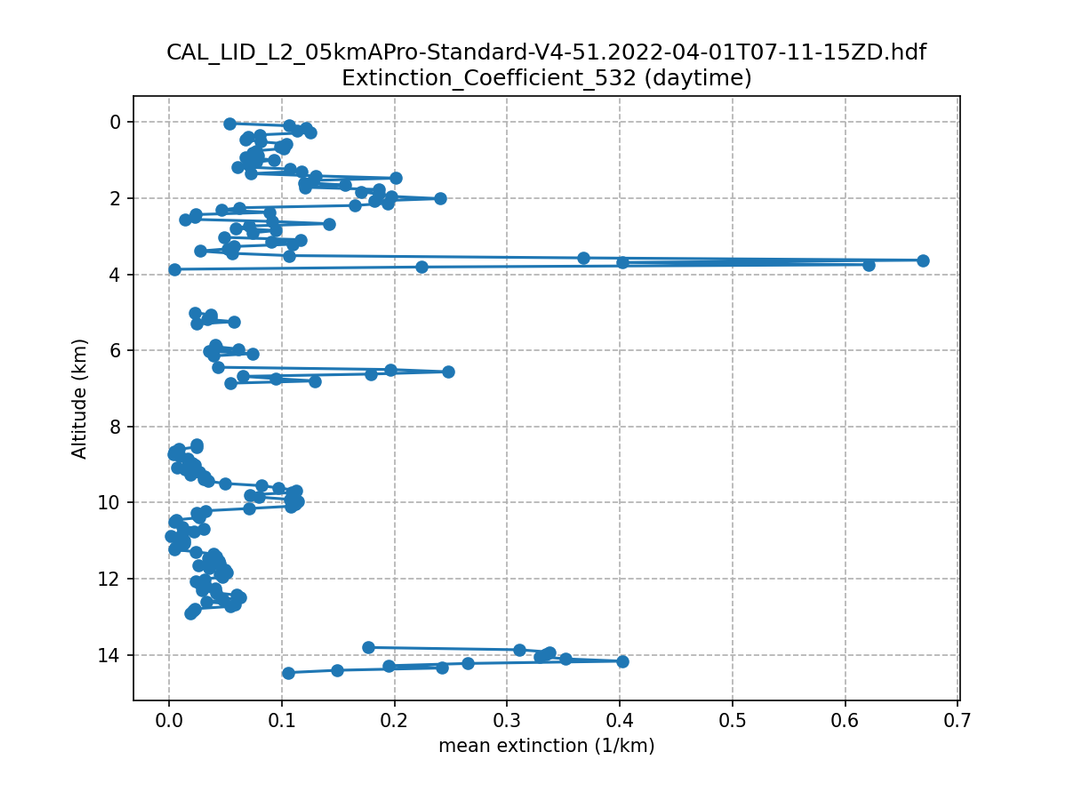
I am trying to plot Extinction_Coefficient_532 from Level-2 Aerosol profile data. Please see the python script (https://github.com/hdfeos/forum/discussions/31)
I’m seeking clarification regarding the indexing of data values and altitude bins in CALIPSO products. According to Table 1 in the CALIPSO documentation (https://asdc.larc.nasa.gov/documents/calipso/quality_summaries/CALIOP_L1ProfileProducts_3.01.pdf), the altitude bin index starts at the top (40 km).
To address this, I reversed the order of data using [::-1] in the script for plotting. However, I’m unsure if this approach is correct and would appreciate feedback from the community.
Thanks!