ORNL DAAC Data Release - ABoVE: AVIRIS-3 Imaging Spectroscopy for Alaska and Canada, 2023
Posted: Tue Jul 01, 2025 9:34 am America/New_York
ORNL DAAC recently released a new ABoVE dataset by Miller, C.E. et al (2025):
ABoVE: AVIRIS-3 Imaging Spectroscopy for Alaska and Canada, 2023
This dataset includes L1B radiance and L2A surface reflectance imagery acquired by the Airborne Visible / Infrared Imaging Spectrometer-3 (AVIRIS-3) instrument over portions of Alaska and northwestern Canada in 2023.
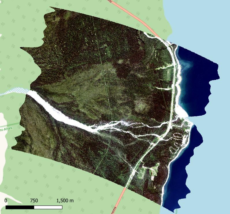
Figure 1. RGB image derived from L2 surface reflectance (R: 627 nm, G: 530 nm, B: 464 nm) for a portion of AVIRIS-3 flight AV320230716t204543 on July 16 2023. This scene includes Congdon Creek Territorial Park on the shore of Kluane Lake in western Yukon Territories, Canada (approximately -138.60 lon, 61.15 lat). Background map from OpenStreetMap (copyright OpenStreetMap contributors).
Citation: Miller, C.E., R.O. Green, and D.R. Thompson. 2025. ABoVE: AVIRIS-3 Imaging Spectroscopy for Alaska and Canada, 2023. ORNL DAAC, Oak Ridge, Tennessee, USA. https://doi.org/10.3334/ORNLDAAC/2388
ABoVE: AVIRIS-3 Imaging Spectroscopy for Alaska and Canada, 2023
This dataset includes L1B radiance and L2A surface reflectance imagery acquired by the Airborne Visible / Infrared Imaging Spectrometer-3 (AVIRIS-3) instrument over portions of Alaska and northwestern Canada in 2023.
Figure 1. RGB image derived from L2 surface reflectance (R: 627 nm, G: 530 nm, B: 464 nm) for a portion of AVIRIS-3 flight AV320230716t204543 on July 16 2023. This scene includes Congdon Creek Territorial Park on the shore of Kluane Lake in western Yukon Territories, Canada (approximately -138.60 lon, 61.15 lat). Background map from OpenStreetMap (copyright OpenStreetMap contributors).
Citation: Miller, C.E., R.O. Green, and D.R. Thompson. 2025. ABoVE: AVIRIS-3 Imaging Spectroscopy for Alaska and Canada, 2023. ORNL DAAC, Oak Ridge, Tennessee, USA. https://doi.org/10.3334/ORNLDAAC/2388