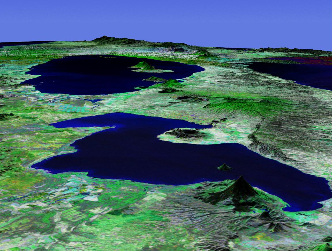
Lake Nicaragua or Cocibolca or Granada (Template:Lang-es, Lago Cocibolca, Mar Dulce, Gran Lago, Gran Lago Dulce, or Lago de Granada) is a massive freshwater lake in Nicaragua of tectonic origin. With an area of 8264 km², it is the third largest lake in Latin America, the 21st largest lake in the world and only slightly smaller than Lake Titicaca. With an elevation of 32 m (105 ft) above sea level, the lake reaches a depth of 26 m (84 ft). It is intermittently joined by the Tipitapa River to Lake Managua.
| Lake Nicaragua | |
|---|---|
| Location | Nicaragua |
| Coordinates | 11°37′N 85°21′W / 11.617°N 85.350°W |
| Primary outflows | San Juan River |
| Surface area | 8264 km² |
| Max. depth | 26 m |
| Surface elevation | 32 m |
| Islands | 400+ Ometepe, Zapatera |
 | |
Lake Nicaragua, despite being a freshwater lake, contains sharks, including the Lake Nicaragua Shark (Carcharhinus nicaraguensis), which is fully adapted to freshwater life.[1] Due to this fact and the lake's small distance from the Pacific Ocean, scientists believe that the area which is now the lake used to be a giant bay. Over time, the gap closed and a lake was formed with the sharks still inside of it.
Nicaraguans call it Lago Cocibolca or Mar Dulce (literally, Sweet Sea; in Spanish, freshwater is agua dulce). In fact, it is just like a sea except that the water is not salty. Like any other sea it has sizeable waves, driven by the easterly winds blowing west to the Pacific Ocean. It also has archipelagos of islands, such as Ometepe and the Solentiname Islands, along with freshwater sharks (now mostly found in the Río San Juan). It has also built a reputation of having periodic, powerful, and impassable storms. The winds on the western side are often very intense.
The lake is connected with the Caribbean Sea by the navigable San Juan River, historically making the lakeside city of Granada, Nicaragua an Atlantic port although it is closer to the Pacific. The lake even had a history of Caribbean pirates. However, despite draining into the Caribbean Sea, the Pacific Ocean is near enough to be easily seen from the mountains on the lake's Island of Ometepe. Before construction of the Panama Canal, a stagecoach line connected the lake with the Pacific across the low hills of the narrow Isthmus of Rivas. Plans were made to take advantage of this route to build an interoceanic canal, the Nicaragua Canal, but the Panama Canal was built instead. In order to quell competition with the Panama Canal, the U.S. secured all rights to a canal along this route in the Bryan-Chamorro Treaty of 1916. However, the idea of another canal in Nicaragua still periodically resurfaces. Ecocanal is one of these projects.
In 1981, Nicaraguan Institute of Natural Resources and the Environment (IRENA) found that half of water sources they sampled were seriously polluted by sewage and that 32 tonnes (70,000 pounds) of raw sewage was released into Lake Managua each day. Scores of industrial plants located on the lake's shore had freely dumped there for over a decade. The worst polluter was the Pennwalt Chemical Corporation. IRENA could not afford, however, to build a sewage treatment plant because of the financial costs involved.
Notes
- ^ Section from Capstick, Peter Hathaway, Lost Horizons, in Shark: Stories of Life and Death from the World's Most Dangerous Waters, p. 225. Ed. May, Nathaniel, Willis, Clint, Thunder's Mouth Press, New York, 2002.
Lake Nicaragua is the only fresh water lake in the world that has sharks.
References
External links
This Nicaragua ___location article is a stub. You can help Wikipedia by expanding it. |