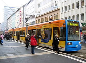
Rete tranviaria di Kassel
rete tranviaria di Kassel, Germania
La rete tranviaria di Kassel (in tedesco Straßenbahn Kassel) è un sistema di trasporti tranviari situato nella città tedesca di Kassel. Gestita dalla compagnia KVG.
| |||
|---|---|---|---|
 | |||
| Tipo | rete tranviaria urbana | ||
| Stati | |||
| Città | Kassel | ||
| Apertura | 1877 | ||
| Gestore | KVG | ||
 | |||
| Trasporto pubblico | |||
Rete
La rete attuale consta di 7 linee urbane, gestite dalla KVG. Le linee urbane in esercizio sono:
| 1 | Wilhelmshöhe (- Rolandstraße bei Fahrten nur bis Bf Wilhelmshöhe)– Bf Wilhelmshöhe – Wilhelmshöher Allee – Königsplatz - Holländische Straße (– Vellmar Nord in Bau) |
| 3 | Druseltal – Bf Wilhelmshöhe – Wilhelmshöher Allee – Königsplatz – Ihringshäuser Straße |
| 4 | Mattenberg – Helleböhn – Bf Wilhelmshöhe – Friedrich-Ebert-Straße – Königsplatz – Leipziger Straße – Kaufungen – Helsa – Hessisch Lichtenau |
| 5 | Baunatal – / (VW-Werk Schleife –) Mattenberg – Auestadion – (Scheidemannplatz nur bei Fahrten bis Am Stern) – Königsplatz - Holländische Straße |
| 6 | Brückenhof – Auestadion – Königsplatz – Wolfsanger |
| 7 | (Baunatal - Mattenberg –) / (Rolandstraße nur bei Fahrten bis Bf Wilhelmshöhe) - Bf Wilhelmshöhe – Goethestraße – Lutherplatz – (5/7 Königsplatz) – Klinikum Kassel – Ihringshäuser Straße |
| 8 | Hessenschanze – Friedrich-Ebert-Straße – Königsplatz – Leipziger Platz – Kaufungen Papierfabrik |
Altri progetti
- Wikimedia Commons contiene immagini o altri file sulla rete tranviaria di Kassel
Collegamenti esterni
- (DE) KVG - Kasseler Verkehrs-Gesellschaft, su kvg.de. URL consultato il 25 settembre 2012 (archiviato dall'url originale il 27 settembre 2013).
- (DE) Mappa ufficiale della rete tranviaria[collegamento interrotto] (File PDF)