Wikipedia:Graphics Lab/Map workshop/Archive/Sep 2020
| This is an archive of past discussions on Wikipedia:Graphics Lab, for the period 2020. Do not edit the contents of this page. If you wish to start a new discussion or revive an old one, please do so on the current main page. |

Independence from Britain
-
-
 Actual flag of Dominica
 -
 Current flag of Belize
 -
 Pacific islands map


- Article(s)
- List of countries that have gained independence from the United Kingdom
- Request
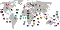
- Okay, I've noticed a few inaccuracies with the above-left map that should probably be fixed:
1) The flag of the Dominican Republic is incorrectly shown for Dominica (above-centre), a completely different country.
2) Saint Vincent and the Grenadines gained independence in 1979, not 1931.
3) There's no arrows linking the flags of Myanmar and Sudan to their respective countries.
4) The flag of Malta is wrongly shown to be linked to the Balearic Islands, not at Malta itself.
5) Nauru gained independence in 1968, not 1957.
6) The Maldives gained independence in 1965, not 1982.
7) The flags of Tonga and Tuvalu are actually shown pointing to Fiji, and the flag of Fiji itself is linked to Vanuatu (the actual locations of said countries are provided on the above-right map).
8) The flag of Qatar is wrongly shown to be linked to the United Arab Emirates, not at Qatar itself.
9) The flag of Jordan seems to be pointing more at the West Bank than at Jordan itself.
10) The flag of Belize was slightly altered in 2019 (as shown above), so the one on the map should be changed to reflect that.
11) The flag of Mauritius is not pointing at Mauritius at all, but rather at a random spot in the Indian Ocean.
12) Papua New Guinea gained independence from Australia in 1975, not from Britain, hence it should be removed from the map (otherwise the map would have to include all other countries that gained independence from former British holdings, such as Samoa, Bangladesh, Namibia, South Sudan, etc.).
Thanks. Snow Lion Fenian (talk) 19:49, 23 August 2020 (UTC)
- Discussion
Trim map of semi-arid regions
-
 Map of semi-arid regions worldwide
 -
 Map of deserts worldwide


- Article(s)
- Semi-arid climate
- Request
- These two maps are nearly identical, but the nominal size of the semi-arid map is a little bit larger. If you look at the very bottom, "below" Antarctica, there are lots of bright colors, and the far right side has a bunch of white areas. Could you trim this map so its nominal dimensions are the same are the nominal dimensions of the deserts map? 64.203.187.125 (talk) 18:40, 1 September 2020 (UTC)
- Discussion
Update to 4.0 Copyright for Mozambique map

-
Description of first image
-
Description of second image (if needed)
-
Description of third image (if needed; don't request too many at once, though)
- Article(s)
- Request
- Details of your request go here… I modified the map of Mozambique for use in this journal article https://journals.plos.org/plosntds/article?id=10.1371/journal.pntd.0007138
The journal will be removed unless the copyright on this image is updated to CC 4.0: https://commons.wikimedia.org/wiki/File:Magude_District_in_Mozambique_2018.svg
Can you help with this? We are a malaria charity.
- Discussion