Fil:C77198s1 Ant.Map Taylor Glacier.jpg
Størrelse af denne forhåndsvisning: 795 × 600 pixels. Andre opløsninger: 318 × 240 pixels | 637 × 480 pixels | 1.018 × 768 pixels | 1.280 × 965 pixels | 2.560 × 1.931 pixels | 4.312 × 3.252 pixels.
Fuld opløsning (4.312 × 3.252 billedpunkter, filstørrelse: 1,45 MB, MIME-type: image/jpeg)
|
|
Denne fil er fra Wikimedia Commons. Beskrivelsen af filen fra Commons er gengivet nedenfor. |
Beskrivelse
| Beskrivelse |
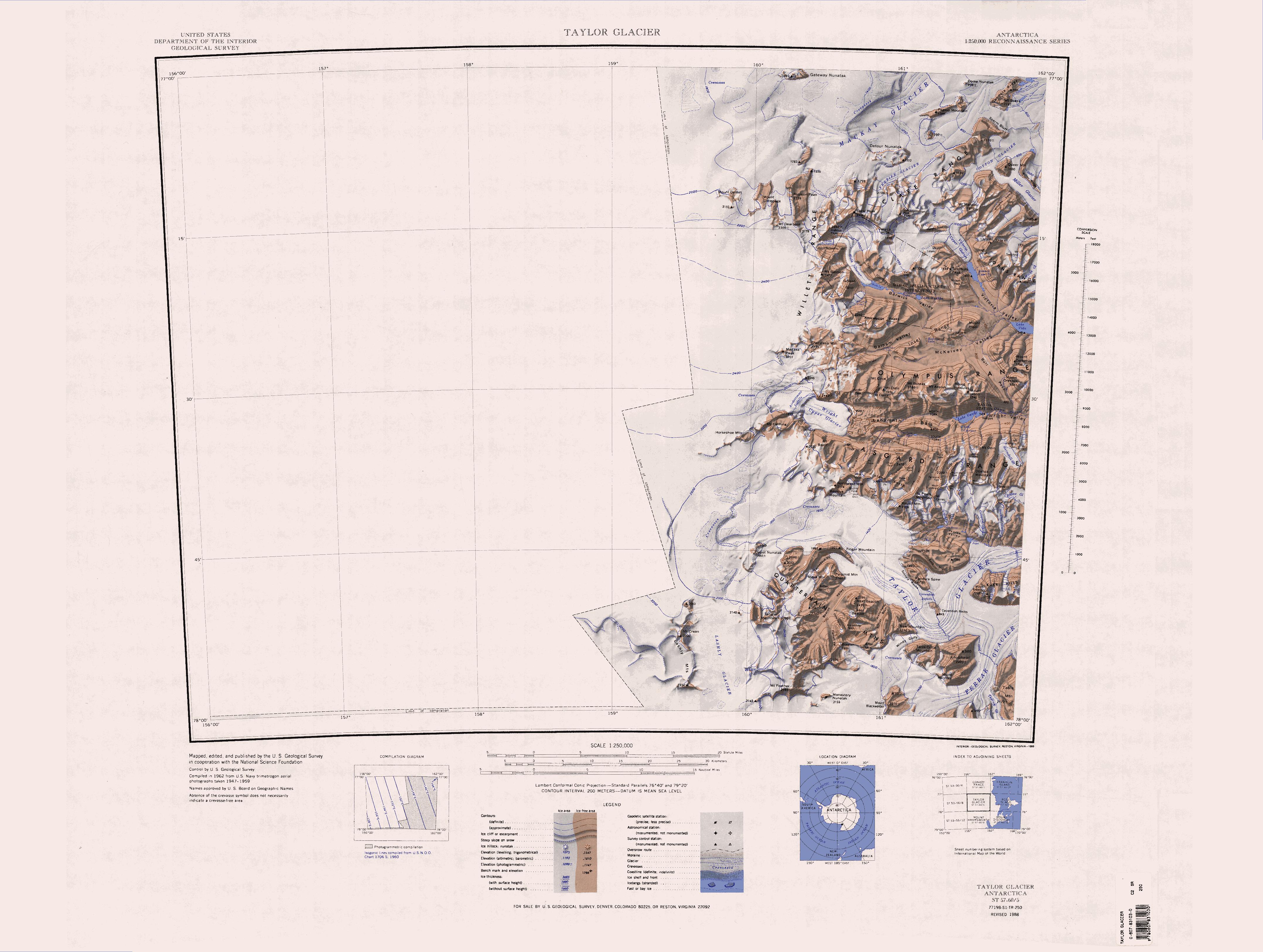
English: 1:250,000-scale topographic reconnaissance map of the Taylor Glacier area from 156°-162'E to 77°-78°S in Antarctica. Mapped, edited and published by the U.S. Geological Survey in cooperation with the National Science Foundation. |
|||
| Dato | ||||
| Kilde | http://usarc.usgs.gov/drg_dload.shtml | |||
| Forfatter | United States Geological Survey | |||
| Tilladelse (Genbrug af denne fil) |
|
| Annotations | This image is annotated: View the annotations at Commons |
Filhistorik
Klik på en dato/tid for at se filen som den så ud på det tidspunkt.
| Dato/tid | Miniaturebillede | Dimensioner | Bruger | Kommentar | |
|---|---|---|---|---|---|
| nuværende | 17. apr. 2013, 15:30 | | 4.312 × 3.252 (1,45 MB) | 4ing | == {{int:filedesc}} == {{Information |description={{en|1=1:250,000-scale topographic reconnaissance map of the Taylor Glacier area from 156°-162'E to 77°-78°S in Antarctica. Mapped, edited and published by the U.S. Geological Survey in cooperation w... |
Filanvendelse
Der er ingen sider der bruger denne fil.
Global filanvendelse
Følgende andre wikier anvender denne fil:
- Anvendelser på ceb.wikipedia.org
- Anvendelser på de.wikipedia.org
- Antarktische Trockentäler
- Mackay-Gletscher
- Depot-Nunatak
- Clare Range
- Gondola Ridge
- Taylor-Gletscher (Viktorialand)
- Quartermain Mountains
- Mount Handsley
- Beacon Heights
- Pyramid Mountain (Viktorialand)
- Turnabout Valley
- Willett Range
- Balham Valley
- Insel Range
- Apocalypse Peaks
- McKelvey Valley
- Barwick Valley
- Northwest Mountain
- Beehive Mountain
- The Fortress (Antarktika)
- Lashly Mountains
- West Beacon
- Mount DeWitt
- Bullseye Lake
- Canoe-Nunatak
- Pegtop Mountain
- Head Mountains
- Anvendelser på en.wikipedia.org
Vis flere globale anvendelser af denne fil.