
Size of this PNG preview of this SVG file: 531 × 414 pixels. Other resolutions: 308 × 240 pixels | 616 × 480 pixels | 985 × 768 pixels | 1,280 × 998 pixels | 2,560 × 1,996 pixels.
Original file (SVG file, nominally 531 × 414 pixels, file size: 1.89 MB)
| This is a file from the Wikimedia Commons. Information from its description page there is shown below. Commons is a freely licensed media file repository. You can help. |
Summary
| Description |
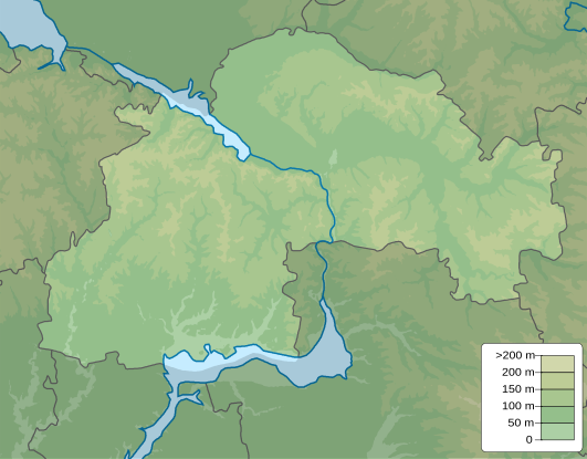
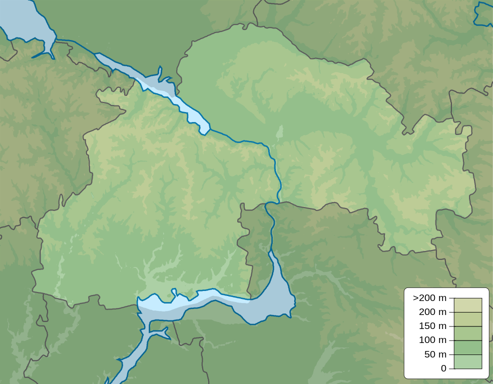
English: Physical map of Dnipropetrovsk Oblast, Ukraine
Русский: Физическая карта Днепропетровская область, Украина |
| Date | |
| Source | Own work |
| Author | Urutseg |
| Other versions |
 |
Licensing
| I, the copyright holder of this work, release this work into the public ___domain. This applies worldwide. In some countries this may not be legally possible; if so: I grant anyone the right to use this work for any purpose, without any conditions, unless such conditions are required by law. |
File history
Click on a date/time to view the file as it appeared at that time.
| Date/Time | Thumbnail | Dimensions | User | Comment | |
|---|---|---|---|---|---|
| current | 18:03, 10 December 2010 | | 531 × 414 (1.89 MB) | Urutseg | == {{int:filedesc}} == {{Information |Description={{en|1=Physical map of Dnipropetrivsk province, Ukraine}} {{ru|1=Физическая карта Днепропетровской области, Украина}} |Source={{own}} |Author=[[User:Urutseg|Uru |
File usage
The following 21 pages use this file:
- Dachne, Novopavlivka hromada
- Dnipro
- Kalynivske, Velykomykhailivka rural hromada, Synelnykove Raion, Dnipropetrovsk Oblast
- Kryvyi Rih
- Kurylivka, Dnipropetrovsk Oblast
- Maliivka, Dnipropetrovsk Oblast
- Malomykolaivka, Dnipropetrovsk Oblast
- Nikopol, Ukraine
- Novoheorhiivka, Synelnykove Raion, Dnipropetrovsk Oblast
- Novopavlivka, Synelnykove Raion, Dnipropetrovsk Oblast
- Osokorivka, Dnipropetrovsk Oblast
- Petropavlivka, Dnipropetrovsk Oblast
- Stepove, Velykomykhailivka rural hromada, Synelnykove Raion, Dnipropetrovsk Oblast
- Sursko-Mykhailivka
- Ternove, Dnipropetrovsk Oblast
- Tomakivka
- Vilnohirsk
- Voronove, Dnipropetrovsk Oblast
- Zaporizke, Velykomykhailivka rural hromada, Synelnykove Raion, Dnipropetrovsk Oblast
- Module:Location map/data/Ukraine Dnipropetrovsk Oblast
- Module:Location map/data/Ukraine Dnipropetrovsk Oblast/doc
Global file usage
The following other wikis use this file:
- Usage on ar.wikipedia.org
- Usage on be.wikipedia.org
- Usage on bg.wikipedia.org
- Usage on ceb.wikipedia.org
- Usage on ce.wikipedia.org
- Usage on da.wikipedia.org
- Usage on de.wikipedia.org
- Vorlage:Positionskarte Ukraine Oblast Dnipropetrowsk
- Schowta
- Saksahan
- Schlacht bei Schowti Wody
- Krywbas
- Karatschuniwka-Stausee
- Makorty-Stausee
- Chrystoforiwka-Stausee
- Dnepr-Krywyj-Rih-Kanal
- Klosterinsel
- Mokra Sura
- Kamjanka (Basawluk)
- Samotkan (Fluss)
- Benutzer:Francis McLloyd/Becken/Dnepr-Becken
- Kiltschen
- Usage on eo.wikipedia.org
- Dnepra rezervujo
- Krivij-Riho
- Nikopol (Ukrainio)
- Pavlohrad
- Kamjansko
- Ŝablono:Situo sur mapo Ukrainio Dnipropetrovska provinco
- Sinelnikove
- Pjatiĥatki
- Ĵovti Vodi
- Marhanec
- Samar (Ukrainio)
- Mirne (Dnipropetrovska provinco)
- Apostolove
- Rozdori (Sinelnikivskij rajon)
- Ĉapline
- Lozuvatka
- Verĥivceve
- Inhulec (Krivij Rih)
- Usage on es.wikipedia.org
- Usage on fa.wikipedia.org
View more global usage of this file.