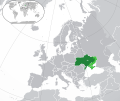
Size of this PNG preview of this SVG file: 713 × 600 pixels. Other resolutions: 285 × 240 pixels | 571 × 480 pixels | 913 × 768 pixels | 1,218 × 1,024 pixels | 2,435 × 2,048 pixels | 2,045 × 1,720 pixels.
Original file (SVG file, nominally 2,045 × 1,720 pixels, file size: 7.37 MB)
File history
Click on a date/time to view the file as it appeared at that time.
| Date/Time | Thumbnail | Dimensions | User | Comment | |
|---|---|---|---|---|---|
| current | 18:36, 10 July 2023 |  | 2,045 × 1,720 (7.37 MB) | Krestenti | areas are not under control of Ukraine on 1 June 2022. |
| 11:53, 12 November 2022 |  | 2,045 × 1,720 (7.01 MB) | Рагин1987 | Kherson | |
| 19:05, 4 October 2022 |  | 2,045 × 1,720 (6.98 MB) | Nahabino | Cleaning, update | |
| 07:37, 12 September 2022 |  | 2,045 × 1,720 (7.05 MB) | Рагин1987 | Small correction | |
| 12:37, 11 September 2022 |  | 2,045 × 1,720 (7 MB) | Nahabino | Update per ISW | |
| 08:17, 10 September 2022 |  | 2,045 × 1,720 (7 MB) | Nahabino | update, Balakliia | |
| 13:20, 22 July 2022 |  | 2,045 × 1,720 (7.37 MB) | Cyrobyte | Bilohorivka is occupied by Russia | |
| 16:44, 1 June 2022 |  | 2,045 × 1,720 (7.37 MB) | GrandEscogriffe | Uploaded a work by {{u|Rob984}}, {{u|GrandEscogriffe}} from File:Europe-Ukraine (disputed territory).svg with UploadWizard |
File usage
The following page uses this file:
Global file usage
The following other wikis use this file:
