File:Front Range Urban Corridor.svg

Dimensioni di questa anteprima PNG per questo file SVG: 514 × 599 pixel. Altre risoluzioni: 206 × 240 pixel | 412 × 480 pixel | 659 × 768 pixel | 878 × 1 024 pixel | 1 756 × 2 048 pixel | 723 × 843 pixel.
File originale (file in formato SVG, dimensioni nominali 723 × 843 pixel, dimensione del file: 265 KB)
| Questo file e la sua pagina di descrizione (discussione · modifica) si trovano su Wikimedia Commons (?) |
Dettagli
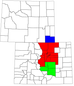
| Descrizione | A county map of the Front Range Urban Corridor of Colorado and Wyoming, United States |
| Data | |
| Fonte | Derived from the National Atlas of the United States as converted by David Benbennick (CC) and adapted by Buaidh |
| Autore | Buaidh |
| Licenza (Riusare questo file) |
Questo file è disponibile in base alla licenza Creative Commons Attribuzione 2.0 Generico
|
| Altre versioni | Map of Colorado counties, blank.svg and Map of Wyoming highlighting Laramie County.svg |
Licenza
| Io, detentore del copyright su quest'opera, la rilascio nel pubblico dominio. Questa norma si applica in tutto il mondo. In alcuni paesi questo potrebbe non essere legalmente possibile. In tal caso: Garantisco a chiunque il diritto di utilizzare quest'opera per qualsiasi scopo, senza alcuna condizione, a meno che tali condizioni siano richieste dalla legge. |
Cronologia del file
Fare clic su un gruppo data/ora per vedere il file come si presentava nel momento indicato.
| Data/Ora | Miniatura | Dimensioni | Utente | Commento | |
|---|---|---|---|---|---|
| attuale | 03:20, 12 dic 2007 | | 723 × 843 (265 KB) | Buaidh | == Summary == {{Information |Description=A county map of the Front Range Urban Corridor of Colorado and Wyoming, United States |title=Map of the Front Range Urban Corridor |Source=Derived from the National Atlas of the United States as converted by David |
| 00:23, 11 dic 2007 |  | 723 × 843 (265 KB) | Buaidh | {{Information |Description=A county map of the Front Range Urban Corridor of Colorado and Wyoming, United States |title=Map of the Front Range Urban Corridor |Source=Derived from the National Atlas of the United States as converted by David Benbennick (CC | |
| 00:13, 11 dic 2007 |  | 765 × 990 (265 KB) | Buaidh | {{Information |Description=A county map of the Front Range Urban Corridor of Colorado and Wyoming, United States |title=Map of the Front Range Urban Corridor |Source=Derived from the National Atlas of the United States as converted by David Benbennick (CC |
Pagine che usano questo file
La seguente pagina usa questo file:
Utilizzo globale del file
Anche i seguenti wiki usano questo file:
- Usato nelle seguenti pagine di ar.wikipedia.org:
- Usato nelle seguenti pagine di bs.wikipedia.org:
- Usato nelle seguenti pagine di en.wikipedia.org:
- Usato nelle seguenti pagine di fr.wikipedia.org:
- Usato nelle seguenti pagine di ja.wikipedia.org:
- Usato nelle seguenti pagine di pt.wikipedia.org:
- Usato nelle seguenti pagine di www.wikidata.org: