No higher resolution available.
Illinois_Locator_Map_with_US.PNG (288 × 405 pixels, file size: 13 KB, MIME type: image/png)
| This is a file from the Wikimedia Commons. Information from its description page there is shown below. Commons is a freely licensed media file repository. You can help. |
Summary

|
This locator map image could be re-created using vector graphics as an SVG file. This has several advantages; see Commons:Media for cleanup for more information. If an SVG form of this image is available, please upload it and afterwards replace this template with
{{vector version available|new image name}}.It is recommended to name the SVG file “Illinois Locator Map with US.svg”—then the template Vector version available (or Vva) does not need the new image name parameter. |
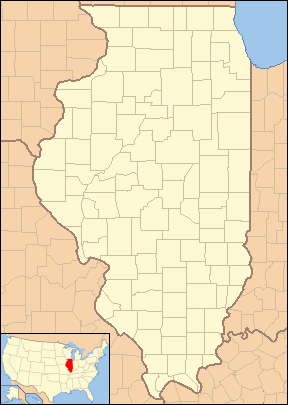
| Description | Locator Map of Illinois, United States |
| Date | |
| Source | taken from US Census website [1] and modified by User:VerruckteDan, User:Ruhrfisch, User:Huebi, and User:Appraiser |
| Author | US Census, User:VerruckteDan, User:Ruhrfisch, User:Huebi, and User:Appraiser |
| Permission (Reusing this file) |
US Census / US Government work is public ___domain, my modifications licensed under the GNU Free Documentation License |
Licensing

|
Permission is granted to copy, distribute and/or modify this document under the terms of the GNU Free Documentation License, Version 1.2 or any later version published by the Free Software Foundation; with no Invariant Sections, no Front-Cover Texts, and no Back-Cover Texts. A copy of the license is included in the section entitled GNU Free Documentation License. |
| This file is licensed under the Creative Commons Attribution-Share Alike 3.0 Unported license. | ||
| ||
| This licensing tag was added to this file as part of the GFDL licensing update. |
This file is licensed under the Creative Commons Attribution-Share Alike 2.5 Generic license.
- You are free:
- to share – to copy, distribute and transmit the work
- to remix – to adapt the work
- Under the following conditions:
- attribution – You must give appropriate credit, provide a link to the license, and indicate if changes were made. You may do so in any reasonable manner, but not in any way that suggests the licensor endorses you or your use.
- share alike – If you remix, transform, or build upon the material, you must distribute your contributions under the same or compatible license as the original.
You may select the license of your choice.
and
This image or file is a work of a United States Census Bureau employee, taken or made as part of that person's official duties. As a work of the U.S. federal government, the image is in the public ___domain.
|
 |
File history
Click on a date/time to view the file as it appeared at that time.
| Date/Time | Thumbnail | Dimensions | User | Comment | |
|---|---|---|---|---|---|
| current | 12:16, 24 June 2013 | | 288 × 405 (13 KB) | Zyxw | Same width & height as File:Illinois Locator Map.PNG for use with mapping templates. Inset is File:Map of USA IL.svg. Smaller file size. |
| 21:43, 8 March 2008 |  | 292 × 409 (18 KB) | Appraiser | {{Information| |Description= Locator Map of Illinois, United States |Source= taken from US Census website [http://factfinder.census.gov/] and modified by User:Ruhrfisch, User:Huebi, and User:Appraiser |Date= March 2008 |Author= US Census, [[U | |
| 03:03, 3 March 2008 |  | 288 × 405 (17 KB) | Appraiser | {{Information| |Description= Locator Map of Illinois, United States |Source= taken from US Census website [http://factfinder.census.gov/] and modified by User:Appraiser |Date= March 2007 |Author= US Census, Appraiser |Permission= US Census / US Gover |
File usage
The following 3 pages use this file:
Global file usage
The following other wikis use this file:
- Usage on ar.wikipedia.org
- Usage on be-tarask.wikipedia.org
- Usage on ceb.wikipedia.org
- Usage on es.wikipedia.org
- Usage on fa.wikipedia.org
- دلاوان (ایلینوی)
- ایست مولین (ایلینوی)
- ایست سنت لوئیس (ایلینوی)
- ادواردزویل (ایلینوی)
- ژنو (ایلینوی)
- گرافتون (ایلینوی)
- جکسونویل (ایلینوی)
- جرزیویل (ایلینوی)
- مندوتا (ایلینوی)
- مانتیسلو (ایلینوی)
- مونتکارمل (ایلینوی)
- ناپرویل (ایلینوی)
- نائوو (ایلینوی)
- اوگلسبی (ایلینوی)
- پئوریا (ایلینوی)
- پرینستون (ایلینوی)
- کوئینسی (ایلینوی)
- سنت چارلز (ایلینوی)
- تیلور ویل (ایلینوی)
- Usage on ilo.wikipedia.org
- Usage on kbp.wikipedia.org
- Usage on sh.wikipedia.org
View more global usage of this file.