
-
Federal
Low Elevation Coastal Zone (LECZ) Global Delta Urban-Rural Population and Land Area Estimates, Version 1
National Aeronautics and Space Administration —
The Low Elevation Coastal Zone (LECZ) Global Delta Urban-Rural Population and Land Area Estimates, Version 1 data set provides country-level estimates of urban,... -
Federal
Georeferenced Population Datasets of Mexico (GEO-MEX): Urban Place GIS Coverage of Mexico
National Aeronautics and Space Administration —
The Urban Place GIS Coverage of Mexico is a vector based point Geographic Information System (GIS) coverage of 696 urban places in Mexico. Each Urban Place is... -
Federal
Global Rural-Urban Mapping Project, Version 1 (GRUMPv1): Urban Extents Grid
National Aeronautics and Space Administration —
The Global Rural-Urban Mapping Project, Version 1 (GRUMPv1): Urban Extents Grid distinguishes urban and rural areas based on a combination of population counts... -
Federal
Global Urban Heat Island (UHI) Data Set, 2013
National Aeronautics and Space Administration —
The Urban Heat Island (UHI) effect represents the relatively higher temperatures found in urban areas compared to surrounding rural areas owing to higher proportions... -
Federal
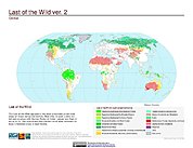
Last of the Wild Project, Version 2, 2005 (LWP-2): Last of the Wild Dataset (Geographic)
National Aeronautics and Space Administration —
The Last of the Wild Dataset of the Last of the Wild Project, Version 2, 2005 (LWP-2) is derived from the LWP-2 Human Footprint Dataset. The gridded data are... -
Federal
Last of the Wild Project, Version 2, 2005 (LWP-2): Global Human Influence Index (HII) Dataset (Geographic)
National Aeronautics and Space Administration —
The Global Human Influence Index Dataset of the Last of the Wild Project, Version 2, 2005 (LWP-2) is a global dataset of 1-kilometer grid cells, created from nine... -
Federal
Global High Resolution Daily Extreme Urban Heat Exposure (UHE-Daily), 1983-2016
National Aeronautics and Space Administration —
The Global High Resolution Daily Extreme Urban Heat Exposure (UHE-Daily), 1983-2016 data set contains a high-resolution, longitudinal global record of geolocated... -
Federal
Annual Mean PM2.5 Components (EC, NH4, NO3, OC, SO4) 50m Urban and 1km Non-Urban Area Grids for Contiguous U.S., 2000-2019 v1
National Aeronautics and Space Administration —
The Annual Mean PM2.5 Components (EC, NH4, NO3, OC, SO4) 50m Urban and 1km Non-Urban Area Grids for Contiguous U.S., 2000-2019, v1 data set contains annual... -
Federal
Gridded Population of the World, Version 4 (GPWv4): Land and Water Area, Revision 11
National Aeronautics and Space Administration —
The Gridded Population of the World, Version 4 (GPWv4): Land and Water Area, Revision 11 consists of two rasters that measure surface areas of land and water in... -
Federal
SDG Indicator 9.1.1: Rural Access Index (RAI), 2023 Release
National Aeronautics and Space Administration —
The SDG Indicator 9.1.1: The Rural Access Index (RAI), 2023 Release data set, part of the SDGI collection, measures the proportion of the rural population who live... -
Federal
Anomaly Detection for Complex Systems
National Aeronautics and Space Administration —
In performance maintenance in large, complex systems, sensor information from sub-components tends to be readily available, and can be used to make predictions about... -
Federal
Poverty Mapping Project: Poverty and Food Security Case Studies
National Aeronautics and Space Administration —
The Poverty Mapping Project: Poverty and Food Security Case Studies data set consists of small area estimates of poverty, inequality, food security and related... -
Federal
Daily 8-Hour Maximum and Annual O3 Concentrations for the Contiguous United States, 1-km Grids, v1 (2000 - 2016)
National Aeronautics and Space Administration —
The Daily 8-Hour Maximum and Annual O3 Concentrations for the Contiguous United States, 1-km Grids, v1 (2000 - 2016) data set contains estimates of ozone... -
Federal
Annual Global High-Resolution Extreme Heat Estimates (GEHE), 1983-2016
National Aeronautics and Space Administration —
The Annual Global High-Resolution Extreme Heat Estimates (GEHE), 1983-2016 data set provides global 0.05 degrees (~5 km) gridded annual counts of the number of days... -
Federal
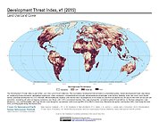
Development Threat Index
National Aeronautics and Space Administration —
The Development Threat Index data set is a terrestrial global, future development threat map based on combining these resources: agricultural expansion, urban... -
Federal
Global Database of Light-based Geospatial Income Inequality (LGII) Measures, Version 1
National Aeronautics and Space Administration —
The Global Database of Light-based Geospatial Income Inequality (LGII) Measures, Version 1 data set contains Gini-coefficients of inequality for 234 countries and... -
Federal
National Aggregates of Geospatial Data Collection: Population, Landscape, And Climate Estimates, Version 4 (PLACE IV)
National Aeronautics and Space Administration —
The National Aggregates of Geospatial Data Collection: Population, Landscape, And Climate Estimates, Version 4 (PLACE IV) provides measures of population (head...

Official websites use .gov
A
.gov website belongs to an official government
organization in the United States.
Secure .gov websites use HTTPS
A
lock (
) or https:// means you’ve safely connected to
the .gov website. Share sensitive information only on official,
secure websites.