
-
Federal
Faults of the Caribbean Region (flt6bg)
Department of the Interior —
This dataset describes faults and structural features of the Caribbean region (Anguilla, Antigua and Barbuda, Aruba, Bahamas, Barbados, Belize, British Virgin... -
Federal
Surface Geology of the Caribbean Region (geo6bg)
Department of the Interior —
This dataset includes polygons that describe the geologic age of surface outcrops of bedrock of the Caribbean region (Anguilla, Antigua and Barbuda, Aruba, Bahamas,... -
Federal
Mineral facilities of Latin America and the Caribbean
Department of the Interior —
This dataset presents information about facilities relating to the mineral industries of Latin America and the Caribbean. Facilities include mines, mineral processing... -
Federal
500m Bathy Contours Derived from ETOPO2 Global 2' Elevations (bathy_500m)
Department of the Interior —
This bathymetry contour data is in ESRI shapefile format and was derived from a National Oceanic Atmospheric Administration (NOAA), National Geophysical Data Center... -
Federal
Yale stocks and flows database (YSTAFDB) describing anthropogenic materials cycles, recycling, and criticality for 102 materials on spatial scales ranging from suburbs to global and timescales from the early 1800s to circa 2013
Department of the Interior —
This data release presents the Yale stocks and flows database (YSTAFDB). Its data describe the use of 102 materials from the early 1800s to circa 2013 through... -
Federal
Oil and Gas Fields of the Caribbean Region, 2004 (fld6bg)
Department of the Interior —
The Caribbean region is part of World Energy Assessment region 6 (Central and South America). A fundamental task in the assessment is to map the locations and type of... -
Federal
Mass-wasting triggered by the 2010 Haiti earthquake
Department of the Interior —
This inventory was originally created by Gorum and others (2013) describing the landslides triggered by the M 7.0 Haiti earthquake that occurred on 12 January 2010 at... -
Federal
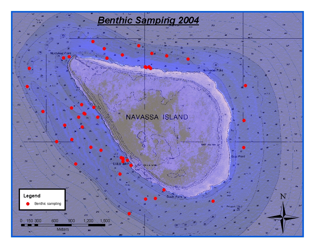
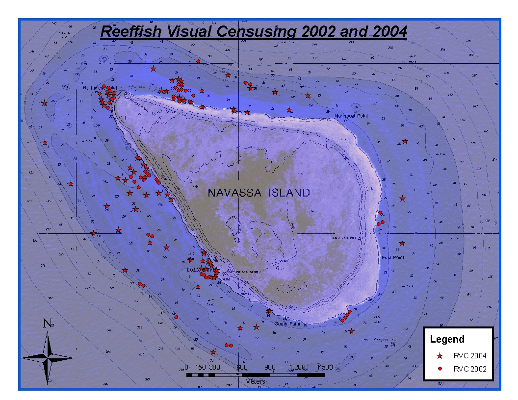
CRCP-Navassa reef assessment
National Oceanic and Atmospheric Administration, Department of Commerce —
Episodic cruises ( every 2 years) were conducted to perform assessments of Navassa Island coral reef resources including reeffish visual census, benthic reef... -
Federal
Data Release for the 2010 Haiti Seismic Hazard Model
Department of the Interior —
Gridded seismic hazard curve data, gridded ground motion data, and mapped gridded ground motion values are available for the 2010 Haiti Seismic Hazard Model.... -
Federal
NOAA/WDS Paleoclimatology - Power et al. 2008 Global Charcoal Database
National Oceanic and Atmospheric Administration, Department of Commerce —
This archived Paleoclimatology Study is available from the NOAA National Centers for Environmental Information (NCEI), under the World Data Service (WDS) for... -
Federal
Assessment of heat stress exposure in the wider Caribbean coral reefs through the regional delineation of degree heating week data from 1985-01-01 to 2017-12-31 (NCEI Accession 0205786)
National Oceanic and Atmospheric Administration, Department of Commerce —
This data package presents a three-decade (1985-2017) assessment of heat stress exposure in the wider Caribbean coral reefs at the ecoregional and local scales. The... -
Federal
Shaded Relief Image of the Caribbean Region (shadedrelief.jpg)
Department of the Interior —
This composite shaded relief image dataset depicts generalized bathymetry and topography of the Caribbean region. -
Federal
Nesting habitat suitability for the Black-capped Petrel Pterodroma hasitata on Hispaniola, Supplementary Material
Department of the Interior —
To focus nest-search efforts on Hispaniola and estimate the extent of the available nesting habitat, we analyzed the environmental characteristics of Black-capped... -
Federal
January 2010 Port-au-Prince, Haiti Images
National Oceanic and Atmospheric Administration, Department of Commerce —
According to official estimates, 222,570 people killed, 300,000 injured, 1.3 million displaced, 97,294 houses destroyed and 188,383 damaged in the Port-au-Prince area... -
Federal
Regional and Teleseismic Observations for Finite-Fault Product
Department of the Interior —
This data release complements the following publication: Goldberg, D. E., P. Koch, D. Melgar, S. Riquelme, and W. L. Yeck (2022). Beyond the Teleseism: Introducing... -
Federal
Geologic Provinces of the Caribbean Region, 2004 (prv6bg)
Department of the Interior —
This dataset includes a modified subset of polygon features that describe U.S. Geological Survey's defined geologic provinces of the World. Each province has a set of... -
Federal
NOAA/WDS Paleoclimatology - Lake Miragoane, Caribbean Past 10,500 Years Oxygen Isotope Data
National Oceanic and Atmospheric Administration, Department of Commerce —
This archived Paleoclimatology Study is available from the NOAA National Centers for Environmental Information (NCEI), under the World Data Service (WDS) for... -
Federal
Data Release for the Geologic Map of the Greater Antilles and Virgin Islands
Department of the Interior —
Geologic map geodatabase depicting the geology of the Greater Antilles and Virgin Islands region, including countries of Cuba, Haiti, Dominican Republic, and Jamaica,... -
Federal
Map of landslides triggered by the January 12, 2010, Haiti earthquake
Department of the Interior —
This inventory was originally created by Harp and others (2016) describing the landslides triggered by the M 7.0 Haiti earthquake that occurred on 12 January 2010 at...

Official websites use .gov
A
.gov website belongs to an official government
organization in the United States.
Secure .gov websites use HTTPS
A
lock (
) or https:// means you’ve safely connected to
the .gov website. Share sensitive information only on official,
secure websites.