
-
Federal
Fish assemblages in central and southern California using fish catch and effort data from the Recreational Fisheries Information Network
National Oceanic and Atmospheric Administration, Department of Commerce —
This dataset was provided by the Recreational Fisheries Information Network (RecFIN), and contained GPS coordinates for 680 CPFV trips during 1999 and 2001 at depths... -
Federal
Santa Monica, California Tsunami Forecast Grids for MOST Model
National Oceanic and Atmospheric Administration, Department of Commerce —
The Santa Monica, California Forecast Model Grids provides bathymetric data strictly for tsunami inundation modeling with the Method of Splitting Tsunami (MOST)... -
Federal
Fish diversity in central and southern California using fish catch and effort data from the Recreational Fisheries Information Network
National Oceanic and Atmospheric Administration, Department of Commerce —
This dataset was provided by the Recreational Fisheries Information Network (RecFIN), and contained GPS coordinates for 680 CPFV trips during 1999 and 2001 at depths... -
Federal
Hydrographic and CTD data from various platforms from the North Pacific Ocean from 1958-07-01 to 1983-03-08 (NCEI Accession 9000018)
National Oceanic and Atmospheric Administration, Department of Commerce —
This dataset contains Oregon State University Newport Line CTD data, and BT and Station Data provided by the California Department of Fish and Game. These data were... -
Federal
Pacific angel shark habitat suitability model for Channel Islands National Marine Sanctuary Biogeographic Assessment
National Oceanic and Atmospheric Administration, Department of Commerce —
The National Marine Sanctuary Program (NMSP) updates and revises the management plans for each of its 13 sanctuaries. This process, which is open to the public,... -
Federal
California market squid habitat suitability model for Channel Islands National Marine Sanctuary Biogeographic Assessment
National Oceanic and Atmospheric Administration, Department of Commerce —
The National Marine Sanctuary Program (NMSP) updates and revises the management plans for each of its 13 sanctuaries. This process, which is open to the public,... -
Federal
San Diego, California 1/3 Arc-second NAVD 88 Coastal Digital Elevation Model
National Oceanic and Atmospheric Administration, Department of Commerce —
NOAA's National Geophysical Data Center (NGDC) is building high-resolution digital elevation models (DEMs) for select U.S. coastal regions. These integrated... -
Federal
Santa Monica, California 1/3 arc-second NAVD 88 Coastal Digital Elevation Model
National Oceanic and Atmospheric Administration, Department of Commerce —
NOAA's National Geophysical Data Center (NGDC) is building high-resolution digital elevation models (DEMs) for select U.S. coastal regions. These integrated... -
Federal
NOAA Environmental Sensitivity Index (ESI) maps and geographic information systems data from 1900 to 2009
National Oceanic and Atmospheric Administration, Department of Commerce —
This collection comprises the Environmental Sensitivity Index (ESI) data for various regions in U.S. coastal waters. ESI data characterize estuarine environments and... -
Federal
Data collected in the Southern California Bight in order to understand the coastal waters ecological systems, 1977 - 1999 (NCEI Accession 0001162)
National Oceanic and Atmospheric Administration, Department of Commerce —
Chemistry, fish species, atmospheric pollutants, and temperature profile were collected using CTD casts and other collection methods in the Southern California Bight... -
Federal
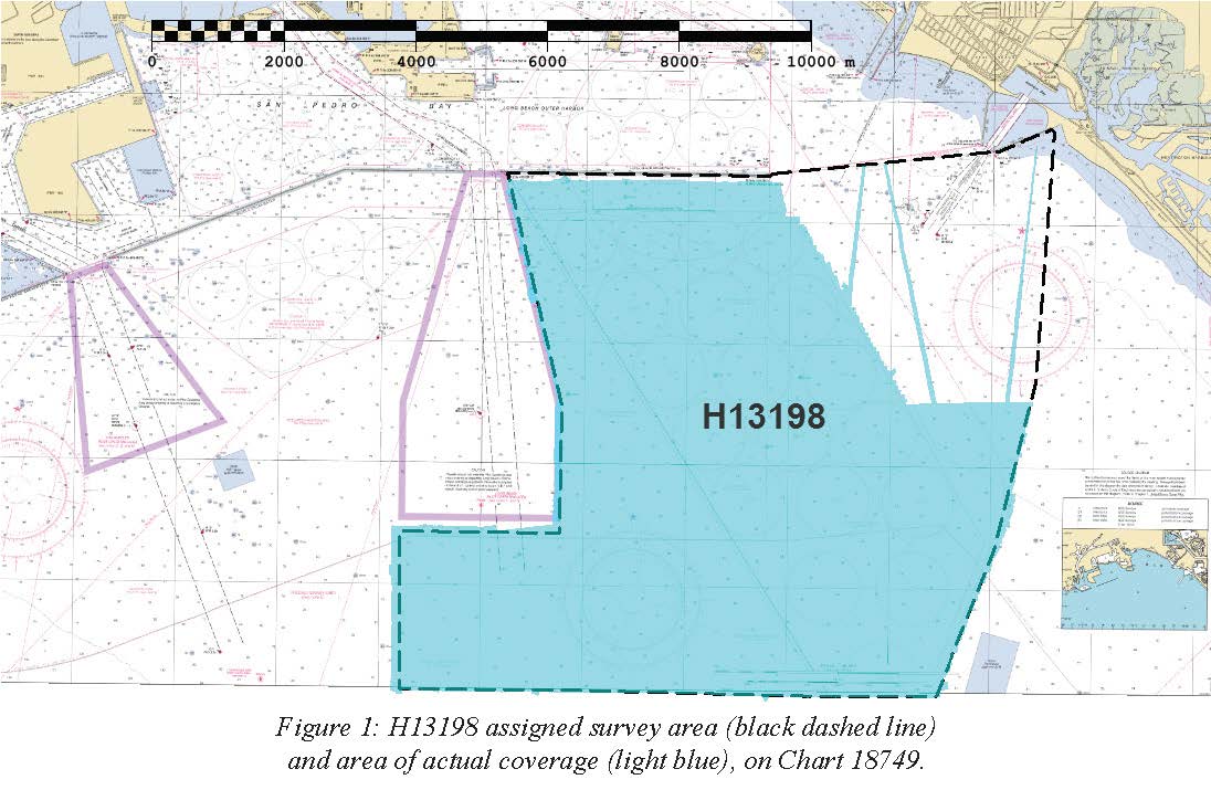
H13198: NOS Hydrographic Survey , 2018-10-29
National Oceanic and Atmospheric Administration, Department of Commerce —
The National Oceanic and Atmospheric Administration (NOAA) has the statutory mandate to collect hydrographic data in support of nautical chart compilation for safe... -
Federal
H13197: NOS Hydrographic Survey , 2018-10-29
National Oceanic and Atmospheric Administration, Department of Commerce —
The National Oceanic and Atmospheric Administration (NOAA) has the statutory mandate to collect hydrographic data in support of nautical chart compilation for safe... -
Federal
Sensitivity of Coastal Environments and Wildlife to Spilled Oil: Southern California: M_MAMMAL (Marine Mammal Polygons)
National Oceanic and Atmospheric Administration, Department of Commerce —
This data set contains sensitive biological resource data for seals, sea lions, whales, dolphins, porpoises, and sea otters in Southern California. Vector polygons in... -
Federal
Sensitivity of Coastal Environments and Wildlife to Spilled Oil: Southern California: NESTS (Nest Points)
National Oceanic and Atmospheric Administration, Department of Commerce —
This data set contains sensitive biological resource data for nesting and roosting gulls, terns, seabirds, shorebirds, and T/E species in Southern California. Vector... -
Federal
Water quality, meteorological, and nutrient data collected by the the National Estuarine Research Reserve System's System-wide Monitoring Program (NERRS SWMP) from January 1, 1995 to August 1, 2011 (NCEI Accession 0052765)
National Oceanic and Atmospheric Administration, Department of Commerce —
The National Estuarine Research Reserve System's System-wide Monitoring Program (NERRS SWMP) collected water quality, meteorological, and nutrient data in 26 reserves... -
Federal
Southern California Hook and Line Survey - 2020 Southern California Shelf Rockfish Hook and Line Survey
National Oceanic and Atmospheric Administration, Department of Commerce —
The Fisheries Research Survey team proposes to conduct the annual Shelf Rockfish Hook and Line Survey during September-October 2020. The survey is an ongoing... -
Federal
California spiny lobster habitat suitability model for Channel Islands National Marine Sanctuary Biogeographic Assessment
National Oceanic and Atmospheric Administration, Department of Commerce —
The National Marine Sanctuary Program (NMSP) updates and revises the management plans for each of its 13 sanctuaries. This process, which is open to the public,... -
Federal
Spot shrimp habitat suitability model for Channel Islands National Marine Sanctuary Biogeographic Assessment
National Oceanic and Atmospheric Administration, Department of Commerce —
The National Marine Sanctuary Program (NMSP) updates and revises the management plans for each of its 13 sanctuaries. This process, which is open to the public,... -
Federal
Giant seabass habitat suitability model for Channel Islands National Marine Sanctuary Biogeographic Assessment
National Oceanic and Atmospheric Administration, Department of Commerce —
The National Marine Sanctuary Program (NMSP) updates and revises the management plans for each of its 13 sanctuaries. This process, which is open to the public,... -
Federal
Nearshore marine fish diversity in southern California using trawl information from the Southern California Coastal Water Research Project.
National Oceanic and Atmospheric Administration, Department of Commerce —
This is a point file of mean fish diversity within 5 minute grid cells. The Shannon Index of diversity was calculated from Southern California Coastal Water Research...

Official websites use .gov
A
.gov website belongs to an official government
organization in the United States.
Secure .gov websites use HTTPS
A
lock (
) or https:// means you’ve safely connected to
the .gov website. Share sensitive information only on official,
secure websites.