

EGS Collab Experiment 2: Continuous Broadband Seismic Waveform Data
Access & Use Information
Public: This dataset is intended for public access and use.
License:
Creative Commons Attribution
Downloads & Resources
-
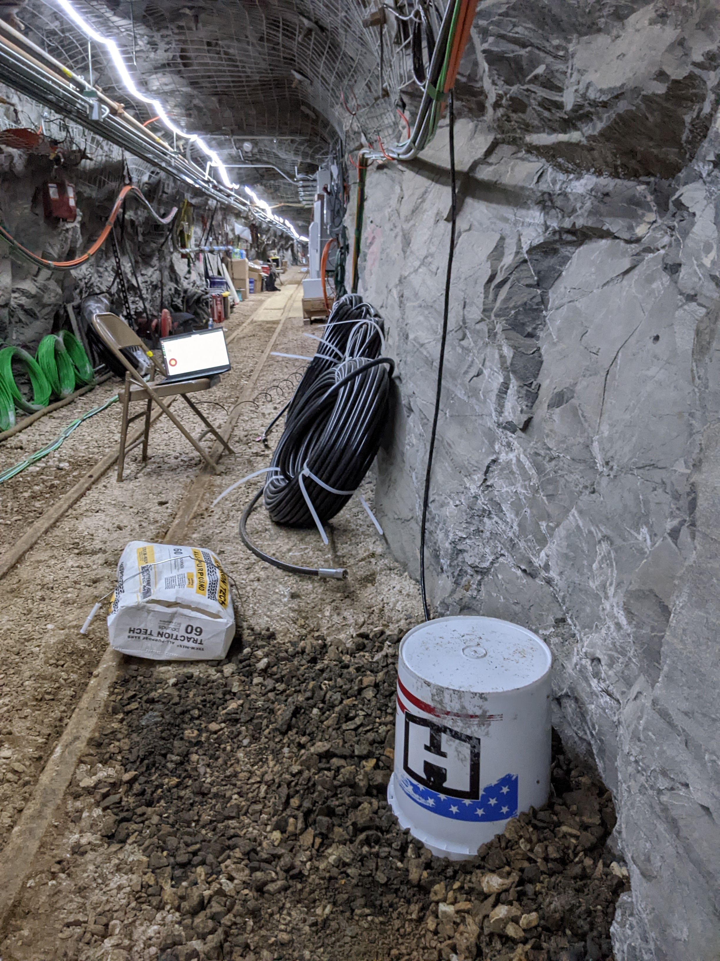
BBB Sensor Locations.jpgJPEG
Picture of the ___location of sensors BBB, south of Site B.
-
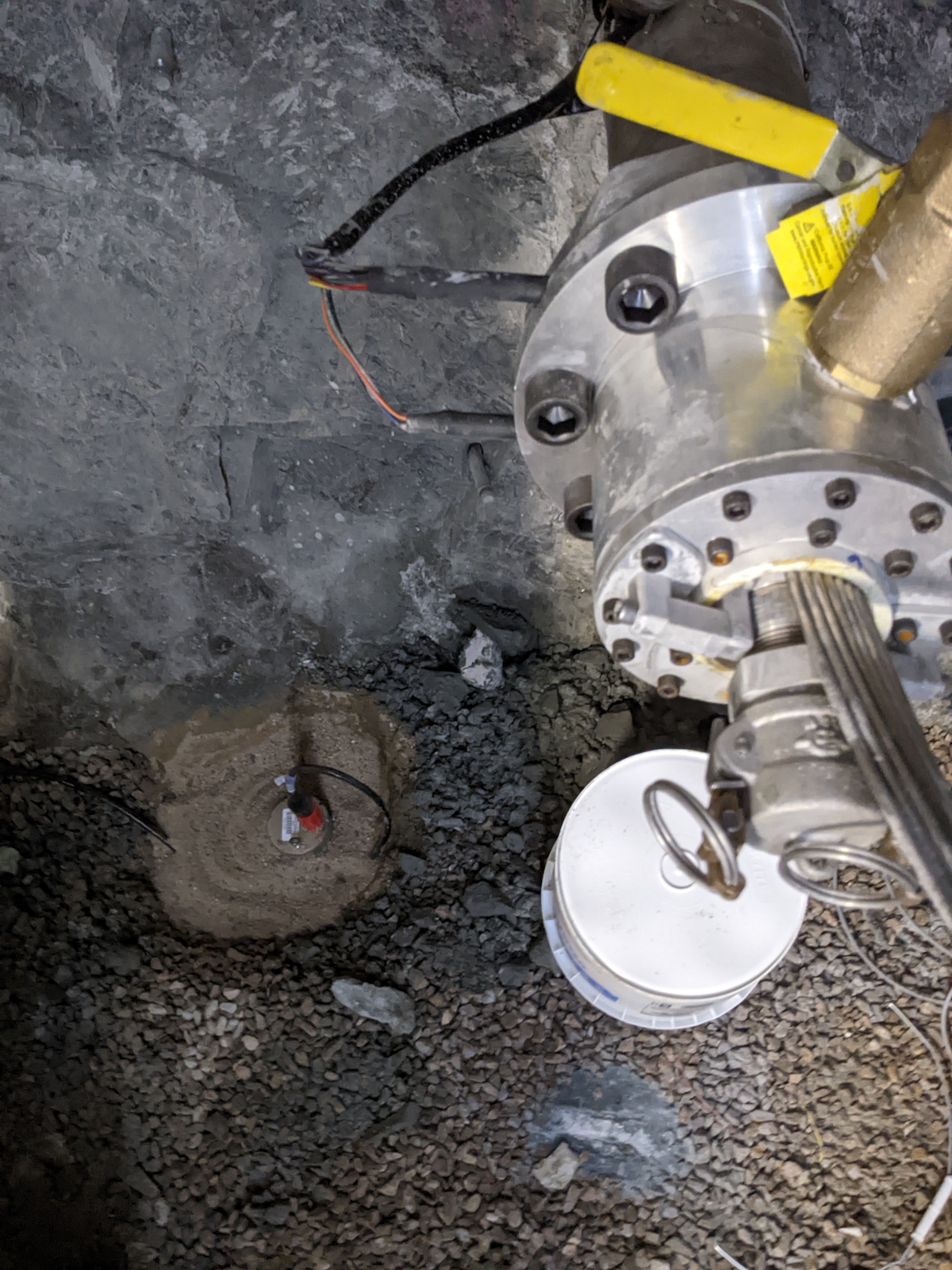
BBA Installation Picture.jpgJPEG
Picture of the installation of site BBA, prior to covering with insulation...
-
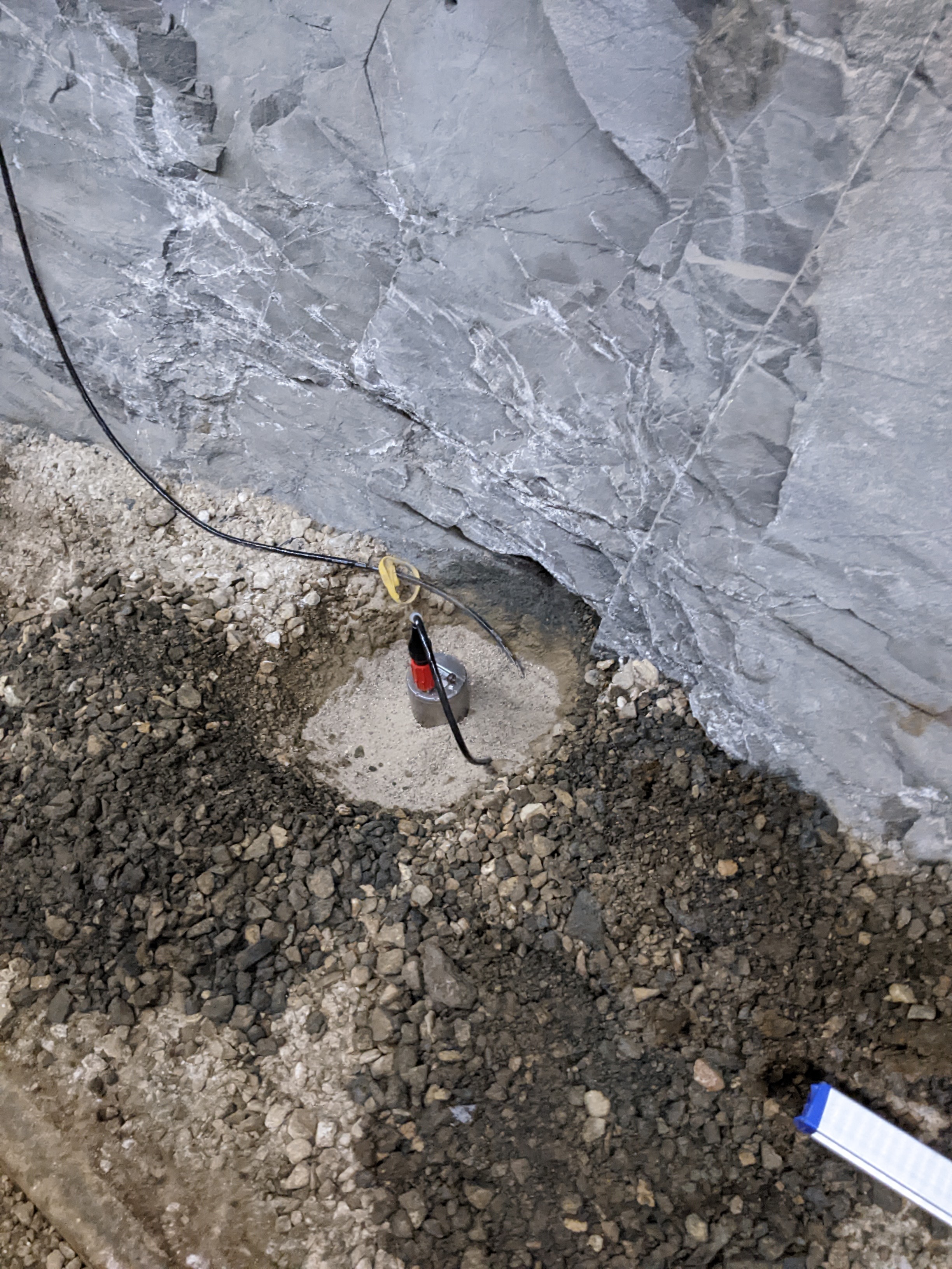
BBB Installation Picture.jpgJPEG
Picture of the installation of site BBB, prior to covering with insulation...
-
IRIS Network Page for Data DownloadHTML
Location of the network metadata. You can download the data from this site.
-
Network MapHTML
Link to the IRIS GMAP service showing the locations of the sensors in this...
-
FDSN Network PageHTML
International Federation of Digital Seismograph Networks (FDSN) site for the...
-
Landing PageLanding Page
Dates
| Metadata Created Date | January 11, 2025 |
|---|---|
| Metadata Updated Date | January 20, 2025 |
Metadata Source
- Data.json Data.json Metadata
Harvested from OpenEI data.json
Additional Metadata
| Resource Type | Dataset |
|---|---|
| Metadata Created Date | January 11, 2025 |
| Metadata Updated Date | January 20, 2025 |
| Publisher | Lawrence Berkeley National Laboratory |
| Maintainer | |
| Doi | 10.15121/1907655 |
| Identifier | https://data.openei.org/submissions/7532 |
| Data First Published | 2022-09-12T06:00:00Z |
| Data Last Modified | 2023-10-25T17:29:03Z |
| Public Access Level | public |
| Bureau Code | 019:20 |
| Metadata Context | https://openei.org/data.json |
| Metadata Catalog ID | https://openei.org/data.json |
| Schema Version | https://project-open-data.cio.gov/v1.1/schema |
| Catalog Describedby | https://project-open-data.cio.gov/v1.1/schema/catalog.json |
| Data Quality | True |
| Datagov Dedupe Retained | 20250120155001 |
| Harvest Object Id | e611dcf9-d350-4095-9f41-6cc716cb9f3e |
| Harvest Source Id | 7cbf9085-0290-4e9f-bec1-91653baeddfd |
| Harvest Source Title | OpenEI data.json |
| Homepage URL | https://gdr.openei.org/submissions/1422 |
| License | https://creativecommons.org/licenses/by/4.0/ |
| Old Spatial | {"type":"Polygon","coordinates":-103.7577,44.3488,-103.7465,44.3488,-103.7465,44.3544,-103.7577,44.3544,-103.7577,44.3488} |
| Program Code | 019:006 |
| Projectlead | Lauren Boyd |
| Projectnumber | EE0032708 |
| Projecttitle | EGS Collab |
| Source Datajson Identifier | True |
| Source Hash | 739827e326c717d97a4cc9aa7c664b19457190cbccf8d900f58b29b473c36309 |
| Source Schema Version | 1.1 |
| Spatial | {"type":"Polygon","coordinates":-103.7577,44.3488,-103.7465,44.3488,-103.7465,44.3544,-103.7577,44.3544,-103.7577,44.3488} |
Didn't find what you're looking for? Suggest a dataset here.