

74 datasets found
-
Federal
Newberry EGS Demonstration: Well 55-29 Stimulation Data
Department of Energy —
The Newberry Volcano EGS Demonstration in central Oregon, a 3 year project started in 2010, tests recent technological advances designed to reduce the cost of power... -
Federal
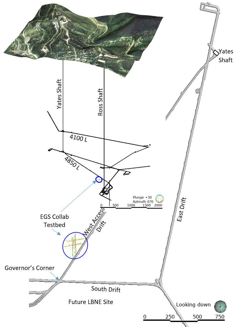
EGS Collab Experiment 2: Core Logs
Department of Energy —
Core logs and photos from the EGS Collab project Experiment 2 for the Top Vertical well (TV4100) and the Top Horizontal well (TV 4100) on the 4100 Level of SURF (the... -
Federal
EGS Collab Experiment 1: Tracer data tests
Department of Energy —
This file contains the first set of tracer data for the EGS Collab testbed. The first set of tracer tests were conducted during October-November, 2018. We have... -
Federal
Depth grids for flood-inundation maps for the Cuyahoga River in and near the City of Independence, Ohio
Department of the Interior —
The depth grids show the depth of flooding on the Cuyahoga River in and near the City of Independence, Ohio on local map backgrounds, based on stages of 14.0 ft to... -
Federal
Azura WEC 1/15th Wave Tank Test Data
Department of Energy —
Test data from the 1/15th Wave Tank Tests of the Azura performed in 2017/2018 to validate the power performance and survivability of the Azura Design developed by... -
Federal
EGS Collab Experiment 2: Testbed Well Orientation Data
Department of Energy —
This dataset contains the north seeking gyro data for each of the 11 boreholes drilled at the Experiment 2 testbed on the 4100 foot level of the SURF (Sanford... -
Federal
Depth grids for stages 8.0 ft to 14.0 ft at the USGS streamgage Nimishillen Creek near North Industry, Ohio (03118500)
Department of the Interior —
The depth grids show the depth of flooding on Nimishillen Creek near North Industry, Ohio, on local map backgrounds, based on stages of 8.0 ft to 14.0 ft at the USGS... -
Federal
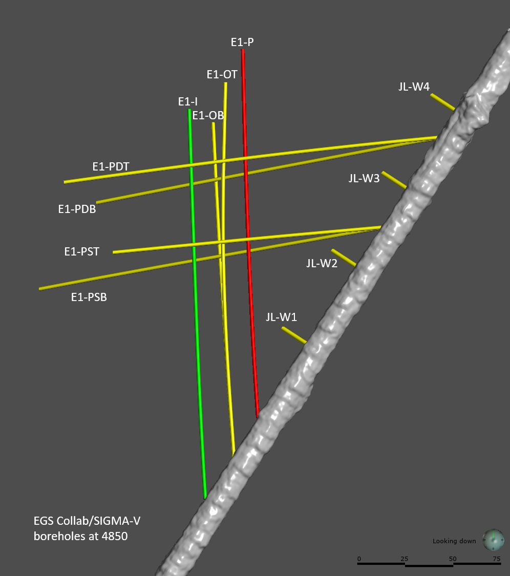
EGS Collab Experiment 1: Well Locations and Orientations.
Department of Energy —
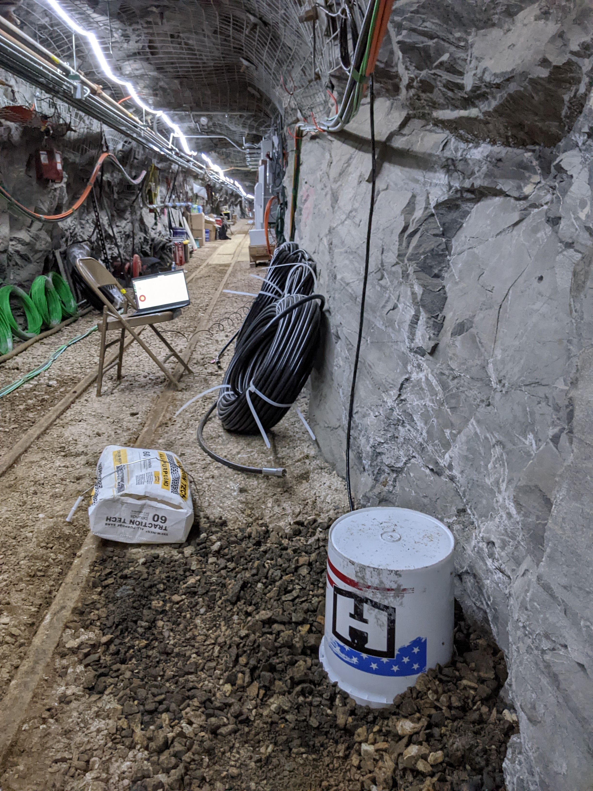
The EGS Collab is conducting experiments in hydraulic fracturing at a depth of 1.5 km in the Sanford Underground Research Facility (SURF) on the 4850 Level. A total... -
Federal
Utah FORGE: Hydrothermal Friction-Hydraulic Transmissivity Laboratory Experiments
Department of Energy —
Submission includes data from laboratory slide-hold-slide tests, combined with flow through tests, conducted on Westerly granite with 30 degree sawcut. Tests were... -
Federal
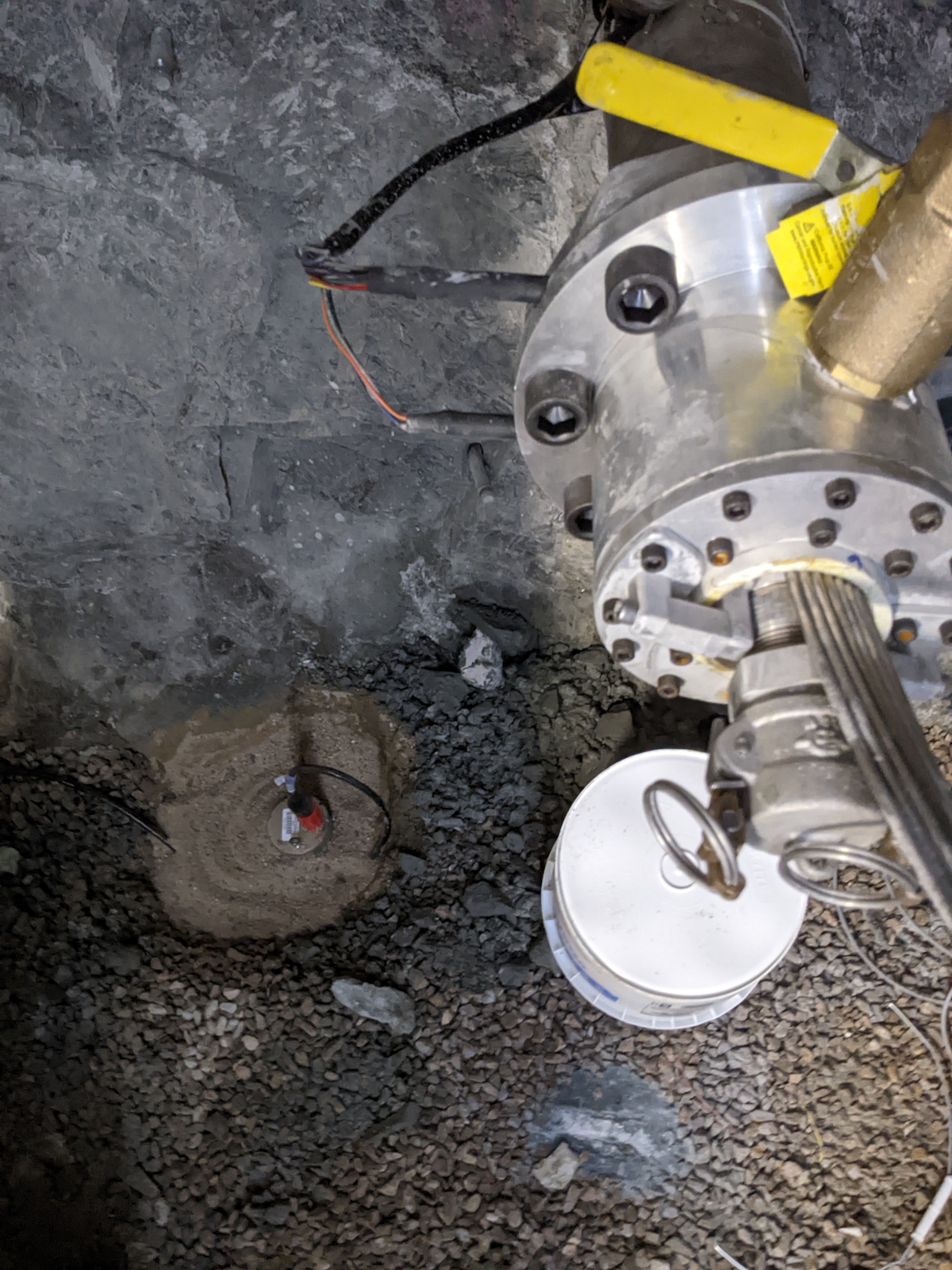
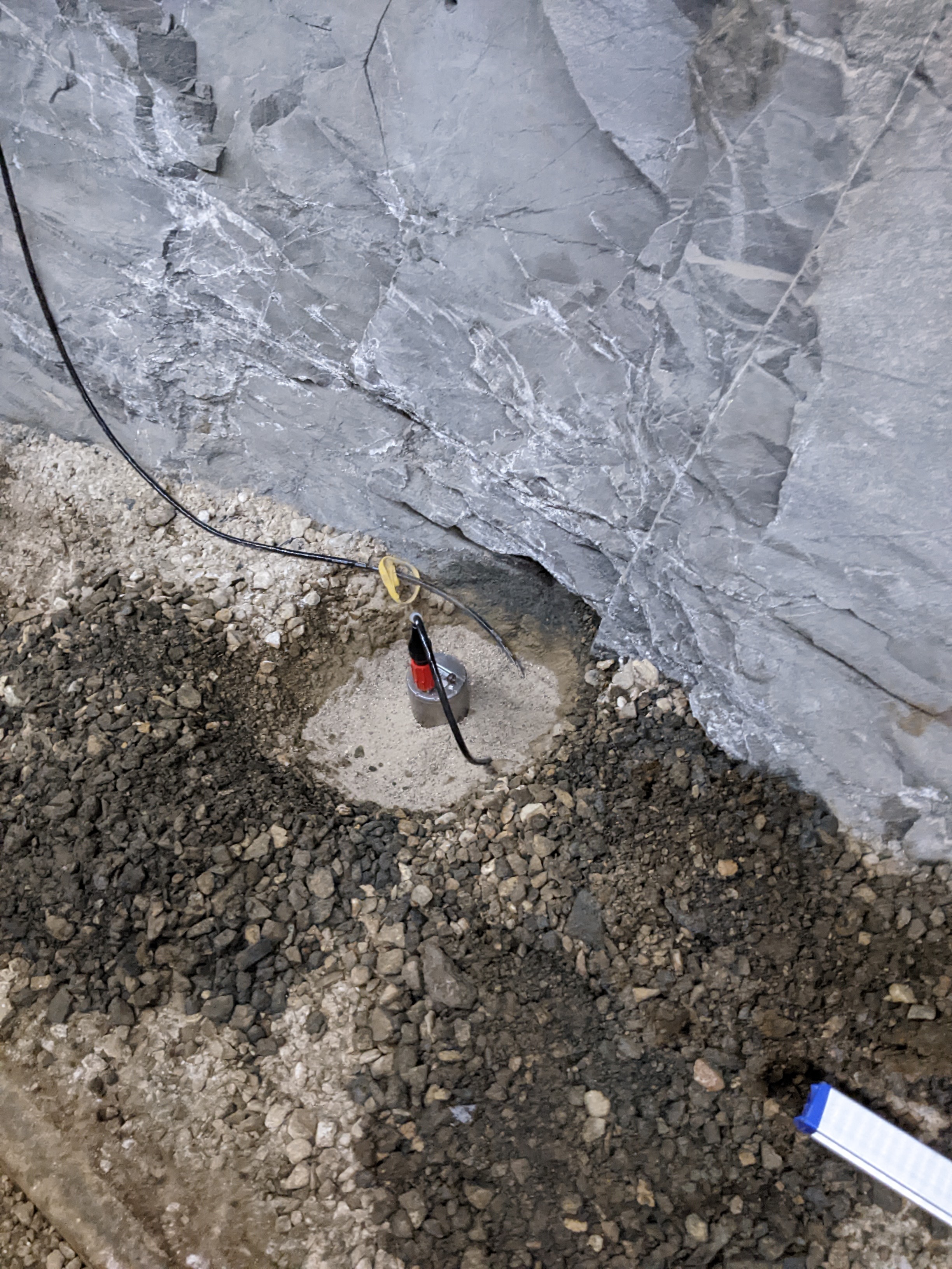
EGS Collab Experiment 1: Microseismic Monitoring
Department of Energy —
The U.S. Department of Energy's Enhanced Geothermal System (EGS) Collab project aims to improve our understanding of hydraulic stimulations in crystalline rock for... -
Federal
STRESSINVERSE Software for Stress Inversion
Department of Energy —
The STRESSINVERSE code uses an iterative method to find the nodal planes most consistent with the stress field given fault frictional properties. STRESINVERSE inverts... -
Federal
Utah FORGE: Well 58-32 Stimulation Conference Paper and Data
Department of Energy —
The U.S. Department of Energy's (U.S. DOE) Frontier Observatory for Research in Geothermal Energy (FORGE) is a field laboratory that provides a unique opportunity to... -
Federal
Utah FORGE: Discrete Fracture Network (DFN) Data
Department of Energy —
The FORGE team is making these fracture models available to researchers wanting a set of natural fractures in the FORGE reservoir for use in their own modeling work.... -
Federal
Input and output shapefiles used in the 2018 hydraulic modeling for the Clear Fork Mohican River and Cedar Fork in Richland County, Ohio.
Department of the Interior —
Digital flood-inundation maps for an 18.6-mile (mi) reach of the Clear Fork Mohican River (that extends approximately from 100 feet upstream from Gass Road near... -
Federal
Utah FORGE: InSAR Data from 2020
Department of Energy —
Interferometric Synthetic Aperture Radar data from the TerraSAR-X and the TanDEM-X satellite missions operated by the German Space Agency (DLR). Interferometric pairs... -
Federal
EGS Collab Experiment 2: Wireline Geophysical Well Logs
Department of Energy —
This is the full wireline geophysical datasets for characterization of the EGS Collab Experiment #2 testbed. A metadata fill is included within the dataset explaining... -
Federal
Model archive for the hydraulic model for the Cuyahoga River at Jaite, Ohio
Department of the Interior —
Water-surface elevations along the stream reach were estimated by steady-state hydraulic modeling, assuming unobstructed flow, and using streamflows and hydrologic... -
Federal
Utah FORGE: Optimization of a Plug-and-Perf Stimulation (Fervo Energy)
Department of Energy —
Information around the plug-and-perf treatment design at Utah FORGE by Fervo Energy. Objective and Purpose: - Develop a multistage hydraulic stimulation approach... -
Federal
GEISER Project - The Geysers Seismic Broadband Data 2012 - 2013
Department of Energy —
This link points to the Northern California Earthquake Data Center (NCEDC) to access The Geysers seismic broadband data. The two available data sets consist of...
74 datasets found