Advancing Ecological Insights with NASA Subsetting and Visualization Tools and Services for Site-based Research
This webinar, presented by the ORNL DAAC highlighted new datasets and tool capabilities and provided a Jupyter Notebook demonstration showing how to enable the harmonization of remote sensing and in situ ecological data products.
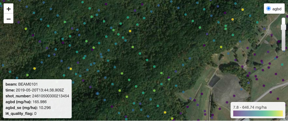
These tools bring multiple datasets together in a single integrated platform—allowing users to discover, access, and analyze data for research areas at the 1km to 100 km scale. Datasets include gridded Moderate Resolution Imaging Spectroradiometer (MODIS), Visible Infrared Imaging Radiometer Suite (VIIRS), and Soil Moisture Active Passive (SMAP) mission data products as well as recent, non-gridded Global Ecosystem Dynamics Investigation (GEDI) footprint-level Aboveground Biomass Density and Ice, Cloud and land Elevation Satellite-2 (ICESat-2) photon-level Land and Vegetation Height products.
See the ORNL DAAC's Learning Resources page for a complete listing of webinars, tutorials, and other resources to help you use ORNL DAAC data and services.